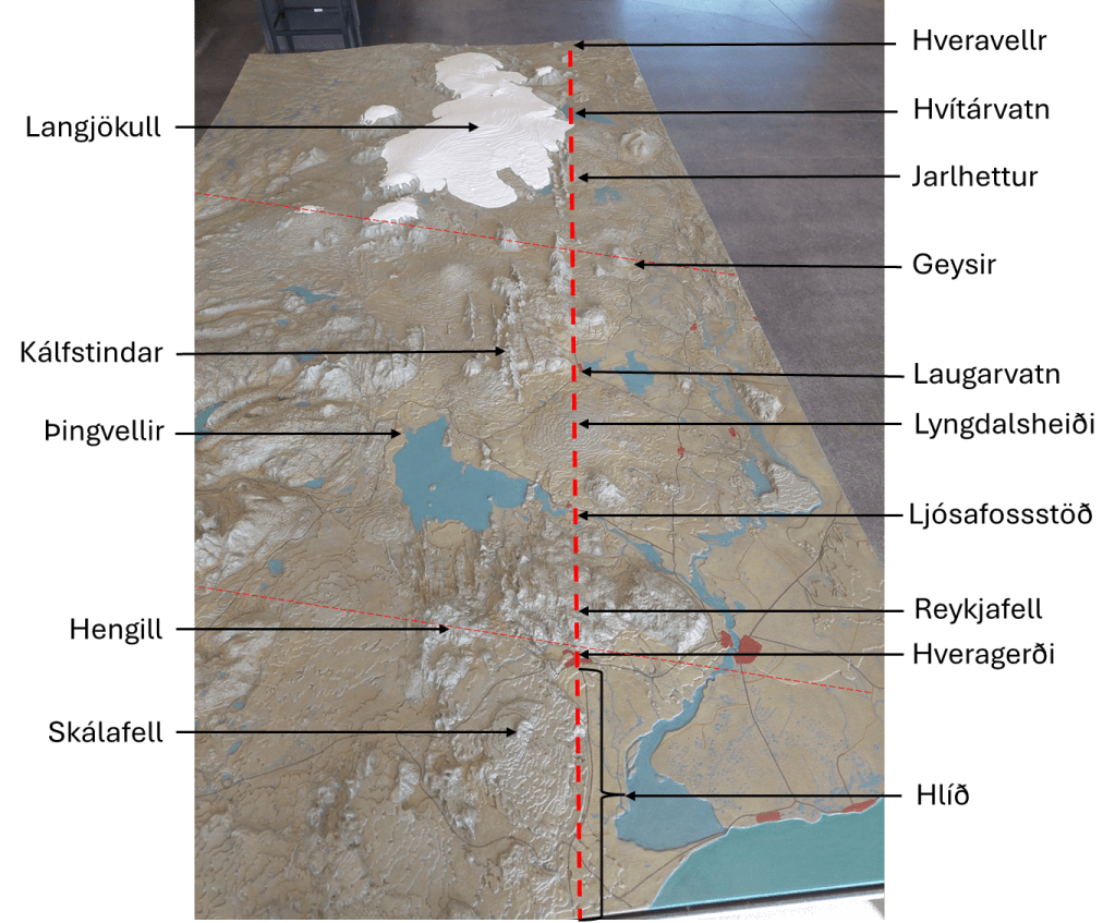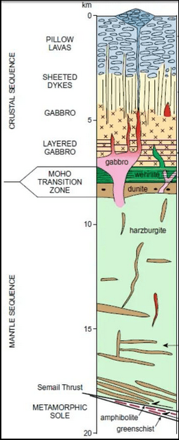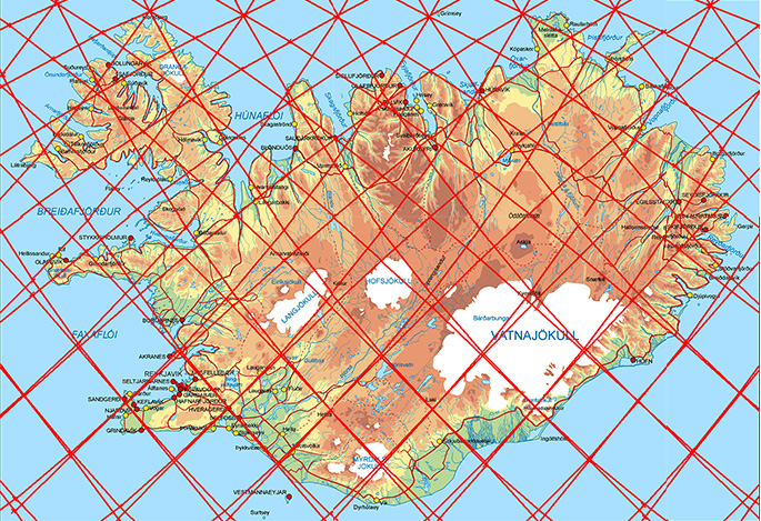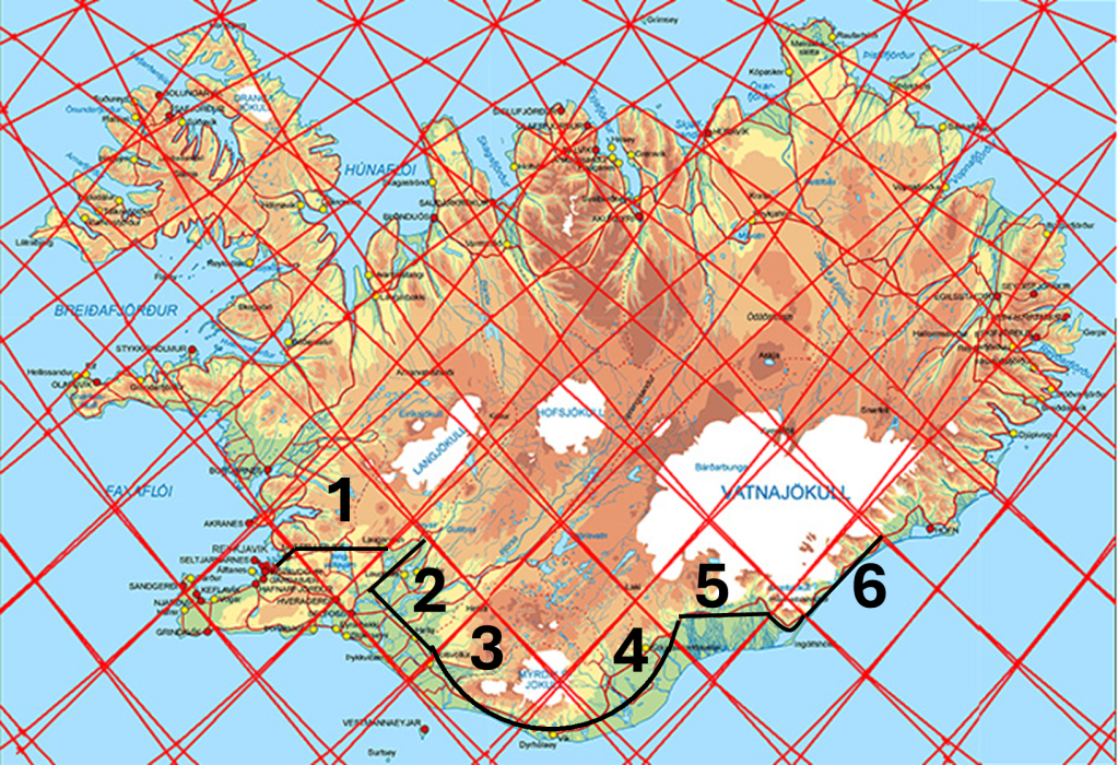
For the first chapter marked on the map, you visit Þingvellir National Park. In order to get there, you pass through the highland structure of the West Volcanic Zone, and at its central axis you find the rift valley of Þingvellir. You then drive all the way to Laugarvatn, where abundant geothermal activity is found along the boundary of polygon 2. From there, you turn north until you reach the Geysir area and Gullfoss at the northern end.
If you wish to continue to other scenic areas in the south, you can follow the main road running parallel to the boundary between polygons 1 and 2 until you reach the Ring Road, where you make a 90° turn toward the southeast. The road remains fairly straight until it crosses the boundary between polygons 2 and 3. After that, it curves around the two glaciers Eyjafjallajökull and Mýrdalsjökull.
Polygon 3 is centered around Eyjafjallajökull and includes two famous waterfalls: Seljalandsfoss at its western end and Skógafoss on its southern slopes. After passing the town of Vík í Mýrdal, at the southernmost point of Iceland, you enter chapter 4.
There, you pass two enormous lava fields, the largest on Earth formed in recorded history, one from the Eldgjá eruption of 939 and the other from the Laki eruption of 1783. There are two parallel roads there, and you would probably choose the northern one (road No. 1), but I chose the southern one for illistration 🙂 At the boundary between polygons 4 and 5, another turn is made to the right, crossing that polygon and passing the glacial rivers flowing from Vatnajökull. This area is generally known as Skeiðarársandur.
Upon reaching the end of polygon 5, you drive around Öræfajökull, the largest volcano in Iceland. Entering polygon 6, you are on the road toward the Glacier Lagoon, Jökulsárlón. You can then continue along the road running parallel to the side of the polygon all the way to the eastern end.
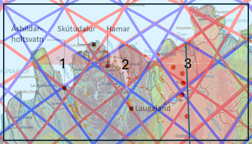
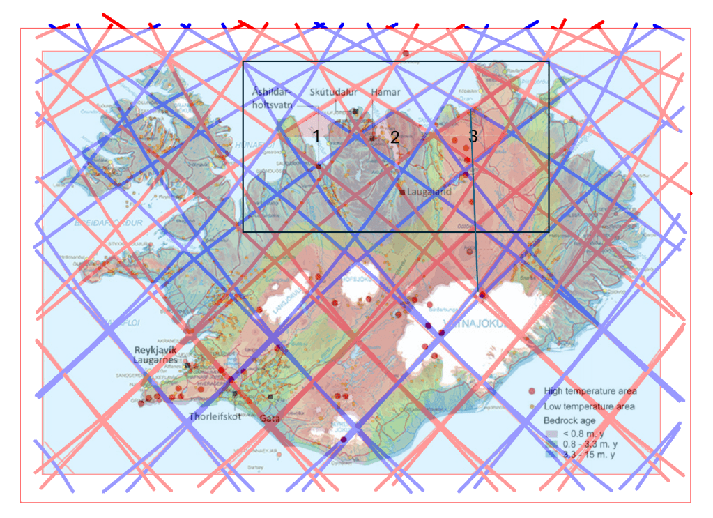
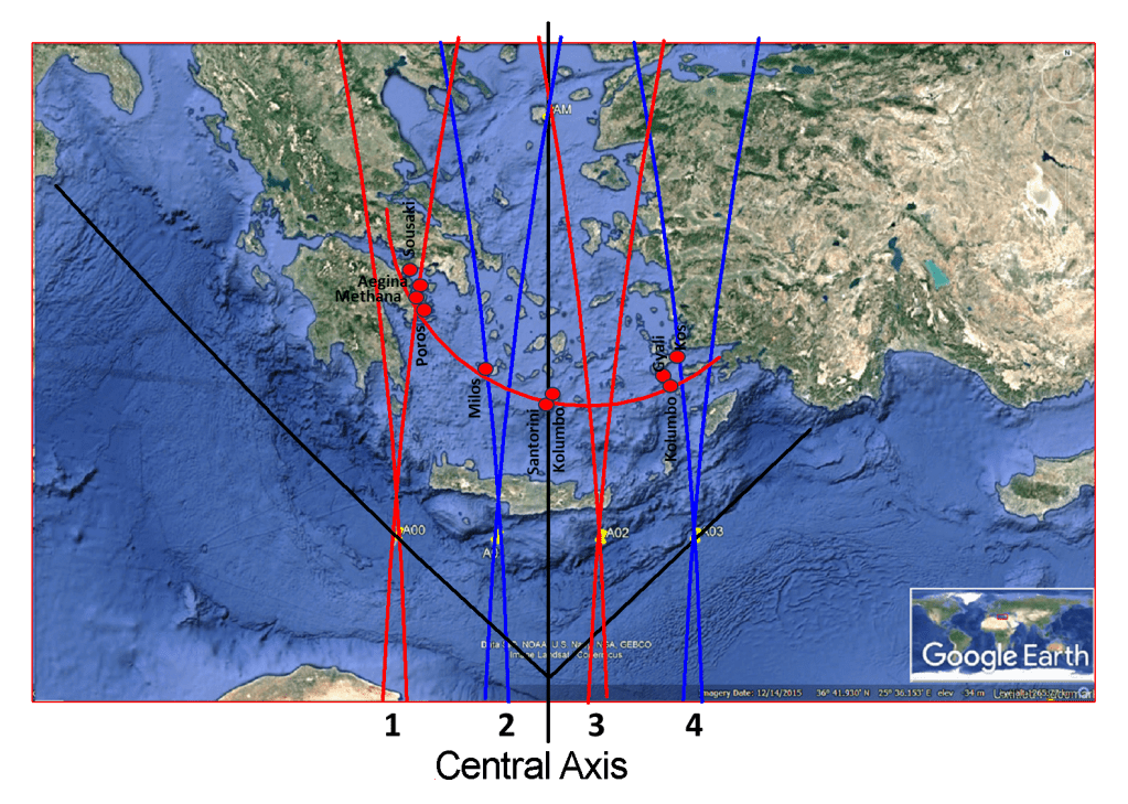
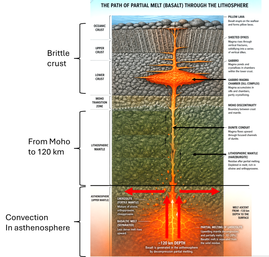
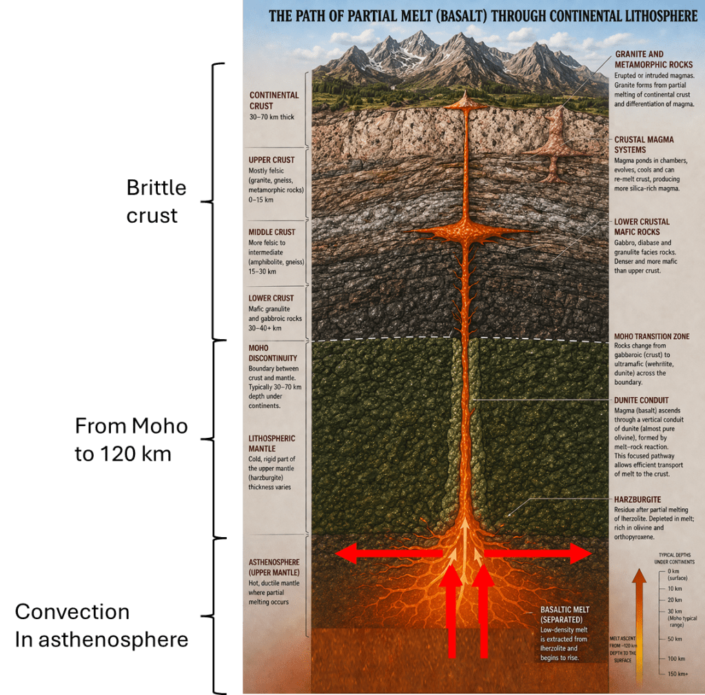
If you notice other roads that fit this pattern in a similar way, convection rolls underneath affecting the road system, it would be very interesting to examine them as well.