The Active South
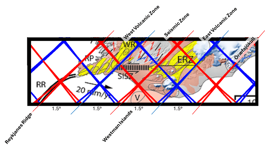
Looking closely at southern Iceland, from the Reykjanes Ridge in the west to Öræfajökull in the east, a sequence of 1.5° spatial intervals can be observed. This pattern can be analyzed in detail, as many geological features align consistently within it.
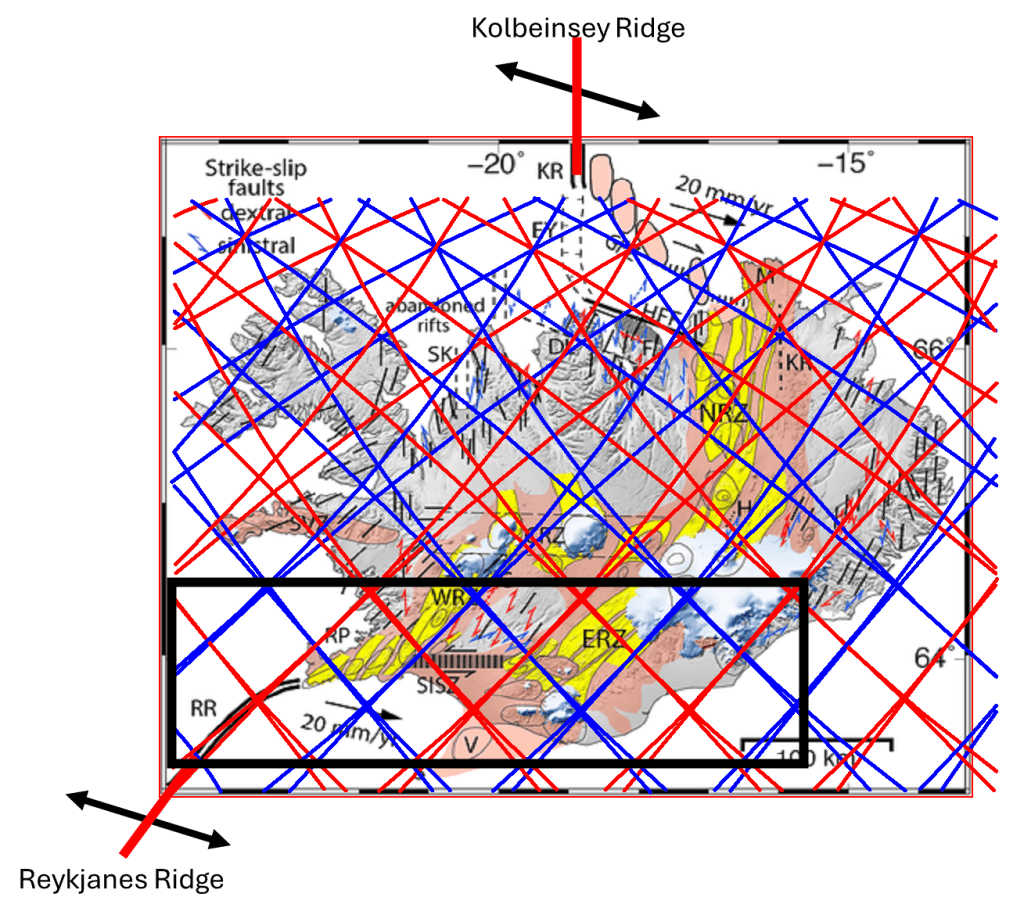
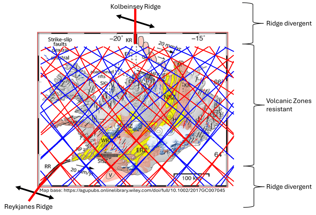
First, the mid-ocean ridge forms a continuous structural trend, including a section approximately 900 km long. The Reykjanes Peninsula can be interpreted as a single volcanic zone, although its westernmost part represents a transition from a side-stepping arrangement of volcanic systems to a more continuous ridge structure.
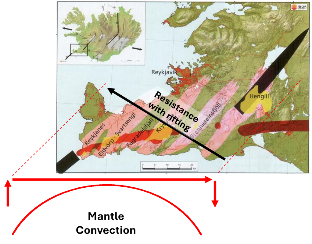
Within this framework, a polygonal area can be identified that is densely filled with volcanic systems. A southwest (SW) division line within this polygon marks the location of the Blue Lagoon. At present, this line appears to provide a steady flow of magma into the crust, feeding a magma chamber beneath the area. When this chamber empties, eruptions occur along the Sundhnúkur crater row.
A dike intrusion and associated surface deformation have developed along a SW–NE trend, extending across much of the peninsula, from the southern coast toward the area near the road connecting Reykjavík and Keflavík Airport in the north.
To the east, the volcanic systems of Krýsuvík, Trölladyngja, and Hengill are aligned along the same structural trend. The eastern boundary of Hengill is marked by a clear slope known as Hlíð, after which other volcanic systems of the West Volcanic Zone (WVZ) continue along the calculated division line.
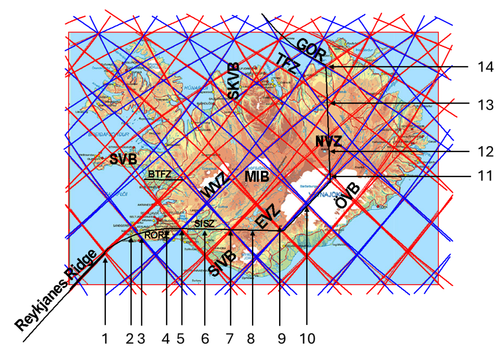
These intersections also define the western boundary of the South Iceland Seismic Zone (SISZ), which dominates the next 1.5° interval eastward, extending toward the volcano Hekla.
Hekla lies at a key boundary:
- between the SISZ and the East Volcanic Zone (EVZ)
- between the divergent tectonic region to the north and the volcanic but non-divergent region to the south
The southern region is therefore often referred to as the South Iceland Volcanic Belt, distinguishing it from the actively rifting EVZ. South of this lies the Westman Islands, which are sometimes treated separately, although they can also be viewed as part of a continuous volcanic system with the EVZ and the southern belt.
As in the West Volcanic Zone, the calculated division line clearly marks the eastern boundary of the EVZ. Across the region, the main volcanic systems consistently align with the pattern expected from underlying convection rolls. The division lines, their intersections, and the polygonal areas all appear to play structural roles. Even the north–south and east–west axes that subdivide these polygons seem to influence volcanic behavior.
A comparable polygonal structure includes the volcanic systems of Katla and Eyjafjallajökull. This has both:
- an east–west axis from Katla to Eyjafjallajökull
- a north–south axis running from Hekla through Vatnafjöll to Eyjafjallajökull
Eyjafjallajökull lies at the center of this polygon. The 2010 eruption of Eyjafjallajökull can be interpreted within this framework: basaltic magma flowed along the east–west axis from the east into the volcano, triggering an eruption from a more silica-rich magma chamber with a lower melting point.
From the EVZ, another 1.5° step to the east leads to Öræfajökull, the highest volcano in Iceland. A narrow volcanic zone extends northeast from it along a division line. At this location, four inferred convection-roll division lines appear to converge. A similar structural role is observed at Grímsvötn, located to the northwest and also separated by a polygon of 1.5° span from east to west.
There are, of course, many additional details, which are explored in other posts.