Uncategorized

Division between N-America and Eurasia

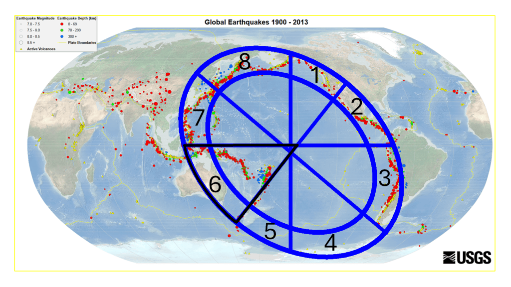
Tectonic drift is measured quite accurately, and the relevant main division line through Iceland is marked here.

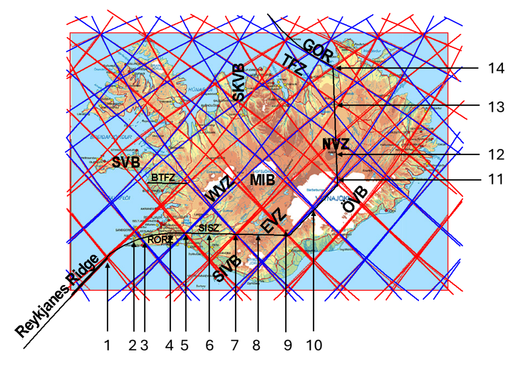
The division between the North American and Eurasian plates in Iceland has a chain of geologically significant landmarks. These sites, when viewed together, outline the structure of the plate boundary and reveal a coherent tectonic pattern that aligns with large-scale mantle flow processes.

1. Njörður volcanic site (offshore)

https://images.openai.com/static-rsc-4/1Oy6PGXlHxf2-PGc5v0V4DLiuKfj5wWQLchmTv4vveZDEa985soWUDPHCpG1RR9qyZ-_D9fYp01S5I_Ogjun5xPKkfBbVFfcHBzF1XjaXflHC5xTh9aXYUKOkdzaxNG8RUgOgvK0r64gN71IUyKZcFNKDGd4R5Rz475Up9Im6oMdNpQoUUfU8VOZYqTK3n-x?purpose=fullsize
https://images.openai.com/static-rsc-4/rVe21HcHV4BehAXBWwUGZ1SAxU6lwrPQTK2Y-dMI0dk4iOCufNvKt4Lt9Qf9EJtugGc52hXKpkhXcpq31MogpBKQ15DKglE9T12Av7fjaSHvwONSQOiAHdxpB8NLA2F14U6-3pk9OvpVoMK0TAiZGR3aZcepHOh3fE6uT1eJVXz--UNCzYexp1S4CBfy4x-w?purpose=fullsize

To the west, the system begins offshore at the Njörður volcanic site, an area characterized by frequent earthquakes. This location acts as a shifting point in the tectonic framework. South of it lies the typical structure of the Mid-Atlantic Ridge, which can be traced according to a regular geometric pattern as it extends southwestward. At Njörður, however, the ridge bends more sharply toward Iceland, marking a transition from a classic mid-ocean ridge into a more complex on-land system with volcanic systems, grouped into volcanic zones.

2. Reykjanes Peninsula – Bridge Between Continents

https://images.openai.com/static-rsc-4/r6fjQj4ZoZGsxy7AuobvNWgqhARs03mSvzq9MheQwngaEDHJfmR1TM2Nw8QjGmTetjQicLRP29UaC3valA_Zt1gQgbgpX8B-A5HIuSUQmtK_mXH98go1oNT8eUgZ-OPbMNRPCWVECXQ6NHZ-SO31kKa_Yp_xLXNrMdM9ODLAWKIJgPNRaVhJgCuHgw_aDQlm?purpose=fullsize
Bridge between continents

The next key landmark is the Bridge Between Continents, a man-made structure that directly reflects geological reality. It sits at the northern edge of a rift valley and marks the visible boundary between the plates. Interestingly, the bridge itself is located on the North American Plate, illustrating how the plate boundary is not a single line but a zone of deformation.

3. Svartsengi / Blue Lagoon volcanic system

https://images.openai.com/static-rsc-4/O4kbRjzT_k0EgCuNSjH7PYtVl5UroPp45M3MJDGqhJGZwh93NcPEklE3dKaNiLx3UqAdrfcgaFJLzOb5zbRJIt_v4JyuMSs9_FY1P8ehpA4_z-a14v2j9W-21VncYgh4KOjTZcKbYE1v5W606SLxhOK44qpgwsfaaoq2bSXZ60IKOM7Q_OjxFrx_w04ZmLKa?purpose=fullsize
https://images.openai.com/static-rsc-4/2LqiKM8LXBNBxIB9yQhAIQbZR9pj_EMLBBqrkHHLtF4HRPwWtOF7YqvxAv0uHrbhO_jnC0dWoo5DanH-O2ljrg7JPE4WjYX9lZyYYx6207dWSPP30TeSfENMyIBgrGObeksansdY0OWL7SbzsPMAnkHR0SZd3GLXjax9A2-Y9XJ1K8Fs3VBqoVMt5xmKzkko?purpose=fullsize
https://images.openai.com/static-rsc-4/O_NlEFi_fI_UZg-He-pqB_OeneqH1rY9msoYkM_yODTJpCH2C01Dy6lA-DBc-x9XUlmfuALTawBlubsIyUtMw-oPWUHQou8atiQQl0qO9XsX_jpJz4mGHHuUr7ofSzS6DXrZpDPA578QBl3jzCfK6Kz05UzCfHGnpsk3TbCsLmUHxXF8v_xjlJXrZfADWqx3?purpose=fullsize

7

In this region, magma actively ascends from depth, accumulating in a shallow magma chamber beneath the Blue Lagoon. From there, it propagates into dikes aligned southwest–northeast, consistent with the regional stress field. These intrusions periodically reach the surface, producing fissure eruptions characteristic of the Reykjanes volcanic zones.

4. Þríhnúkahellir and Bláfjöll

https://images.openai.com/static-rsc-4/wuXNrjxV6rQ_gbFKnat6ALaubW8bphCttRG6kj9J9bW0aE8k7A7oHHOGMhEN5SenFzsDnENyDqYjV7Y7Hd1bMEvw1yW64i3-HVwaxHV2CmQRHbNwp2eOBqsKWGsJIK6ctfN1In2u6CQWIkViFj0j2c6pcNU0laZcoPiqtvhH5O3JJ6Co5Dy1fP-S9dFwU7hC?purpose=fullsize

7

Further inland lies the volcanic area of Þríhnúkahellir and Bláfjöll. This region provides rare access to the interior of a magma chamber and represents a structurally distinct volcanic system within the broader plate boundary zone.

5. Hveragerði

https://images.openai.com/static-rsc-4/zuXDEpPmeYL-KaOEbMAsQ85NpaBTC1C9JODOdYRlNRJV32iuuW44_B_Bzv3eIN4k5AfnM5CW8kle-kWrB_eX5iPJk9BV4HxpQbG2q6JoHBj7BGdVg_rCVyvjlF3JwYuQo23KhzccTspkI9JhII3oMCiwIEUV-HKyTsFL1mwyyNuUgqWvsyTB0QnZHAJeqare?purpose=fullsize
https://images.openai.com/static-rsc-4/UfqNLlwIXyDs629FU5qQrtgcoD9ZjlfpHTIMDpWj9RVwdmsF7PlZueKO8xmAbHWHTIdDJVD0JbCWtPbmGB4IctKhxawJdojPxNrG0trD3LBTB33FiXUVZYyxPvUlZetAzfXEfonGB2fdzVy-ZZxGEZFgznZcnbaKImlqpoenlCKReONb7gz2p6ZpJZiY5pBV?purpose=fullsize

The town of Hveragerði, often called the “hot spring town” or “flower town,” sits directly within a geothermal field. Its numerous hot springs and greenhouse agriculture reflect high heat flow and shallow geothermal activity.

6. South Iceland Seismic Zone

Between Hveragerði and Hekla lies the South Iceland Seismic Zone, a region of intense seismic activity. This transform-like zone accommodates lateral motion between segments of the plate boundary and is clearly detectable through geophysical measurements.

7. Hekla

https://images.openai.com/static-rsc-4/bj5dlqhCsrn7PZwwBi3TAJD4rKsyM0ojukjbEo3jBMnAXUJNwazrDJ94XX9y88ChVYuAvBlPTDOU3_gTJt2a3aymkmzqJJ-UZPYjqZx2nocHlXphhysVXihuKlpRsMVRzIP83GWKevpNDG19okivHxowL9S-4kmEaaS5CXDVjoFMWntWIxSePdWdIZ_Udch4?purpose=fullsize
https://images.openai.com/static-rsc-4/ZWpcU-09FqFoJS23xSxXbllWe2OBfw91L7m4Mfmt2fxOINLmF2zRagsdzBy8la_c9GEGkSLnDPth5dH65oJeHN56Z2GmhT9I-5_Hhvr63DJkhMiI2PL-SE-OO3RASTGibeT6kcOdxJRc_3H3TqC18YCe7nxDX90wIoZPedjYOX9S-iuetjZeuXZBlumhtAjP?purpose=fullsize

Hekla is one of Iceland’s most famous volcanoes. Its frequent eruptions and mixed eruptive style make it a key marker within this tectonic alignment.

8. Landmannalaugar

https://images.openai.com/static-rsc-4/w5ceemmGsJo0PPp7KRGAeV32TYUM7Io0A9zRDKO5WT9SdAxeghc6oCLwDk12OTlSyWZPHdjn15brZ3csBx7yo8QL88iJq_yDPbpzDrJlnGLiRUrA-kzLb0YWtLbP4X6hRpbcwR49CAMzIX1QDS1nXfbo8fixFtf23Gn2eoLTudaxMflPH2iFpEzgYJpVrdAw?purpose=fullsize
https://images.openai.com/static-rsc-4/UpblWNvZUvPYjGZZTjA3yjSWfztRyeiFhHHz7V10o7NPreijaAWnLREyEhbPSZIfYvcyP5LXXRddjsESenejYDXzxFVDNpBYT9hlvjWLDrPj8SdwB_4yu0rssyI9oyR8mqHryYfuSTDVjwpqvFR1udlVeeScJrTqh99xb6LZnanT0pdX4eHos_Wov9UZQqtN?purpose=fullsize
https://images.openai.com/static-rsc-4/ntFN8fjVwTXTw-p2FCiejhKgtUa5e9esRelEgdNbcal4yvsBOr9drhyMnRVBT03TVzFGuSIZ7iHGdRJHMJtExGEAAdBwa0UmW0kjznxWqHXqabDIUuadaVXwWj3QE4w6qSrouTxk36E-oAaF22ss5kqZkT74-Q5sZ1ZtICKRakW1HYq4rUZDnQTWRF7C7X21?purpose=fullsize

The geothermal area of Landmannalaugar is known for its rhyolitic formations, hot springs, and complex volcanic history, representing a more evolved magmatic system.
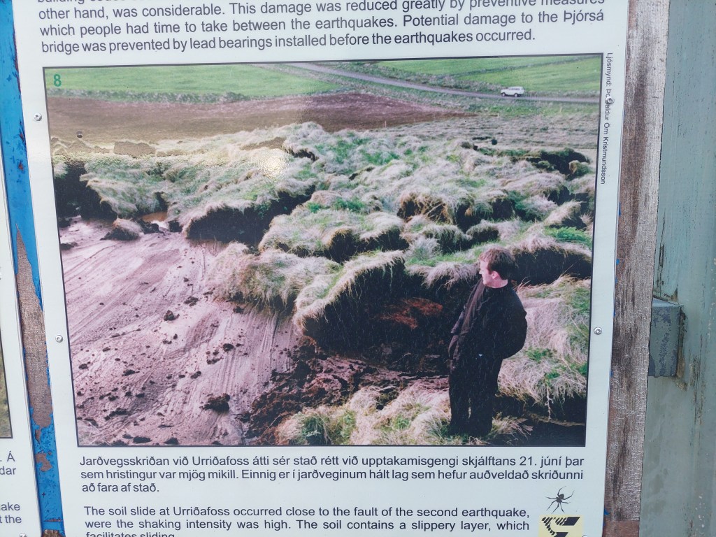
9. Laki (Lakagígar)

https://images.openai.com/static-rsc-4/otHyt5S_CA02G1fmc-2ceauC9TP0zhY5piyAOxrDSjzG66rHQitEAMWNG0mj1esKpzgzJdFK8y82q_7-F04rTRigzbKxoE2DNxLM7IUMIPSTVIvT1yyFwoypkVDe9WAv1rJdJX2BoQwmpWNk90M73oyU-ev9c2yEiTbdYuTlbotrHV0ccG4lYwjE-OpBFo4M?purpose=fullsize
https://images.openai.com/static-rsc-4/xQI1Trkv1BjufZhngOqNnoYg6rUgc63EDnEBh_f8j09YdNJCgj0RRF7LyqTvN5uEIFI2IpFal1MDPsOpfyzGG8HweTBOzyEuyLAQ15vPuoiNdgNHUIfKDw68SoBK5QyO6KVlqiZSIXo5ANmAnbPbAOJe1eayg8ypeSBA7yRheuKYr0P2VZKBlVYX8DzOiuxF?purpose=fullsize

5

The Laki fissure system produced the devastating 1783 eruption, one of the largest lava outpourings in recorded history, with profound climatic and societal impacts.

10. Grímsvötn

https://images.openai.com/static-rsc-4/6okzEhCrS4BQveHSM0_tzwCu03xm1yubfRCuoKDn02LCQOj0mTTOjdObMgwNJ5bwmpX0aiY8uqgymDjJ70fx1o9KhSErZ1879mUh26qucj3tSBwc-OwWLbc0jwQl6PHMp9dmttcjn5Nv9hOuWwJeGKBbFX7aIbjmvOIHWtXghJkeT3ssEPTpQlm2sPAFfTDM?purpose=fullsize
https://images.openai.com/static-rsc-4/-3BaFsOmUC5a9gSDgU2NjRpi6fhcT757hIweGPvViGbNYe8-mYrDKAlSFjB2Kd1QGfdEfyq04lC7Z4fe4oByd0UZJFWfbWDvxk5dw7FY_NakkzCud8se_CZ0VdsOhzapanZYtulvqOY0pJg8qK-RcC0MdeTAbL68R2JW2y8ZwxsJQTm8MEODcs6GXtc3LN2H?purpose=fullsize
https://images.openai.com/static-rsc-4/vZKygj_wEq0nLIFLeeLmuzXmndgzOfmm2KQkQlUfQMOba8DZ23VemW34Er_tw5xU0-fq7XetcE6_4ZbmN2FGtllhdYpSBxhzTp95ihkyHamH494btssLgmWhq2-TtyIQ027XnVNtVbevvqeIQ5IlQCXUfQXdkShJ1rG1VQ5EAwK3TRAHJA8NXt98j-NjaxZE?purpose=fullsize

7

Grímsvötn is a powerful subglacial volcanic and geothermal system beneath Vatnajökull, known for frequent eruptions and strong geothermal activity.

11. Kverkfjöll

https://images.openai.com/static-rsc-4/LSHPy5oNFDgDu2zG4vHXZwKfZ3ISTKl2YxbJ8VOgVGZVE33grgQkNqa_h5EAdRmQ25Kg6BMAi2SOhVtJUmkgXBw3DS1WuGrmwzmoEmChPzIgImP4YzTy7t9Q-Ns02RD0UA4oVpQcLCcQUr6GHPaUknm0RHk3ITepX8bNUDIjSzesQdwumTYeo0PnKB8hNQjv?purpose=fullsize
https://images.openai.com/static-rsc-4/VhkUYA96oT8wwOfZ7ReLWR1l_Cn5xCZNw-kWg-htuxN_FdBLxFbmwpJlAyYvEQ5ZzFSGAX-7jtXC3A5dj0QMA9UxpYkrwO_xgKQZT82XTwjcwAr2gjaP5kmi0aKDnL4GW2mIqYrtepc22USsMp0iyOlEbTtcUGCfG2SexVYg5PctYhSV24AZABZGgOzQXZq3?purpose=fullsize
https://images.openai.com/static-rsc-4/4pqdCBjma1hfwv1iZ4xpGNJ68gKROk3LscSoSQABUFaS-souEmD20_hQhdaBhn_35HuErIWEeQwDum-9-DJaXGDO7U_A8f7c9-oy0hyXptZEbNHhzAYFQVvDyeD3ivPG1mGeNpcKowN27a0PswljozBp0El9vQ5Cfs4QJrCRg1x43sWKqZHxLIuIzt-W7QPJ?purpose=fullsize

7

At Kverkfjöll, geothermal heat interacts directly with glacial ice, forming a complex volcanic environment. Within your framework, this site fits particularly well into the broader convection-roll pattern.

12. Askja

https://images.openai.com/static-rsc-4/F3r74x0_WNlQdtzaBU39zO30vfU3sIpvF_cJb6Vj-A_CK_Wdg0nXgx99A05tWSsWruyK59b8wEZ3odVQG370yPFJOO4liJFtkdslBvhEltlebkRuL5dmZe-I4SVDBqiQ5iIgyfNpdUcxJf-ftsrxRMCTxegzHmm-2oAFoFAOEAOcYj-5ZYfxJDwTYb8Sh5AM?purpose=fullsize
https://images.openai.com/static-rsc-4/8Vz679tauailJ_yYkhog6DeNj9y2-aiNV9RUj5olC3Y1-CNjlsTQFFCetFp8oY2ZyhvgWpIsrnUdHPBKU76uErpTa2pBj6nhR4NavEslGEsIs7r4bIozdegJ9UQ4xUwdWHUUOJ3CHKFrkbw35SmZtJMLCCG0KOIPn66HmwyGxvuNvCzTzWzRLH1ETzAPM87w?purpose=fullsize

The Askja caldera lies near the central axis of the North Volcanic Zone. It represents a major կենտրոն point in the tectonic and magmatic system.

13. Krafla

https://images.openai.com/static-rsc-4/9MGcSC-ARwX9eGXAHZyRUhZ2YxsXgMF4kvQvSjpzNuS_YpyIR3qLb6t96lY2Du1V0rLclGT-1T-8eyy_LydEX9vTPcn_Xd7jtzCTiOoKsHTx6r3mHvt1Ldxd-v0f3AfDLPh8TNKrUeXzxOiQjQRIhluaBGPIXYEWM6XcYu5WurH22kFofIU8YsKN3sk9-FyH?purpose=fullsize
https://images.openai.com/static-rsc-4/sGWqrRskYJG3jDdD9fisvsiCcp8ouP4B_wex8OqN_-OeDf9YdtBcQ2yCNZb7Fd7J1HeU9FiLVSUO_NMYpvLhKmtAiP5TM-ndqLtTdQICHl8J7LXz8MHex0LhwJGDjveVbUtZzklqRGxwwtJDdSIpFNi7oNU40CBW244vNyYqgw5Pkn2ss-ZxBqPsL_5DZVg_?purpose=fullsize
https://images.openai.com/static-rsc-4/gq0JFvUlRnPK0eDU1H8auj2TdkjRsHuApuFtWaYbdZReLnmlFYJYBmWacIY8_D38J67MZQx4jkEpQm76w93WZ3EekAJEC9L_PF0mXBIN2ad7l6ffex0YWRFMUubF7PzmsjcBjI1DQCJyCKyv8W4wu2hmySQnYOOrtYWnhpy8QakLB-Bnw3lTJISsFY0DdAXm?purpose=fullsize

7

The Krafla volcanic system sits within a structurally complex region, where multiple smaller tectonic segments intersect, forming what can be interpreted as a hub within the larger pattern.

14. Öxarfjörður

https://images.openai.com/static-rsc-4/sLBIJDlXDJeeruA55P8vUbhJcvH4BbqNl4QgaUfzXbQy1C5tdhUyMpyNZfINFdr7M8nCudlD-MPh_abzzuRqAP02vay0LNqb_YcDcFosWHY5fcon1kHmJTD3OX4GOHgelzRQzUXVhHIp-jmWGa4dnTVV-4ANwWiq0bgjjkGL4tzgos3rWygiaDxwZUxPpOre?purpose=fullsize

Finally, at Öxarfjörður, geothermal activity reaches the coastline. This marks the northern continuation of the system and again aligns with the broader structural framework.


Uncategorized

Double Convection Layers: A Geometric Framework for Mantle Structure

Working with numerical models is ultimately grounded in measurements and physical principles. The observational basis for Earth’s internal structure has been accumulating for more than a century, and the discovery of the inner core 90 years ago illustrates that our knowledge of the deep Earth is not new. However, it remains significantly more challenging to resolve the structure of the mantle itself, primarily because seismic observations are affected by multiple factors, including:

  • limited resolution of seismic tomography,
  • dependence on inversion methods and starting models,
  • heterogeneity in temperature and composition,
  • anisotropy and attenuation effects,
  • uneven global distribution of seismic data.

Modelling therefore plays an essential role in filling the gaps between observations. We have relatively robust constraints on the layering of the Earth, and the physical behaviour of mantle materials under pressure and temperature. This makes it possible to explore simplified but physically consistent flow structures within these layers. One such approach is to introduce convection rolls into the mantle, layer by layer, guided by physical constraints.

Under an adiabatic temperature gradient, and with mantle material close to the melting point (and solidus as well) of peridotite, conditions favour Rayleigh–Bénard-type convection, which naturally produces convection rolls with approximately equal height and width. Based on this principle, a geometrically consistent model can be constructed and subsequently tested against observations.

However, this approach raises an important question: What if our current understanding of mantle layering is itself incomplete?

There are several indications that the lower mantle may not be as homogeneous as the commonly assumed continuity between ~670 km and ~2700 km suggests. For example:

  • Subducting slabs often change direction or flatten at depth rather than descending vertically.
  • Seismic waves may show reflections or scattering, suggesting internal structure.
  • The upper mantle is already organized into paired layers:
    • the asthenosphere (~120–410 km), and
    • the transition zone (~410–670 km).

One possible interpretation of these paired layers is that they facilitate horizontal circulation within the mantle. If large-scale convection rolls exist below 670 km, it would seem inconsistent if that part of the mantle lacked a comparable capacity for lateral circulation. This motivates the exploration of a model in which the lower mantle is also divided into two layers, enabling similar circulation behaviour at greater depths.

Importantly, introducing such a subdivision does not significantly alter the aspects of the model that most strongly affect surface observations. The dominant surface expressions remain controlled by the ~1.5°-wide convection rolls in the asthenosphere and transition zone. Furthermore, processes below 670 km remain difficult to observe directly, and many key constraints are still derived from shallower structures such as slabs and convergent boundaries.

One intriguing aspect, however, is the possibility that there are more large-scale division lines than the 12 ones predicted by simpler whole-mantle convection models. For instance, the relatively stationary distribution of continental masses on the equator, geologically found to be 30° wide and spaced 60° apart, can be more readily interpreted if two large-scale convection rolls exist beneath them, circulating in opposite directions. This interpretation would also imply that the three major north–south trending oceanic ridges near the equator are associated with large-scale upwelling systems, with convection rolls diverging beneath them.

Based on this reasoning, an alternative geometric model can be constructed. This model:

  • uses circular convection cells with equal height and width,
  • connects each cell to its neighbours at a single point,
  • allows global horizontal circulation, in addition to the more emphasized vertical convection.

Within this framework, geometric constraints suggest that an additional transition layer in the lower mantle should exist. Specifically:

  • a discontinuity zone is predicted at approximately 1850–2030 km depth,
  • with a central depth near ~1940 km,
  • and a thickness of roughly ~180 km.
Convection rolls model with two lower mantle layers.

This construction follows the same mathematical logic used for the upper mantle, where the key divisions occur near 410 km and 670 km. Similarly, at the base of the mantle, the core–mantle boundary region (2700–2900 km) reflects comparable geometric considerations.


Uncategorized

The Equatorial 30° Mapped Fact of the World

Explaining this is becoming easier with good drawings. AI got the idea! Please have a look at this map:

Try this yourself

Look at a world map and focus only on one line: the equator. Now follow it from west to east.

What do you see?

South America spans about 30° – The Atlantic Ocean spans about 60°. If you see that — keep going, and now continue along the equator:

  • West coast of Africa → Great Rift Valley 30°
  • Great Rift Valley → Mid-Indian Ocean Ridge 60°
  • Mid-Indian Ridge → West coast of Indonesia 30°
  • West coast → East coast of Indonesia 30°

Pause. Look again.

What pattern do you get?

30° – 60° – 30° – 60° – 30° One more step. Now try something else.

Start at the east coast of Indonesia
and trace the arc of the Ring of Fire
all the way to the west coast of South America.

So what do you find?

You have now followed the equator across the globe. The question is simple: Do you see a pattern — or not?Is it:more regular than expected, or less? Just look at the map. And decide for yourself. The more accurate maps you use the better. Then we are back to a more scientific approach:

Section of Mantle Convection Rolls System within the Earth

Along the equator, a pattern like this should be expected, because convection within the Earth does not occur randomly but tends to organize itself within each layer. The internal layers of the Earth have been measured with considerable accuracy, and it is well established that the temperature gradient of the mantle is close to adiabatic. This implies conditions similar to those found near the base of the tectonic plates, at depths of around 120 km, where mantle material is relatively stable, and below that it becomes capable of slow flow. Laboratory experiments show that under such conditions, mantle-like material tends to form convection rolls with approximately equal height and width. From this, it is reasonable to expect that a regular pattern of this kind should emerge within the Earth.

This expectation corresponds closely with the observed distribution of continents and mid-ocean ridges along the equator. The equator is a special case, because it represents a zone of symmetry in relation to Earth’s rotation. The horizontal component of the Coriolis effect is effectively zero there, while to the north and south it acts in opposite directions. As a result, the equatorial region provides particularly regular physical conditions, making it a natural place to look for large-scale structural patterns.

A familiar demonstration is often used to illustrate rotational effects: water draining in a sink tends to rotate in opposite directions in the two hemispheres. This is frequently shown near the equator as a simple experiment. But this leads to a more fundamental question: if rotation causes opposite behavior on either side of the equator, what happens exactly at the equator itself, where these effects balance out? Accordingly, we can find a reason why continents and ocean floor sections have a special distribution exactly along the equator! It is The Equatorial 30° Mapped Fact of the World!

Uncategorized

Geometrical Presentation of the Ring of Fire

Main Sections of the Ring of Fire (clockwise)

Geometrical Presentation of the Ring of Fire.

1. Aleutian Islands and Alaska Peninsula

  • Classic subduction arc
  • Aleutian Trench
  • Pacific Plate subducting northward beneath North America
  • Shows segmentation and slab variability

2. Queen Charlotte–Fairweather Fault System

  • Major transform boundary
  • Right-lateral motion between Pacific and North American plates
  • Transition from subduction to strike-slip

3. Cascadia

  • Cascadia Subduction Zone
  • Juan de Fuca Plate subducting beneath North America

4. California

  • Dominated by San Andreas Fault and California Bay
  • Transform motion
  • High seismic activity, limited volcanism

5. Central America

  • Middle America Trench
  • Cocos Plate subducting beneath Caribbean Plate
  • Well-developed volcanic arc

6. Peru

  • Part of the Andean subduction system
  • Nazca Plate subducting beneath South America

7. Chile

  • One of the most active subduction zones on Earth
  • Deep trench and extensive volcanism
  • Site of major megathrust earthquakes

8. Antarctic Peninsula

  • Continuation of Andean-type subduction
  • Interaction between Antarctic, Scotia, and South American plates
  • Complex tectonic transitions

9. Antarctica

  • More diffuse tectonic setting
  • Volcanoes

10. Antarctica to Mid-Ocean Ridge

  • Transition from subduction-related systems to divergent boundaries
  • Includes spreading centers of the Southern Ocean

11. Mid-Ocean Ridge to New Zealand

  • Pacific-Antarctic Ridge
  • Seafloor spreading
  • Transition toward complex plate boundary near New Zealand

12. Tonga–Kermadec Subduction Zone

  • Tonga Trench
  • Among the fastest and deepest subduction zones
  • Very steep slab geometry

13. Trenches Connecting Guinea and Tonga

  • Region including New Hebrides (Vanuatu) subduction system
  • Complex interaction of microplates
  • Highly active volcanism and seismicity

14. Philippine Trench

  • Philippine Trench
  • Westward subduction of the Philippine Sea Plate
  • Multiple interacting subduction systems nearby

15. Ryukyu Trench

  • Ryukyu Trench
  • Subduction beneath the Ryukyu Arc
  • Back-arc extension in the Okinawa Trough

16. Kuril Islands and Kamchatka

  • Kuril-Kamchatka Trench
  • Classic Pacific Plate subduction beneath Eurasia
  • Highly active volcanic arc

Additional Key Reference Points

These are important markers in your framework, linking geometry and deeper structure:


A) Western Equatorial Point

  • Key symmetry point along the equator
  • Potential reference for large-scale mantle structure

B) Eastern Equatorial Point

  • Counterpart to the western point
  • Defines global-scale division of the Pacific system

C) South Island

  • Transition between subduction and transform (Alpine Fault)
  • Oblique plate motion

D) Yellowstone

  • Intraplate volcanism
  • Often linked to deep mantle processes

E) North Island

  • Active subduction (Hikurangi margin)
  • Volcanic arc and back-arc extension

F) San Andreas Fault

  • Major transform boundary
  • Separates Pacific and North American plates

G) Challenger Deep

  • Deepest point in the oceans
  • Extreme subduction environment

H) Hawaii

  • Intraplate hotspot chain
  • Indicates deep mantle upwelling

J) Japan

  • Complex multi-trench system
  • Interaction of Pacific, Philippine, and Eurasian plates

This represents a highly comprehensive description of the Ring of Fire. The underlying causes can be considered from several perspectives. One key factor is the presence of two reference points along the equator, which appear to define the foundation of a large-scale symmetric structure. Rather than forming a perfect circle, this structure resembles a mirrored ellipse, skewed westward in the Northern Hemisphere and eastward in the Southern Hemisphere. This asymmetry may reflect the influence of Earth’s rotation, which affects large-scale flow patterns in a consistent manner. In contrast, a non-rotating Earth would be expected to produce a more uniform, circular geometry.

The boundaries of both the outer and inner parts of this system can also be interpreted within this framework. Not only do the equatorial reference points appear to play a central role, but comparing the details with additional control points throughout the mantle convection system, it seems like they too contribute to shaping the overall structure.

When examining specific details, further intriguing patterns emerge. Along the minor axis, key features such as New Zealand, the San Andreas Fault, and Yellowstone are aligned. Along the major axis, systems such as Japan stand out. A north–south axis can be associated with Hawaii, while the Challenger Deep appears to lie along a principal line within the inner structure of the system. Even the configuration of mid-ocean ridges shows a degree of resemblance to segments of this broader circular or elliptical pattern.

These recurring geometric relationships suggest that the Ring of Fire may reflect a deeper, organized structure within the Earth system, and horozontally the global arrangement is clearly not random at all. Saying ‘not random’ is an inverse scientific statement 🙂 This makes people curious, and this makes people surprised. At the same time, this indeed does raise important questions about the mechanisms responsible for producing such large-scale coherence.

Uncategorized

Aleutian Subduction as a Function of Mantle Convection

The Aleutian Trench extends from Alaska to Kamchatka, forming the northern segment of the Ring of Fire. Along this boundary, the Pacific Plate is subducted northwards beneath the adjacent plate.

However, the character of this subduction differs from many other regions of the Pacific. The slab appears less continuous and less regularly organized than in classic subduction zones. Within the convection rolls model, this can be explained by the direction of plate motion: northward drift causes the plate to move largely parallel to the underlying convection rolls rather than perpendicular to them. As a result, the rolls tend to deflect and segment the slab, producing divisions and irregularities.

The Aleutian Subduction Zone

What remains remarkably consistent, however, is the position of the subduction zone itself. As seen on the model map, the Aleutian subduction zone extends between two major division lines in the lower mantle. Furthermore, its Alaskan end coincides with a crossing of two such deep-mantle structures. These intersections may act as anchoring points, helping to define the outer limits of the entire Ring of Fire.

At first glance, such consistency might be dismissed as coincidence. Yet similar patterns recur around the Pacific margin, collectively forming the well-known Ring of Fire. In the case of the Aleutian system, the subduction zone not only spans between two division lines but also aligns with additional crossings at slightly lower latitudes. These points can be interpreted as key nodes—together with corresponding structures in the upper mantle—controlling the downwelling process responsible for subduction of the Pacific Plate along approximately 51°N.

Consistency between Ring of Fire and circular form.

1. Alaska – Cascades 2. San Andreas – Central America 3. Eastern equatorial point – South America 4. Antarctica 5. Antarctica – New Zealand 6. New Zealand – Indonesia (western equatorial point) 7. Phillipine Sea Plate 8. Kuril Islands – Aleutian Islands.

    In this framework, subduction operates in a manner comparable to regions where plates move predominantly east–west: the plate is forced to bend, descend, and penetrate into the mantle. This process is supported by convection rolls that are arranged more or less perpendicular to the direction of motion, even if only locally. Antarctica represents a further key case study within the broader Ring of Fire system. Here, the main point of interest is the striking consistency between the convection rolls model and the large-scale circular geometry observed around the Pacific margin.

    The recurring geometric relationships observed around the Pacific provide a compelling basis for comparing the convection rolls model with real-world tectonic systems.

    .https://en.wikipedia.org/wiki/Aleutian_subduction_zone#/media/File:EQs_1900-2016_aleutian_tsum.png