Mathematics of Mississippi River
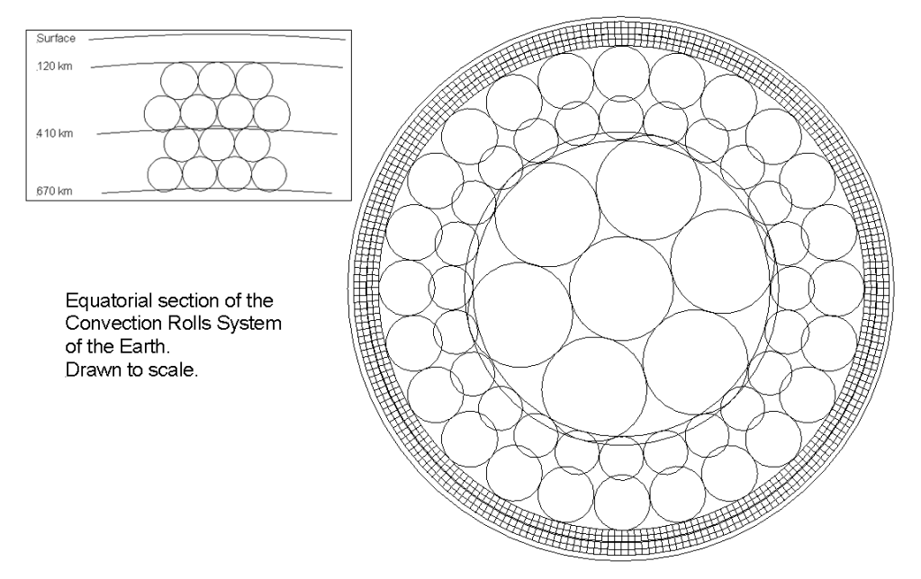
One of the recurring observations in the mantle convection rolls model is that major surface features, both continental and oceanic, are not randomly distributed. Instead, they appear to follow large-scale geometric divisions of mantle convection rolls.
A compelling continental example is the Mississippi River system, as shown below:
The thick lines, one of which closely follows Mississippi, represent the large-scale lower mantle convection rolls as shown here:
The Mississippi River representing a Mantle Division Line
The Mississippi River follows a remarkably linear north–south corridor that coincides with deep tectonic segmentation of the North American lithosphere. Along this corridor lies the New Madrid Seismic Zone, one of the most significant intraplate seismic regions in North America.
In the conventional framework, intraplate earthquakes are often treated as localized structural reactivations. However, when viewed through the mantle convection rolls model, the Mississippi corridor may represent a lithospheric expression of a deeper mantle division line. The seismicity is then not anomalous, but a surface response to organized mantle flow beneath the continent.
This interpretation gains strength when examined geometrically.
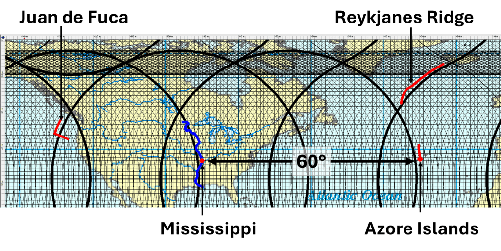
At latitude 37°N, two reference points illustrate a striking longitudinal spacing:
- 37° 0.000’N, 90° 0.000’W — Mississippi River region
- 37° 0.000’N, 30° 0.000’W — Mid-ocean ridge near the Azores Triple Junction
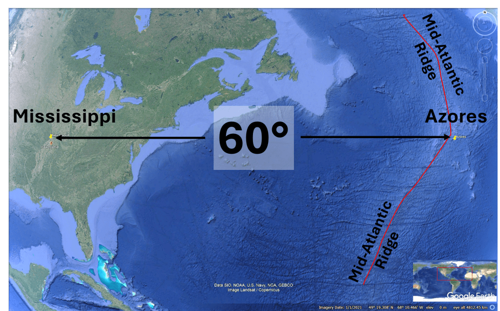
The second point lies along the Mid-Atlantic Ridge, 60° of longitude east of the Mississippi reference. This spacing is consistent with the calculated division intervals derived from large-scale convection roll geometry.
The Mississippi River corridor and the Mid-Atlantic Ridge segment near the Azores thus occupy corresponding positions within the roll framework, one expressed in continental lithosphere, the other in active oceanic spreading.
Extending the Pattern: Juan de Fuca and Reykjanes
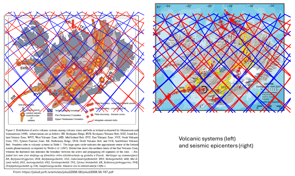
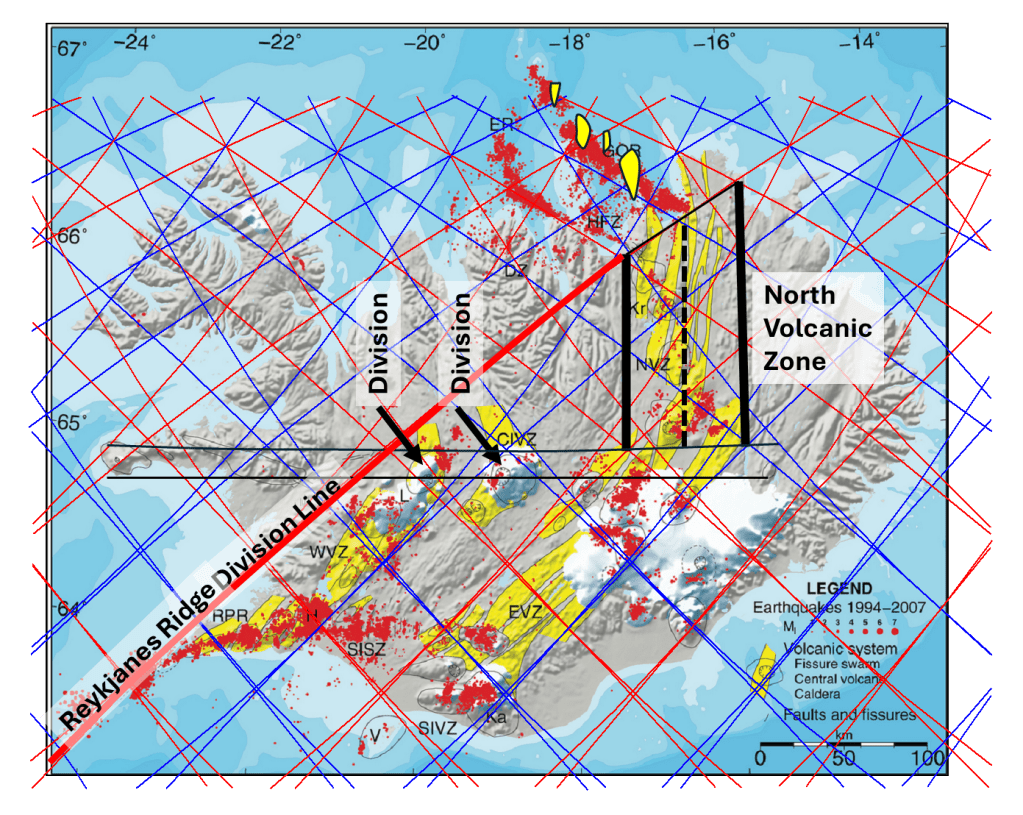
The pattern does not stop there, as two additional ridge systems , the Juan de Fuca Ridge and the Reykjanes Ridge, are also located along mathematically calculated mantle convection roll division lines.
These two ridges show notable geometric consistency with one another:
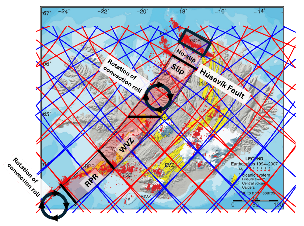
The Reykjanes Ridge forms the northern extension of the Mid-Atlantic spreading system toward Iceland, while the Juan de Fuca Ridge represents an active spreading center in the northeast Pacific. Despite their geographic separation, their placement within the roll division geometry suggests they are not isolated features but components of a larger, organized mantle system, exactly 90° apart from each other.
A Unified Interpretation
When these features are considered together, a coherent spatial pattern emerges:
- The Mississippi River tectonic corridor
- The New Madrid Seismic Zone
- The Mid-Atlantic Ridge near the Azores Triple Junction
- The Reykjanes Ridge
- The Juan de Fuca Ridge
All align within a consistent framework of mathematically derived mantle convection roll divisions.
This alignment suggests that:
- mantle convection rolls structures exert a primary control on lithospheric segmentation.
- Oceanic spreading centers and continental intraplate seismic zones may represent different surface expressions of the same deep mantle flow boundaries.
- Intraplate activity along the Mississippi is not an exception to plate tectonics, but a predictable outcome of organized mantle roll geometry.
Rather than viewing mid-ocean ridges, triple junctions, and intraplate seismic zones as separate tectonic phenomena, the convection roll model places them within a unified dynamic system.
Implications
If these correlations are structural rather than coincidental, they imply that mantle convection rolls operate at a scale capable of organizing both continental drainage corridors and oceanic spreading centers.
The Mississippi River, often treated purely as a surface hydrological feature, may therefore trace a deep mantle boundary. The Azores Triple Junction and associated Mid-Atlantic spreading segment may represent the oceanic counterpart of the same geometric division. The Juan de Fuca and Reykjanes ridges further reinforce the repeating pattern.
In this framework, Earth’s surface geometry reflects a deeper, mathematically structured mantle circulation, one that integrates ridges, faults, triple junctions, and intraplate seismicity into a single coherent system.
The accumulating consistency among these examples adds to the growing collection of geological features adhering to the mantle convection rolls model.