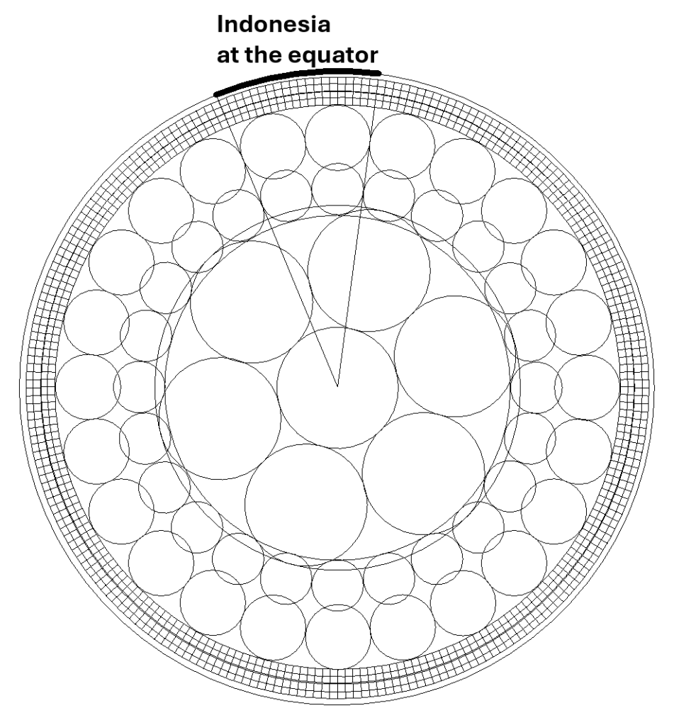
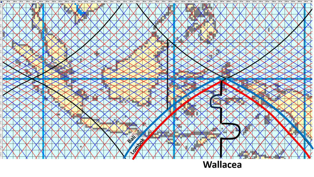
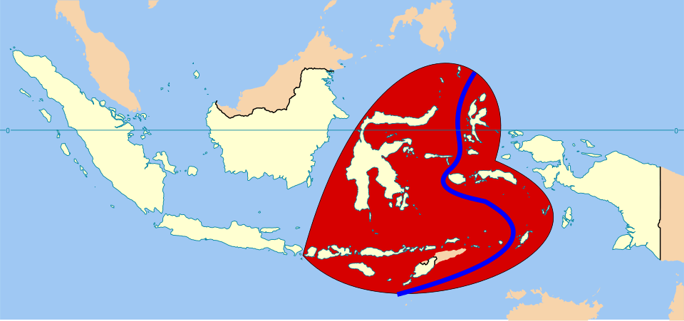
Comparing large-scale convection rolls with the shape of the Pacific Ocean reveals several intriguing geometrical structures. The first step is to consider the equator itself. It forms a simple reference line, but one with important physical implications, because the effects of Earth’s rotation differ there from those at other latitudes. At the equator, the clockwise deflection characteristic of the Northern Hemisphere, and the tendency of horizontally moving particles to turn anticlockwise, do not apply in the same way.
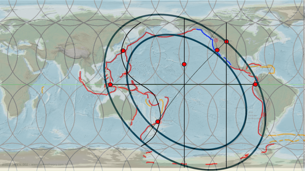
The presence of major subduction zones on either side of the Pacific, Indonesia in the west and South America in the east, approximately 150° apart, provides two stable reference points.
As the Ring of Fire is a well-established concept, the volcanic regions can be outlined in a relatively simple way, beginning from these two equatorial reference points. The San Andreas Fault provides particularly strong support for this geometry, as it forms the sliding boundary between the Pacific Plate and the North American Plate. https://www.youtube.com/watch?v=YQtMBmS49Ew It thereby marks the approximate position of the minor axis of the elliptical form that appears when the Ring of Fire is sketched onto a map. This essay contains a lot of details:
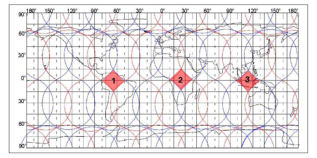
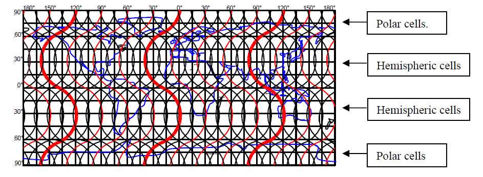
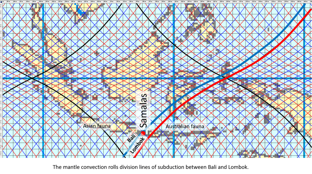
Several principal lower-mantle division lines from the mantle convection rolls model are also drawn on the map. It should perhaps have been mentioned earlier that the major intersections between the main lower-mantle convection rolls coincide with the subduction regions on both the Indonesian and South American sides of the Pacific (shown with red dots). This observation alone deserves attention when comparing the model with the map.
Additional features emerge when examining the northeastern section of the Ring of Fire. When the outer limits of the Ring of Fire are outlined, the resulting elliptical form crosses Yellowstone National Park, a volcanic region unlike any other. Within the model, the pattern created by the division lines between convection rolls of different mantle layers produces a north–south axis between the predominantly north–south-trending rolls. Yellowstone is located directly on such a north–south axis.
With this in mind, the position of Hawaii also becomes significant. Hawaii is located not only on the north–south axis emerging from the convection-roll division pattern, but also on the central north–south axis of the Ring of Fire as represented on this map.
Looking at the western side of the Pacific, one of the first indications of a broader geometrical structure is the position of New Zealand along the minor axis of the elliptical form, opposite the San Andreas region and Yellowstone on the same axis. The Taupō Volcanic Zone is located where this minor axis intersects a principal lower-mantle division line. On the map, that mantle division line is drawn somewhat exaggerated in order to emphasize its significance.
The western Pacific is subject to intense geophysical and tectonic stress, and this particular division line — extending from Japan to New Zealand — appears to accommodate much of that stress. Comparing the Northern and Southern Hemispheres, New Zealand and Japan, together with the subduction systems extending southward and northward from them respectively, display a mirrored relationship. Because stress is concentrated along this division line, and because rotational effects differ symmetrically between the hemispheres, New Zealand appears within the inner elliptical form of the Ring of Fire.
Further similarities emerge when examining the convection-roll division lines. Not only do Japan and New Zealand occupy corresponding positions within the model, but major volcanic centres such as Mount Fuji and Taupō are also found in analogous hemispherical settings on opposite sides of the globe. Likewise, the Kermadec Trench and the Izu–Bonin Trench display mirrored alignments.
The circular — or more precisely elliptical — geometry of the Pacific can therefore be compared with many details of the mantle convection rolls model. At the same time, the dimensions and shape of the Pacific have continually changed through tectonic drift. Over geological time, plate motion gradually alters the geometry of the basin itself.
The geological development of the region is equally revealing. Research has shown that much of the crustal material now forming southern Alaska originated at far more southern latitudes and has since been transported more than a thousand kilometres toward the northwest. The Denali Fault and Tintina Fault systems appear to have played a major role in this transport after island arcs had been sutured onto the North American continent. This partly illustrates how the Ring of Fire functions and why it extends across a geometrically well-defined region composed primarily of two concentric elliptical forms and the area enclosed within them.
This perspective also suggests that subduction zones may remain relatively fixed once established within the mantle convection rolls system. As the geometry evolves through tectonic drift, slabs descending into the mantle may become detached from their original surface plates, while new subduction zones eventually develop elsewhere.
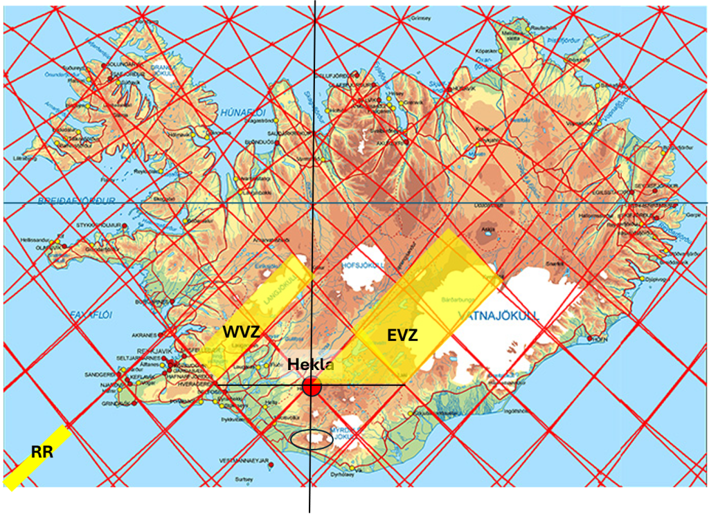
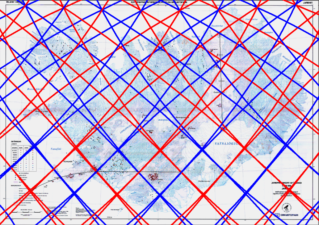
It should be added here, tht there is a possible explanation for the formation of north–south axes within the framework of convection rolls. This becomes apparent when examining the detailed geometry of the division lines and polygonal regions formed between them. These polygons often tend toward a diamond-shaped geometry, with corners aligned approximately east–west and north–south.
Pressure exerted along the sides of such polygons may then create preferential lines of weakness or activity extending from one corner to the opposite corner. When this process is repeated across many adjacent small polygons, the resulting alignment can be extrapolated into the large-scale north–south patterns observed across the Pacific and elsewhere.
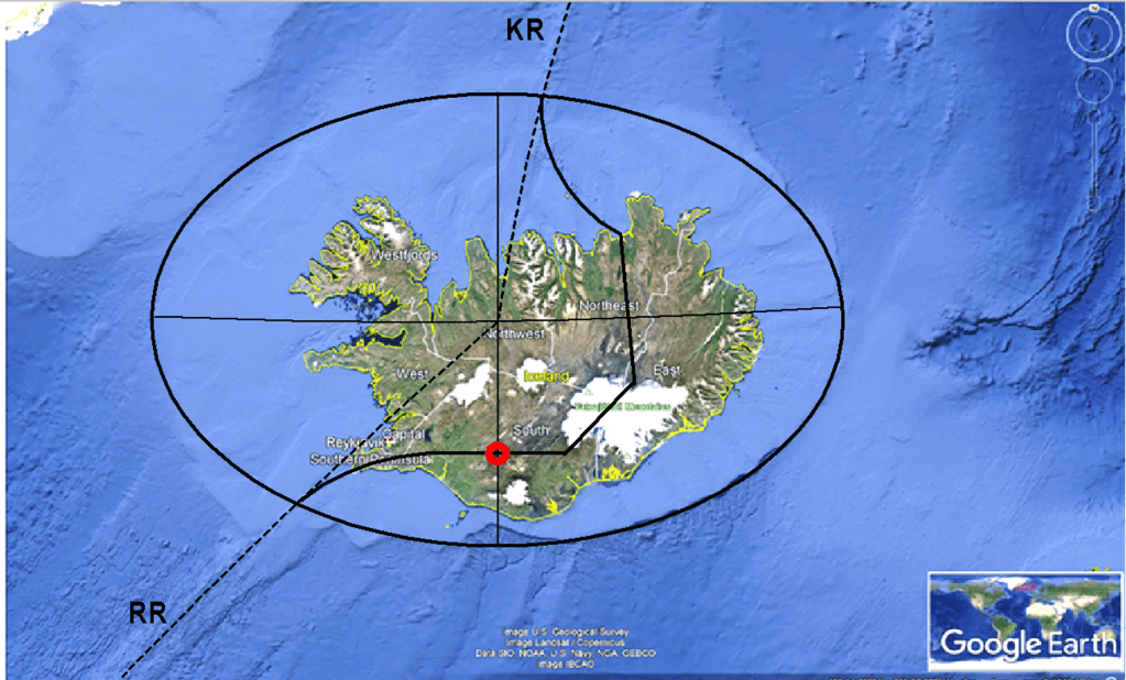
A particularly clear example of this type of geometry can be examined in Iceland. There, the North Volcanic Zone forms a pronounced north–south volcanic alignment, while the South Iceland Seismic Zone follows an east–west-oriented structural trend. Together, these systems illustrate how polygonal stress geometry within the mantle convection rolls framework may influence both volcanic and seismic alignments on the surface.