I am a geologist, graduated from the University of Iceland, and taught geology for a few years. I have gained some knowledge about Earth's inner structure, so I provide this website as my contribution to answer one of the greatest questions remaining within the realm of geoscience. Experiments show that the mantle should form convection rolls when close to the melting point. I took this literally, and calculated the dimensions and shape of these mantle convection rolls. Then I compare that model with the surface. This makes it possible to provide many interesting examples about geology found on my blog.
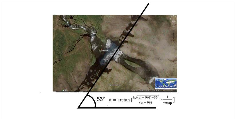
Dynjandi, a mighty waterfall, is located in the Western Fjords area of Iceland, far away from the volcanic zones. Still the orientation of the waterfall can be calculated in the same way as the volcanic zones:
It is located on 65.7°N, about the same latitude as Dettifoss. So those two waterfalls are aligned the same way!
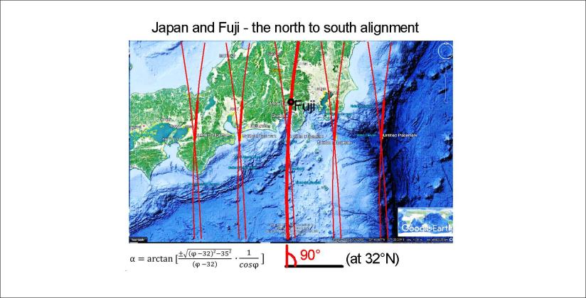
Mount Fuji is located on a triple junction between three plates. It should explain it all, besides the vicinity to the Pacific Plate descending into the mantle. But compared to the convection cell model, the position is unique. Fuji is located directly on one of the division lines of the lower mantle as shown here:
Now we zoom in on Japan to show more details. It is interesting that the convection cells are aligned directly NS at 32°N, and Japan is just north of that parallel, so here is an example of how it works:
This line is a counterpart of the main division line under Iceland:
As has been pointed out in other posts, this line represents both the main convection division at 410 km depth, and the upper most division line of small cells at 120 km depth. The smaller cells are down-welling, and the two lines to each side of course up-welling.
Therefore, in Iceland, The Reykjanes Ridge is found west of this line, whereas Hekla is east of it. Still, many volcanic and geothermal sites are also on the main division line, with the controversy of having up-welling deep below, but down-welling in the upper layer.
This is of course in a way complicated, but it is easy to see what Japan and Iceland have in common according to this model of the convection rolls within Earth’s mantle.
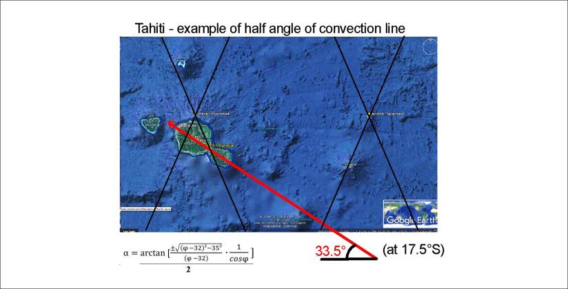
Tahiti is amazingly far away from any mainland. It can be compared with Hawaii, because it has a hot spot at Mehetia. The drift of the Pacific Plate creates a chain of islands. The calculated value of directions can be achieved in the same way as for Hawaii:
This is very close to the measured value of tectonic drift, that is N65°W.
The relevant convection rolls division line is found directly under Mehetia.
Here is the calculated value for Hawaii, for a quick comparison 🙂 Note that the calculations are double for Hawaii (NW and NE trending vectors), because the symmetric effect of the two convection rolls layers appears clearly.
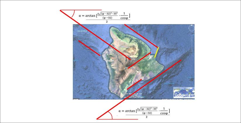
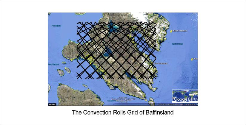
The south of Baffinsland is shaped in the same way as Iceland. Just compare these drawings:
It is obvious that the main faults and coastlines follow the lines. It is also important that at 64°N, Baffinsland extends exactly 9° from coast to coast, or the width of 6 convection rolls. Just to clarify:
In Iceland, at the same latitude as this part of Baffinsland, the upper most (first) layer is of course more apparently shaping the surface. Here is a map of Iceland (based on a map from Náttúrufræðistofnun), and the grid has exactly the same pattern as for Baffinsland:
The numerous details can then by worked out by scrutinizing these maps.
Comparing the west coast of Greenland with Iceland at the same latitudes reveals a common point. At 66°N the coasts are exactly 30° apart. As mentioned before, the basic extension along each latitude is 30°, because each convection roll is 30° wide.
Besides that, similar consistency is found between tectonics and analysis of convection rolls of the mantle in both countries.
This is how it looks:
Just to have Iceland in similar scale to make comparison easier:
There you see that the fjords of NW Iceland follow the equator originated set of lines to the NW, but in Greenland to the NE, but the deviation from east is actually the same, that is 35°.