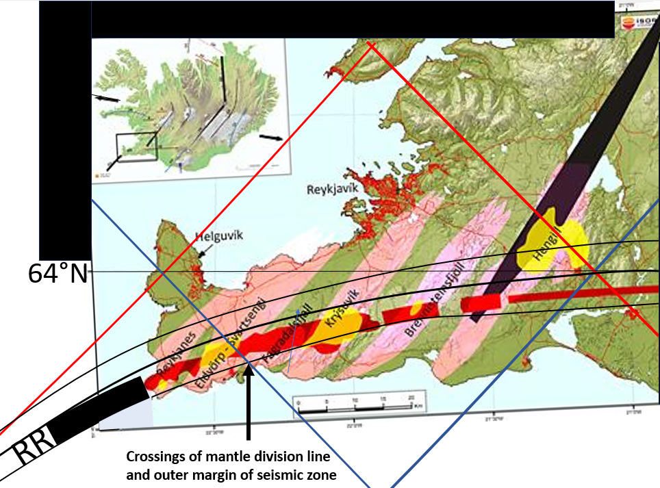
In Iceland, many people think that a mantle plume is responsible for volcanic activity. The plume is thought to be centered around the western part of Vatnajökull. All the same Gilliam R. Foulger came to the conclusion that a plume, of the kind imaged, can not exist. https://www.mantleplumes.org/WebDocuments/P%5E2Rev_Harangi.pdf
In fact, Foulger does find a proof that this kind of plume does not exist. The relevant data shows that no continuous hot mass is ascending under Iceland. Therefore we should stop imaging this plume and continue the search for the inner structure of Earth with measurements and calculations according to the physical properties of the mantle.
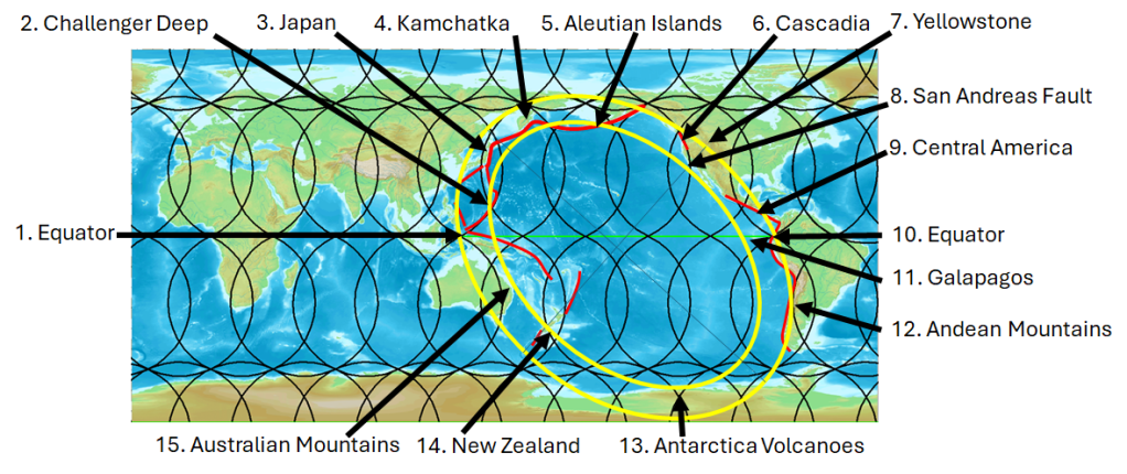
Convection does, on the other hand, fit all available data. Experiments show that mantle material forms convection rolls under those circumstances expected to prevail within the Earth. Testing it, by making a model with convection rolls filling the measured layers, shows remarkable results. Features on Earth, both divergent and convergent, fit to the convection rolls underneath.
Now, when this has been solved, it is very easy to proceed with research programs, further improving our understanding of the inner structure of the Earth. First, we have to admit that the former idea about mantle plumes is wrong. A model of a regular system of convection rolls is what brings us farther ahead. Luckily, we have the scientific method to assist us with our work. By having a foundation of physics, measurements, mapping, calculations and logical thinking, besides being able to communicate freely, these steps forwards can be made.