
Öxarárfoss cascades over the edge of the North American Plate.
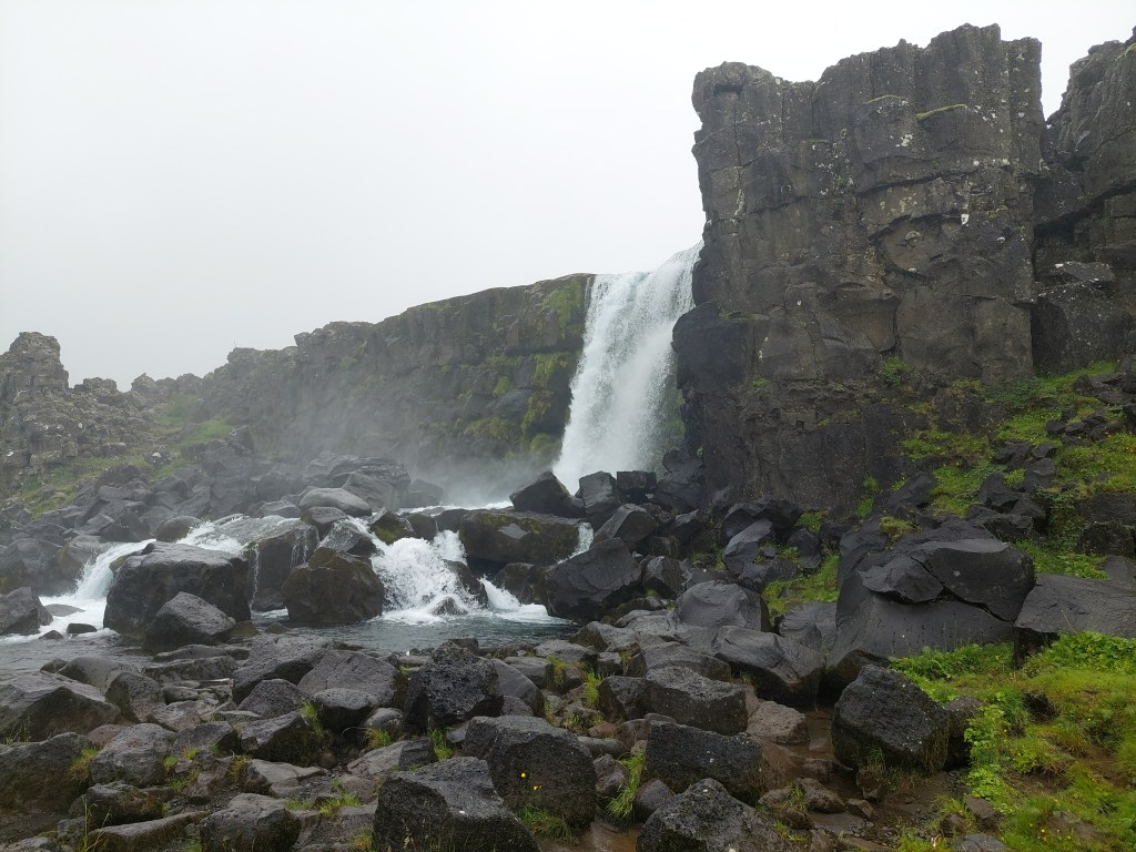
Although it appears completely natural, the waterfall is actually man-made. The course of the Öxará River was deliberately diverted so that it would flow through the site of the Althing, Iceland’s ancient parliament, which was held nearby in the Þingvellir Rift Valley.
According to Haukdælaþáttur, the Öxará River was diverted into Almannagjá, from where it flowed through the assembly site at Þingvellir, providing a reliable supply of fresh water for the thousands of people and horses who gathered at the Althing each summer. The General Assembly lasted for two weeks, beginning at the end of June, every year from AD 930 until 1798. In 1799, it was transferred to Reykjavík.
The Þingvellir Rift Valley was formed by extensional forces as the North American and Eurasian plates move apart. But how do the plates actually move?
Modern GPS measurements are made using the International Terrestrial Reference Frame (ITRF), a global coordinate system that allows scientists to measure the positions and motions of points on the Earth’s surface with millimetre accuracy.
GPS surveys carried out in 1993 and 2004 showed that Iceland as a whole moves primarily northward in the ITRF reference frame. The western part of the country, resting on the North American Plate, moves toward the northwest, while the eastern part, on the Eurasian Plate, moves toward the northeast. Because both sides have a northward component of motion, the island itself drifts northward, while at the same time the two plates gradually move away from each other.
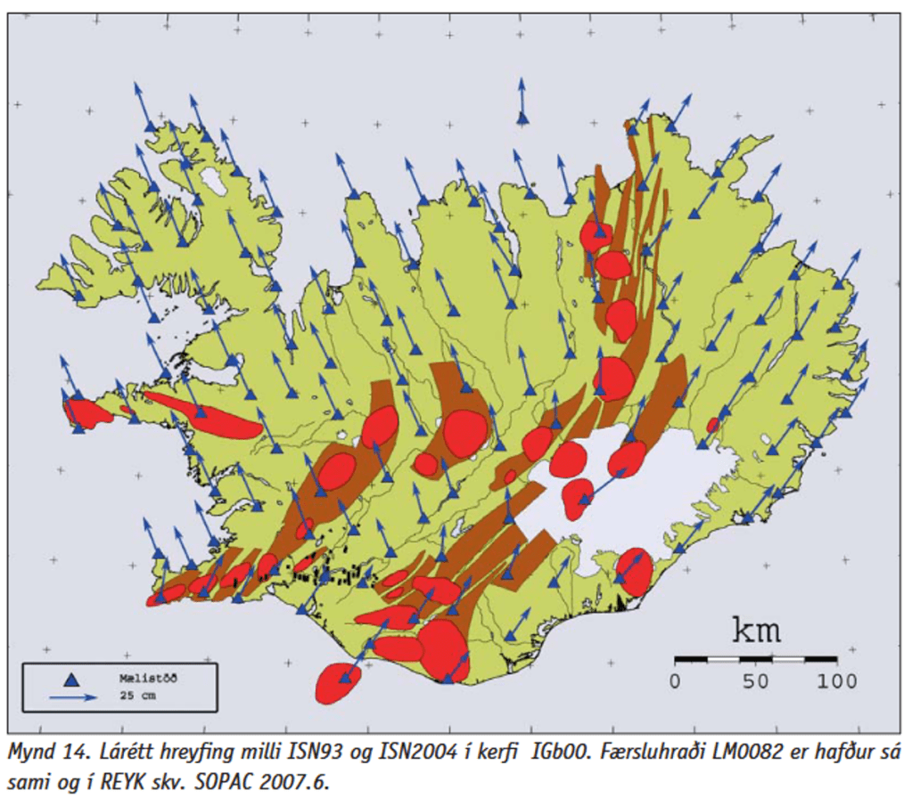
The relative spreading rate across Iceland averages about 18–20 millimetres per year, although it varies somewhat between different volcanic zones. At Þingvellir, this extension is accommodated by repeated earthquakes and movement along normal faults, gradually widening the rift valley. Individual earthquakes can produce sudden offsets of a few centimetres to several decimetres, while the long-term plate motion amounts to only a few centimetres per year.
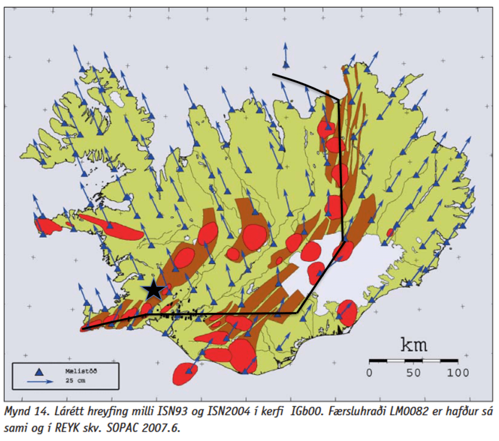
The northward component of Iceland’s motion has received relatively little attention in the geological literature compared with the more widely discussed process of plate separation. This is understandable, as scientific understanding develops gradually, and established models often remain the primary framework for interpreting new observations. As more high-precision GPS measurements become available, they provide an opportunity to further examine the significance of Iceland’s overall northward motion and its relationship to the opening of the rift zones.


