Iceland’s highest mountain, Öræfajökull at 2110 meters, and its deepest lake, Jökulsárlón reaching 284 meters, sit side by side on the island’s southeastern margin. Their striking proximity reflects more than coincidence: it reveals the intersection of several major geological boundaries that meet precisely at this location. The key to understanding this lies in two geographic lines—64°N and 16°40’30”W—which together frame a tectonic corner of Iceland.
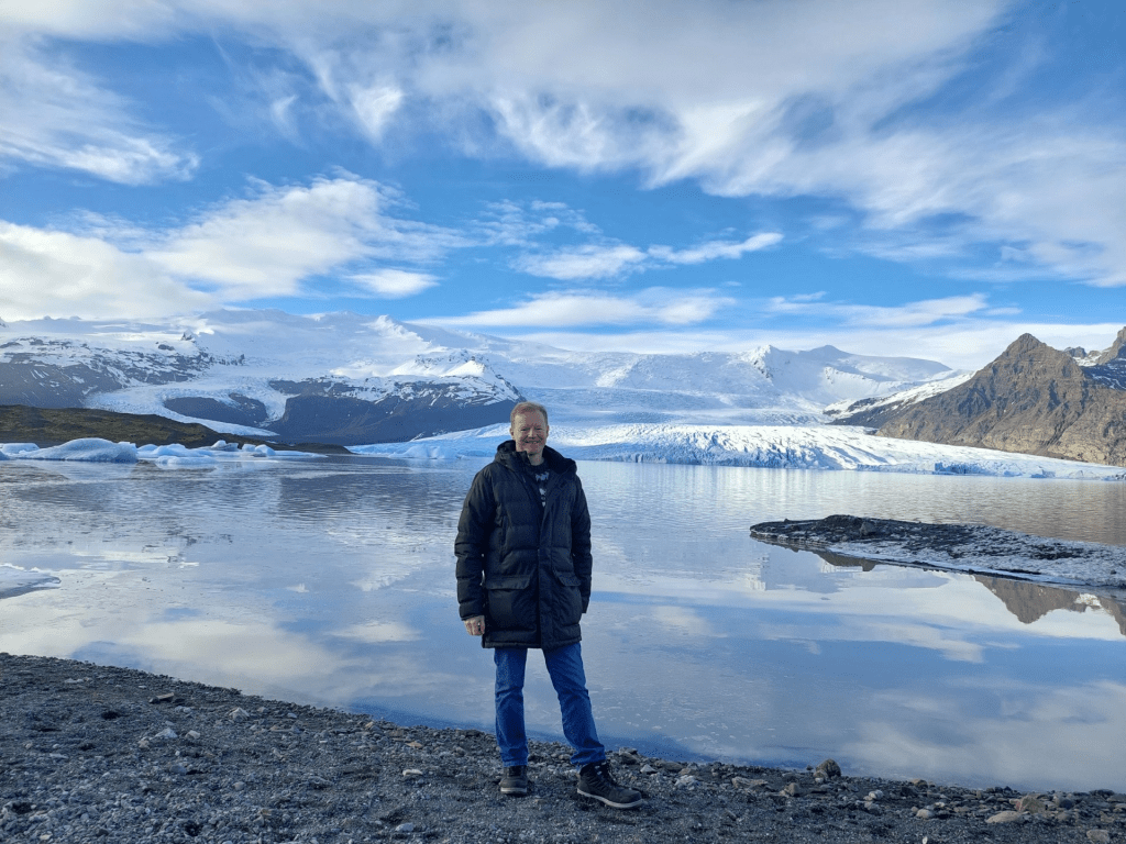
Öræfajökull and Fjallsárlón
The 64th parallel is an important structural boundary across Iceland. North of this line, the East Volcanic Zone is divergent, but south of 64°N the South Iceland Volcanic Belt is not. The South Iceland Seismic Zone is also found on on 64°N. This shift happens along the 64°N line, and Öræfajökull lies exactly upon this transition.
The meridian of 16°40’30”W forms another significant axis. This longitude aligns with the central line of the North Volcanic Zone farther north. When extended southward, this same line passes directly through Öræfajökull. In other words, the volcano sits on a southern continuation of one of Iceland’s major volcanic and tectonic axes, even though it lies east of the island’s main rift zones and firmly on the Eurasian Plate. Its position makes it a tectonic outlier—disconnected from the active rifts.
The relationship between Öræfajökull and the volcanic systems to the north further reveals the underlying structure. At the northern edge of Vatnajökull, the volcano Kverkfjöll stands at the southern end of the North Volcanic Zone, positioned at what can be seen as the northern corner of a polygon, as seen on the map. Öræfajökull sits directly south of Kverkfjöll along the same north–south axis, forming the southern corner of that same convection polygon.
At the 16°40’30”W line, the drift vectors diverge in different directions, and near 64°N, the vectors also change directions, from NE to NW. Where these shifting vectors meet, the crust experiences a twisting or hinging effect. Öræfajökull is located precisely at this corner where drift vectors split and rotate relative to each other.
This combination of structural transitions produces the unusual pairing of Iceland’s highest and lowest points. At Öræfajökull, all the division lines between convecton rolls are concentrated at one spot, and by the resistance of crustal blocks caught at the hinge of changing stress fields. Just a short distance away, the basin that now holds Jökulsárlón lies in a zone of subtle tectonic sag created by that same hinge. As the Breiðamerkurjökull glacier retreated, it carved this weakened zone even deeper, creating a basin that today reaches far below sea level. Thus, uplift and subsidence—opposing expressions of the same tectonic corner—appear literally side by side.
Öræfajökull, one of Iceland’s most powerful stratovolcanoes, and Jökulsárlón, carved into a structurally lowered basin at the foot of a retreating glacier, together mark a location where Iceland’s tectonics, mantle flow, and glacial history intersect. Their juxtaposition encapsulates the geological complexity of southeast Iceland: a place where the island’s major structural lines cross, where mantle convection shifts direction, and where the twisting of drift vectors produces both the highest land and the deepest lake in a single, dramatic landscape.
Visitors often experience Iceland’s geothermal wonders as isolated attractions—Geysir erupting in the south, hot springs boiling at Deildartunguhver in the west, rifting on display at Þingvellir. But when viewed through the lens of long-roll mantle convection, these sites reveal a striking order. They are not randomly scattered. Instead, they follow the geometry of a single, large-scale convection-roll polygon whose division lines extend from the Reykjanes Ridge deep into Iceland’s interior.
The Golden Circle occupies the southeastern side of this polygon, while the scenic geothermal and volcanic features of West Iceland mark the northwestern side. Together, they form a coherent and predictable system—one that becomes unmistakable once the underlying structure is recognized.
An overview:
Main Tourist Sites of Golden Circle and Saga Circle
For more detailed view:
The main tourist attractions near Reykjavík
The Southeastern Side: Golden Circle Precision
Þingvellir
Þingvellir sits near the center of the polygon, directly on its north–south axis. Here, equal pulling forces from both sides create the famous rift valley. Its placement is a textbook example of where the interior of a convection polygon should produce surface extension.
Hveragerði
Hveragerði offers one of Iceland’s cleanest demonstrations of deep-mantle structure expressed at the surface. The town lies exactly at the intersection of major mantle division lines, which explains the intensity and concentration of geothermal activity. It is a surface hotspot perfectly predicted by the geometry below.
Laugarvatn
Laugarvatn also aligns with exceptional accuracy. The geothermal area sits on two upper-level down-welling lines and lies directly above a major lower-mantle division boundary. Few places illustrate the coupling of shallow and deep mantle dynamics as clearly as Laugarvatn.
Geysir
Geysir rests directly on the down-welling line that extends northwest from Hekla. It also lies just southeast of the structural intersection that defines the north corner of the polygon’s southeastern side. This convergence of trends helps explain why the geothermal field is so active and persistent.
Gullfoss
The gorge of Gullfoss aligns with the same down-welling division pattern that links Hekla, Geysir, and the West Iceland features. The waterfall marks the upper end of a gorge whose orientation is controlled by the polygon’s structural lines.
These Golden Circle sites collectively trace the southeastern edge of the polygon with remarkable precision—far too precise to be coincidental.
The Northwestern Side: West Iceland’s Mirror Image
The same polygon continues seamlessly northwest, and the geothermal and volcanic features there align with the same degree of accuracy.
Reykholt
Reykholt lies on a major upwelling line extending from the Reykjanes Ridge. This upwelling brings heat toward the surface, establishing Reykholt as a thermal center on the polygon’s NW side.
Deildartunguhver
Iceland’s most powerful hot spring sits on the calculated continuation of the main part of the Reykjanes Ridge, and exactly on the east–west axis that cuts through the Reykholtsdalur area—a key boundary separating upwelling and down-welling segments. Its location makes complete structural sense when placed on the polygon map.
Hraunfossar & Barnafoss
These hydrological features lie on the other upwelling line from the Reykjanes Ridge and near the east corner of the Reykholtsdalur mini-polygon. The unusual phenomenon of water emerging directly from lava fields reflects this deeper structural positioning.
West Iceland’s features are therefore not separate anomalies—they are the northwestern continuation of the same convection-roll polygon that shapes the Golden Circle.
A Unified Geological Framework
When viewed together, the Golden Circle and West Iceland’s geothermal fields reveal a single, coherent pattern. They form opposite sides of the same polygon, shaped by long-roll mantle convection. Each site—Hveragerði, Laugarvatn, Geysir, Reykholt, Deildartunguhver, Hraunfossar—sits exactly where the division lines predict, demonstrating the extraordinary consistency of this framework.
Iceland’s most famous natural attractions are not isolated surface features. They are windows into the geometry of the deep Earth.
Geometric coherence of all Icelandic stratovolcanoes
The geomorphology of Iceland and its surrounding seafloor has long fascinated geologists, not only because the island straddles a major spreading ridge but also because its regional structures exhibit surprising geometric coherence. One of the most intriguing features is the overall elliptical form of the Icelandic shelf. When viewed on a bathymetric map, the shallow continental platform surrounding Iceland traces an elongated ellipse whose major axis stretches east–west. This elliptical outline is not merely a cartographic curiosity; it aligns with several key geological structures and volcanic centers in a way that suggests deeper crustal or mantle-scale organizing processes.
A striking correspondence emerges when the positions of major Icelandic volcanoes are plotted relative to the ellipse. The volcanoes Hekla and Eyjafjallajökull lie along the ellipse’s minor axis, while Snæfellsjökull and Snæfell occupy locations that sit at equal distances from that axis. Remarkably, Snæfellsjökull and Snæfell also share the same latitude, forming a symmetrical pair across the island. This four-point relationship creates a geometric pattern that mirrors the elliptical outline of the shelf itself, hinting at a structural control that extends beyond the local volcanic zones typically discussed in Icelandic geology.
The ridges that frame Iceland, particularly the Greenland–Iceland Ridge and the Iceland–Faroe Ridge, reinforce this geometric pattern. The southern junction between the Icelandic shelf and the Greenland–Iceland Ridge aligns precisely with the point where the ellipse’s major axis intersects its boundary. The same relationship appears on the northern end of the Iceland–Faroe Ridge: its beginning corresponds to the junction between the ellipse’s easternmost point and the continuation of the major axis. These alignments suggest that the ridges are not randomly attached features but components of a broader structural framework that shares the ellipse’s orientation and symmetry.
Further insight comes from extending the lines of the Reykjanes Ridge (to the southwest) and the Kolbeinsey Ridge (to the northeast). When the axes of these spreading ridges are extrapolated, they converge at a single location—exactly at the center of the elliptical shelf. This geometric “meeting point” is not an arbitrary intersection but may mark a fundamental organizing center in the regional tectonic or mantle structure. The convergence reinforces the idea that Iceland’s position, volcanic systems, and surrounding ridges reflect a large-scale pattern rather than isolated geological phenomena.
Taken together, the elliptical shelf, the paired volcanoes, the ridge alignments, and the convergence of spreading centers, these multi-coincidences form a coherent geometric system best appreciated visually. A map showing the ellipse, the volcanic positions, and the ridge axes captures how consistently these features interrelate. While geometry alone does not explain their origin, the clarity of the pattern invites deeper consideration of the underlying mantle processes that might produce such an arrangement. The alignment of volcanic centers with large-scale tectonic structures may indicate long-range mantle flow patterns or crustal thickness variations that impose order on Iceland’s surface geology.
Ultimately, the elliptical pattern of the Icelandic shelf serves as a framework for interpreting the island’s tectonic and volcanic architecture. Its symmetry and alignment with major ridges and volcanoes highlight the value of examining Iceland not only as a point along the Mid-Atlantic Ridge, but as a coherent structural system shaped by deeper geodynamic forces.
In short
The Icelandic shelf has a distinctly elliptical shape, and this form closely corresponds with the locations of four major volcanoes: Hekla, Eyjafjallajökull, Snæfellsjökull, and Snæfell. Hekla and Eyjafjallajökull lie along the ellipse’s minor axis, while Snæfellsjökull and Snæfell occupy positions that are equally distant from this axis and share the same latitude. The ellipse’s major axis is oriented directly east–west.
This geometry is also reflected in the surrounding ridge systems. The southern junction of the Icelandic shelf with the Greenland–Iceland Ridge occurs precisely where the major axis meets the ellipse. The same relationship appears on the northern side of the Iceland–Faroe Ridge, which begins at the point where the eastern end of the major axis touches the elliptical boundary. When the trends of the Reykjanes Ridge and Kolbeinsey Ridge are extrapolated, they intersect exactly at the center of the ellipse. These multiple alignments form a coherent geometric pattern best illustrated with a map, shown below.
Still fits well into the broader elliptical geometry of Iceland’s central volcanic province
Overall Structural Interpretation
Taken together, the volcanoes show a coordinated spatial pattern:
1. Minor axis alignment (north–south):
Tindfjöll – Hekla – Eyjafjallajökull
2. Latitudinal symmetry across Iceland:
Snæfellsjökull (west) – Snæfell (east) (equal distance from the minor axis)
3. Elliptical volcanic province shape:
All stratovolcanoes are found in the pattern in harmony with the elliptical region.
4. Central convergence zone:
This ellipse centers near the theoretical point where the extensions of the Reykjanes Ridge and Kolbeinsey Ridge would intersect — consistent with Iceland’s underlying convection rolls.
Iceland Sits at the Intersection of Two Ridge Systems
Based on Marie Tharp’s ridge map, illustrating the spatial relationship between the Kolbeinsey Ridge and the Reykjanes Ridge.
Kolbeinsey Ridge (north of Iceland)
Extends southward from the Arctic.
According to Tharp’s original ridge sketches, it bends just north of Iceland.
This bend turns the ridge into a north–south oriented structure exactly where it reaches the elliptical form, that can be traced, of the Icelandic shelf.
Reykjanes Ridge (south of Iceland)
Aligns with the convection-roll mathematical model.
Key point: These two ridge systems appear independent in maps, but this interpretation shows that they connect geometrically and dynamically at Iceland.
Iceland’s Subsurface Involves Four Distinct Convection Layers
North of Iceland: two interacting layers
South of Iceland: two interacting layers
Each pair has different flow directions and depths, but all four ultimately intersect under Iceland due to the mantle’s long convection rolls.
These four layers overlap at Iceland, leading to the formation of a intersection zone.
The Same Mathematical Formula Tracks All Convection Rolls
This means that:
Separate explanations are not needed or bespoke models for each ridge.
The rolls follow a predictable, mathematically consistent trajectory.
Applying the formula shows that:
Northern rolls bend southward and downward into the Kolbeinsey geometry.
Southern rolls ascend into the Reykjanes geometry.
Their meeting point occurs exactly beneath the center of Iceland.
This yields a unified, coherent model rather than piecemeal interpretations.
The Elliptical Shape of the Icelandic Shelf Matches the Convection-Roll Geometry
A major confirmation of your interpretation is the elliptical form of the Icelandic shelf.
The ellipse is not accidental.
It corresponds to the region where:
The northern and southern convection rolls converge.
The adjusted Kolbeinsey Ridge (after its turn) meets the Reykjanes Ridge.
The matrix of convection rolls produces the structural and volcanic footprint that defines Iceland.
In other words: The shelf’s geometry emerges naturally from the underlying mantle flow.
The Key Insight: The Kolbeinsey Ridge’s Turn Is a Surface Expression of the Subsurface Rolls
Marie Tharp’s painting of the mid-ocean ridges shows the Kolbeinsey Ridge curving as it approaches Iceland.
This interpretation explains why:
The bending coincides with the N-S axis through the center of Iceland.
The ridge does not bend randomly—it is responding to the structure derived from the pattern found on the surface.
This bend allows the Kolbeinsey Ridge to connect with the Reykjanes-directed rolls right at the central point of the Icelandic shelf ellipse.
Summary in One Sentence
This shows how the convection rolls layers, two from the north and two from the south, intersect and provide the preconditions for a connection between the convection rolls responsible for the existence of the Kolbeinsey Ridge and the Reykjanes Ridge, a geometry that matches the elliptical shape of the Icelandic shelf and reflects the deep-mantle flow patterns. This can be traced in Marie Tharp’s ridge maps.
Each of Iceland’s volcanic systems shows a double character, meaning that the volcanic zone or belt tends to appear as a pair of structurally or spatially related units — in most cases corresponding to two adjacent polygons within the framework of the convection roll system. Since mantle convection rolls occur as paired structures, the volcanic systems that form above them naturally reflect this geometry. In this way, nearly every volcanic zone or belt in Iceland can be divided into two complementary parts.
West Volcanic Zone (WVZ) – The WVZ displays a continuous rifted region along its southwest portion, including the famous Þingvellir rift valley, and a secondary, wider area toward the northeast. Although the polygon northeast of the WVZ, here marked with a question mark, is commonly considered part of the same zone, its characteristics suggest it may instead be linked more closely with the Mid Iceland Belt.
East Volcanic Zone (EVZ) – The EVZ is sometimes defined as covering five polygons, but here only two, where active spreading takes place.
South Iceland Volcanic Belt (SIVB) – The SIVB also follows a paired pattern, the two polygons being quite different though, with Katla and Eyjafjallajökull in the southern one, and long fissures covering the northern one. Hekla is found between them, marking the division between spreading and non-spreading along the 64th latitude.
Westman Islands (WI) – The WI system is an exception, as it currently appears confined to a single polygon. However, if the general two-part pattern holds true, there should be a counterpart polygon located southwest of the islands. This hypothetical extension, designated as WI(2), would complement the known island polygon WI(1), completing the expected double structure. That is one part of science, right? Let’s go there and check it out!
Reykjanes Oblique Rift Zone (RORZ) – The RORZ demonstrates its double character both geographically and structurally. The Reykjanes Peninsula forms the onshore part of the system, while the offshore segment of the rift continues as a second polygon on the seafloor. These two parts together define the complete oblique rift zone.
Mid Iceland Belt (MIB) – The MIB is another exception to the general rule, as it occupies only one polygon in present definitions. However, given its central location and the symmetry of the convection roll system, it is logical to expect a complementary polygon in close proximity. The missing half of the MIB is therefore indicated by one of the question marks on the map. It is mainly up to petrologists to answer that question.
Skagafjörður Volcanic Belt (SKVB) – It volcanically extinct, and neglected, and even here I do not define the two parts 🙂
North Volcanic Zone (NVZ) – The NVZ can be divided into two principal parts: the northern portion associated with the Theistareykir–Krafla systems, and the southern portion extending toward Askja. These two subdivisions mark distinct volcanic corridors following separate polygons but functioning as a single rifting system.
Grímsey Oblique Belt (GOB) – The GOB likely mirrors the Reykjanes Oblique Rift Zone in both form and behavior. Its paired geometry supports its classification as an oblique twin to the RORZ.
Öræfajökull Volcanic Belt (ÖVB) – The double character of the ÖVB is particularly pronounced, as it clearly spans two distinct polygons: one centered on Öræfajökull and the other on Snæfell to the north. The two volcanic centers form a strongly defined pair, consistent with the structural control of the convection rolls beneath.
Snæfellsnes Volcanic Belt (SVB) – The SVB, is very similar to the ÖVB, and is divided into two parts here, although it actually extends over parts of 3 different polygons, it should not break the main rule of duality of each volcanic zone or volcanic belt.
In summary, the double character of Iceland’s volcanic systems reflects the paired arrangement of mantle convection rolls beneath the crust. Each volcanic zone or belt typically spans two adjacent polygons, forming a conjugate structure that mirrors the flow patterns of the underlying mantle. The only exceptions — MIB and WI — highlight potential locations where the complementary polygon remains unrecognized, indicated on the map by the two question marks.
Around 3 million years ago, a volcanic zone developed in the Skagafjörður region, extending across what is now the Skagi Peninsula in northern Iceland. This area was part of the Neovolcanic Zone at the time — the active rift that carried most of Iceland’s volcanic and tectonic activity.
For roughly 2–2.5 million years, the Skagafjörður volcanic system produced extensive basaltic lava flows, which now blanket the Skagi Peninsula. These lava layers form a thick sequence of Pleistocene basalt plateaus, showing clear evidence of successive fissure eruptions and long-lived rift activity.
The Skagafjörður volcanic zone formed approximately 3° farther west, but at the same latitudes as the present-day Northern Volcanic Zone. This spatial relationship is not coincidental: it reflects the underlying mantle convection pattern. In Iceland’s mantle, long convection rolls extend roughly 1.5° in width from east to west. These rolls guide upwelling zones and determine where rifting and volcanism are concentrated at the surface.
Thus, both the Skagafjörður and Northern Volcanic Zones are expressions of the same large-scale convection pattern — successive manifestations of upwelling between the same pair of convection rolls, but active at different times as the spreading axis gradually shifted eastward.
Volcanic activity in Skagafjörður ceased less than 700,000 years ago, marking the end of its active phase. By then, the rift axis had shifted eastward and thereby replaced by the current Northern Volcanic Zone. During the active period of the Skagafjörður system, tectonic drift continued, resulting in approximately 10 km of crustal extension. This stretching contributed to the widening of Skagafjörður, later sculpted by glaciers into the broad fjord we see today.
The Skagi Peninsula, now far from any active volcanic centers, remains a silent geological record of this earlier rift episode — a remnant of the same convection-driven dynamics that continue to shape Iceland’s landscape today.
The two NS-axis of Iceland – old and new
Here you see the light blue colored area of Skagi, isolated from other volcanic areas.