Uncategorized

The equator plane of convection rolls

How can the convection rolls be derived and mapped? First, we can assume that hight and width is the same, second that horizontal radius is in harmony with Earth’s radius. This has been calculated, and drawn accurately. The result is a model, very useful for geologists and geoscience in general, something we should know about!

Equator plane of Earth – mantle rolls pattern

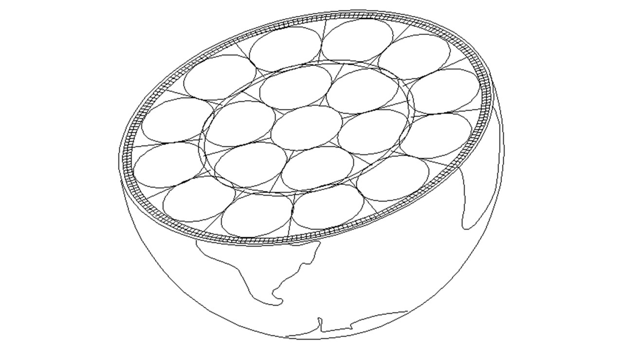
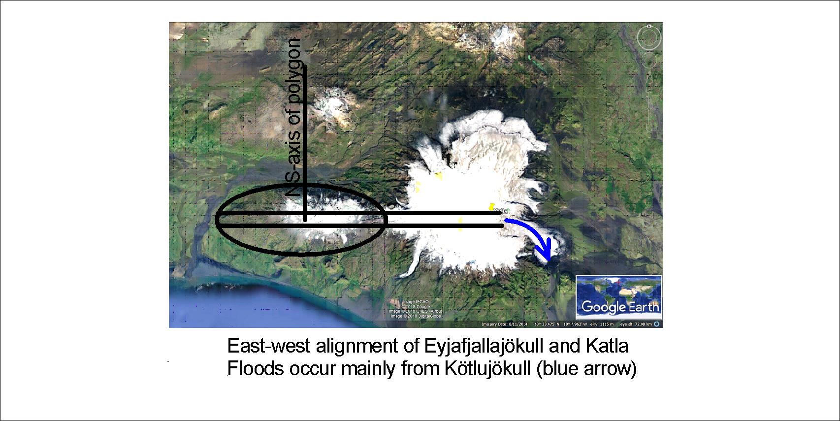
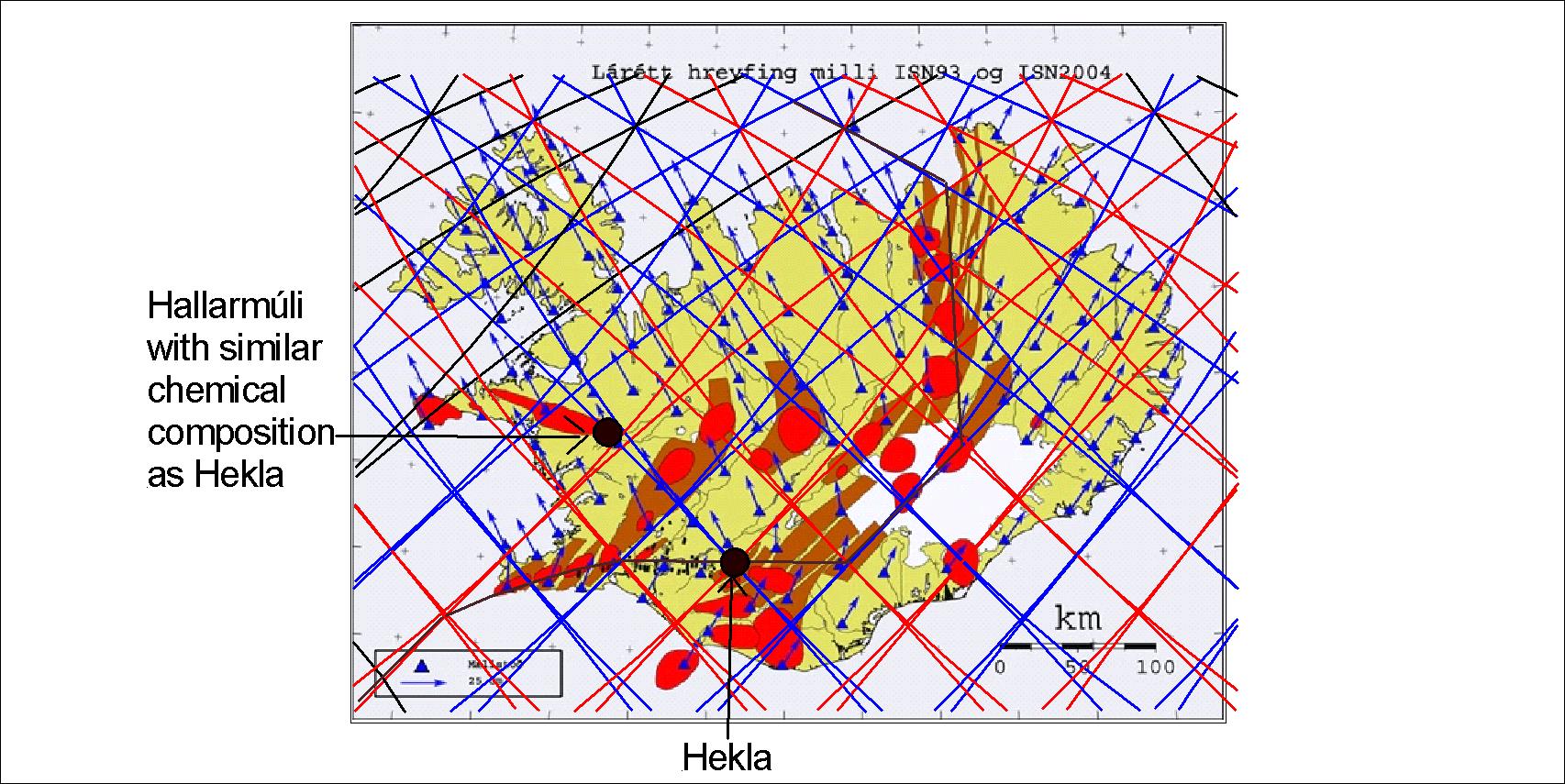
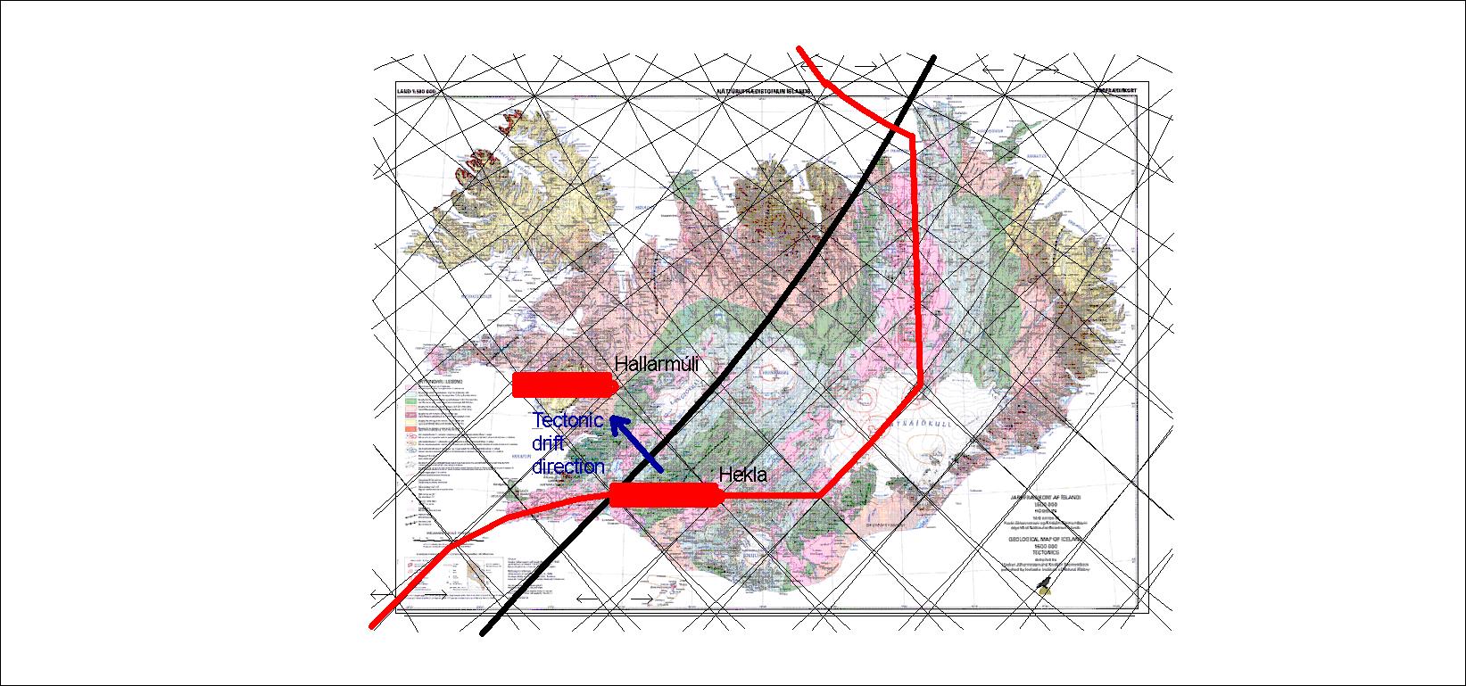
As the layers of Earth are drawn to scale, it is obvious that this convection rolls pattern fits perfectly into the layers. By deriving the system to the north and south, countless geological features can be explained thoroughly, hitherto not understood.

Uncategorized

Kötlujökull and the flows from Katla volcano

Knowing about the mantle currents makes it possible for us to explain tectonics and topography. An EW-axis is found along Eyjafjallajökull through Fimmvörðuháls and farther to the east over the caldera of Katla. This is how it looks:

Try to look at Eyjafjallajökull and Mýrdalsjökull on Google Map yourself, and trace the EW-axis. The reason can be understood by referring to the pattern of magma currents under the tectonic plates of the Earth.

https://en.wikipedia.org/wiki/Katla_(volcano)

https://en.wikipedia.org/wiki/Eyjafjallaj%C3%B6kull

Uncategorized

Hallarmúli with the same chemistry as Hekla – and originated from the same site according to measurements

Hallarmúli has similar composition as Hekla according to Haukur Jóhannsson and Kristján Sæmundsson (http://www.isor.is/sites/isor.is/files/Jar%C3%B0fr%C3%A6%C3%B0i%20og%20gossaga%20vestara%20gosbeltisins%20-%20Haukur%20J%C3%B3hannesson%20og%20Kristj%C3%A1n%20S%C3%A6mundsson.pdf)

In approximately 6 million years Hallarmúli has drifted this distance, according to the measured drift vectors

Hallarmúli is measured to be about 6 million years old, and with the velocity of close to 2 cm a year, it should have drifted this far away from Hekla. It is also in accordance with the direction of the vectors.

This is a proof that the drift vectors, measured with GPS technology in 2004 compared with 1993 point locations, show real drift direction and speed. Actually, the proof is double, because a fault zone is accompanied with the sites of Hekla and Hallarmúli as shown below:


Uncategorized

The most famous Icelandic volcano – Eyjafjallajökull

In 2010 Eyjafjallajökull eurupted. Its location is interesting, as the crater is in the middle of a polygon. It is directly south of Hekla, which is in the north corner of the same polygon. The craters of Vatnafjöll and Tindfjöll are also on that line.

The elliptical form around the crater of Eyjafjallajökull, exactly in the middle of the polygon. Hekla marks the northern corner of the polygon.

Countless examples like this one show how the convection rolls shape the surface.

Uncategorized

The West Volcanic Zone and Thingvellir

The West Volcanic Zone is narrower than the East Volcanic Zone. It is not as active either. Thingvellir has the calculated alignment of convection rolls, and we can then analyse the formations due to horizontal forces of tectonic drift.

The rift valley of Thingvellir

The polygon of Thingvellir is subject to pulling to NW, and a compromise of tension is drawn with blue lines. This compromise also is the decisive factor for the width of the volcanic zone. Lake Thingvallavatn fits into the resulting pattern. The rift valley extending to the NE from the end of Thingvallavatn has then the exact alignment of convection rolls underneath.

The convection roll under this polygon rolls from west to east, opposing the general tectonic drift of the North American tectonic plate extending all the way to the Pacific Coast of N-America, thereby causing rifting like seen in the graben of Thingvellir.