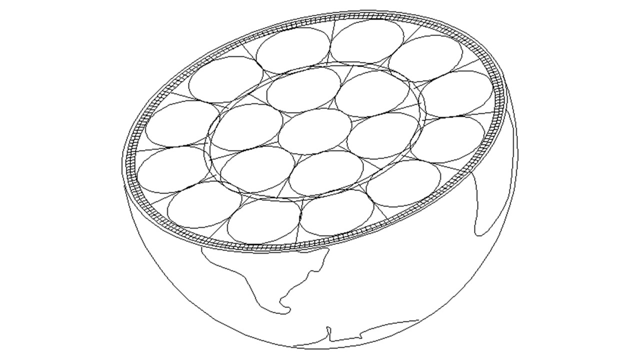
How can the convection rolls be derived and mapped? First, we can assume that hight and width is the same, second that horizontal radius is in harmony with Earth’s radius. This has been calculated, and drawn accurately. The result is a model, very useful for geologists and geoscience in general, something we should know about!
Equator plane of Earth – mantle rolls pattern
As the layers of Earth are drawn to scale, it is obvious that this convection rolls pattern fits perfectly into the layers. By deriving the system to the north and south, countless geological features can be explained thoroughly, hitherto not understood.
I am a geologist, graduated from the University of Iceland, and taught geology for a few years. I have gained some knowledge about Earth's inner structure, so I provide this website as my contribution to answer one of the greatest questions remaining within the realm of geoscience. Experiments show that the mantle should form convection rolls when close to the melting point. I took this literally, and calculated the dimensions and shape of these mantle convection rolls. Then I compare that model with the surface. This makes it possible to provide many interesting examples about geology found on my blog.
View all posts by Steingrimur Thorbjarnarson