Blog

Uncategorized

What is happening today close to Grímsey – calculated!

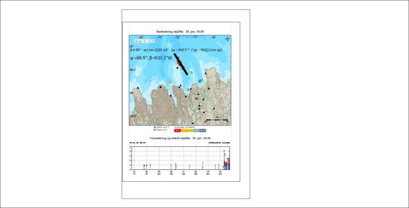
I had a look at the site of Veðurstofa Íslands (Met Office) and saw a good example of earthquakes lined up in a familiar way.

As the tectonic framework is mainly derived from mantle currents, the alignment of earthquakes can sometimes be calculated:

Grímsey - blogg

I have inserted the formula for the convection cell alignment and the relevant line for the direction. Sure it fits!

Uncategorized

The reference to North in the name of Norway

It is said that the name Norway is actually shortening of Norðurvegur, that is Northern Way. It refers to a sailing route between the island Karmoy and the mainland of Norway. The whole area is actually aligned N-S, as can be seen here:

Karmoy

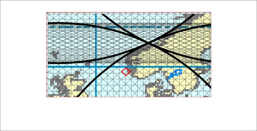
The N-S oriented tectonics have their origins in the symmetry of the relevant polygon.

Here it is marked with red:

Karmoy polygon

The coasts of Karmoy are at the central axis of the relevant polygon.


Uncategorized

Is it useful to be able to calculate the direction of tectonic features?

The answer is yes! When the most likely and most active tectonic alignment can be predicted mathematically, money can be saved and money can be earned by making use of the predictive qualities of calculations instead of rather random or intuitive research, often with expensive drilling equipment or hiring expensive experts etc. Here is one example from the Snæfellsnes Peninsula in Iceland:

Snæfellsnes - formula

The fault found is marked with red, and calculated tectonic direction is drawn with black line. They obviously fit together.

Whereas tectonic features can be predicted and compared with the Convection Cell Model, hopefully this will help avoiding the waste of money and make geological research more effective in the future.

Uncategorized

Iceland and Bering Strait compared – why copy paste?

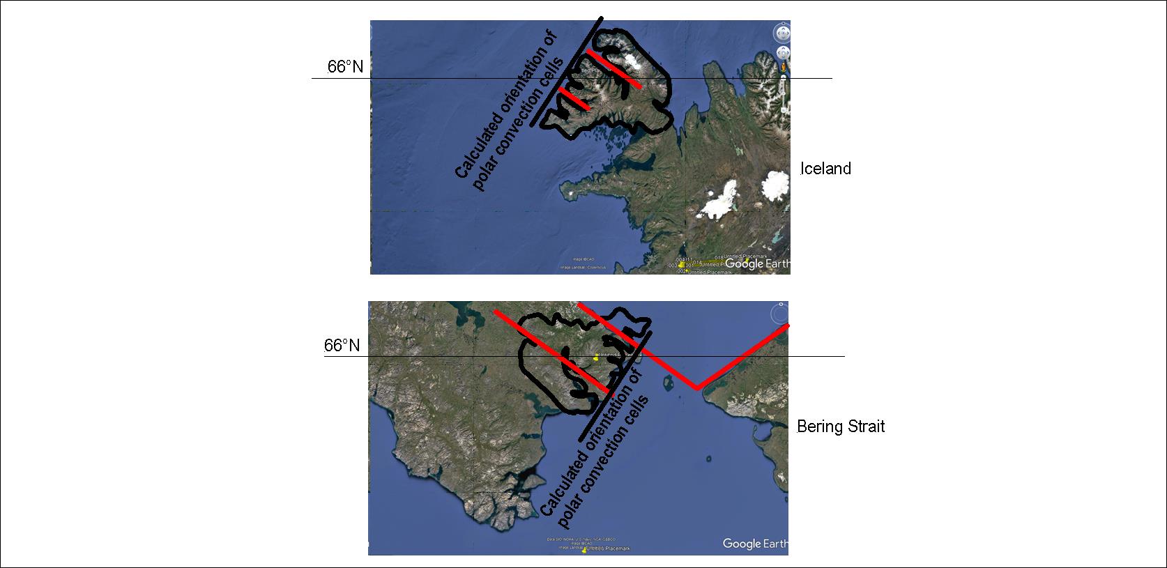
Comparing the Icelandic West Fjords with the Bering Strait at the same latitudes, the same orientation of tectonic features appear. And this is the same case as I have already shown in other posts with Scandinavian Peninsula, Greenland and Baffinland at the same latitudes! When information like this has been gathered, and it can be manifested again and again, it becomes a proof that a systematic convection cell system is affecting the tectonics above:

Bering Strait compared with West Fjords

The black straight line is the alignment of convection rolls extending from the pole, and the red lines indicate the direction of convection rolls extending to equator.

With a map at hand, using the convection cell model for comparing different areas becomes quite easy.

Uncategorized

Some details of the tectonic framework of Thingvellir in Iceland

One of the most popular sites in Iceland is Thingvellir. Here is a simple drawing of Lake Thingvallavatn, showing the combined tectonic forces that make the area so special:
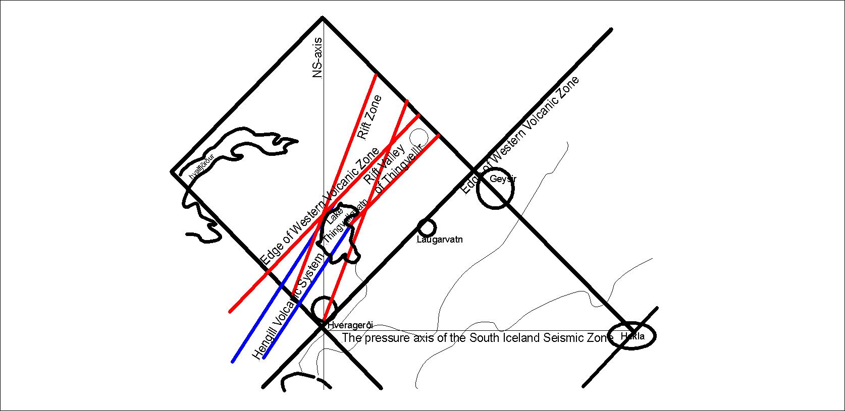
Thingvallavatn - tectonic framework - 01

As can be seen on this simple drawing, the edge of the Western Volcanic Zone of South Iceland, Hengill Volcanic System and a large scale rift zone combine around the NS-axis of the relevant polygon of convection cells underneath. This results in a very prominent line of cliffs including the famous Almannagjá. A similar combination occurs at Hrafnagjá.

Of course, tectonic drift is responsible for this, but the division line of the large convection cells is found at the eastern edge of the Western Volcanic Zone.

The tectonic directions can be calculated one by one, as explained in an earlier post.