Uncategorized

Indonesia and Philippines – chaos or regularity?

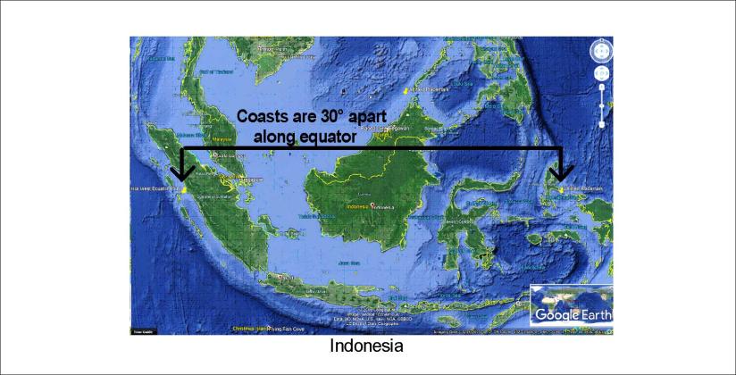
Indonesia does extend exactly 30° along equator, just as everyone can see on a map (approximately from 99°E to 129°E). It fits to the analysis that underneath there is a convection roll in the lower mantle, exactly 30° wide. This is the big mystery of the equator line!

Indonesia 30 at 0

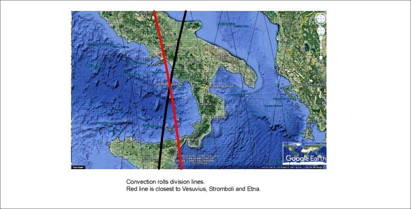
Looking at the details of Indonesia, some interesting forms show up. Two of the convection division lines look like this:

Palawan and Borneo - lines

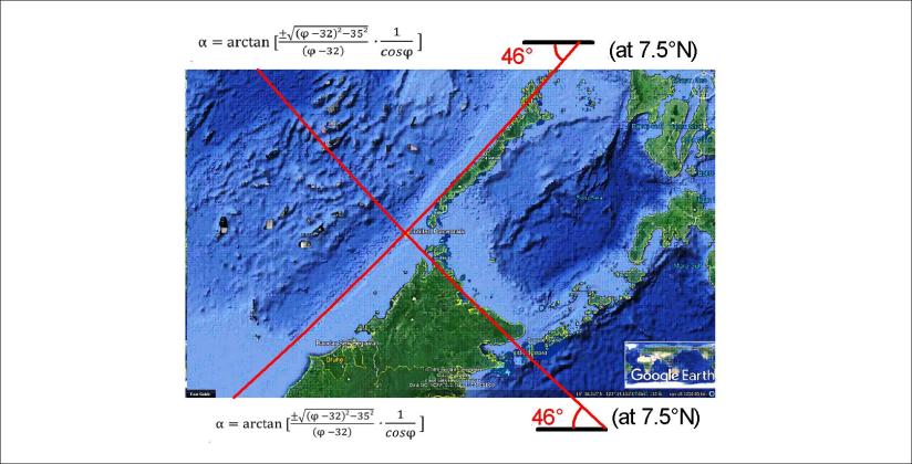
With these calculated lines put into place, let us look at how nature has shaped the tectonics around:

Palawan and Borneo - squares

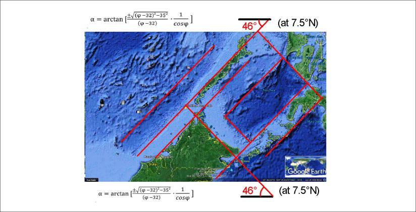
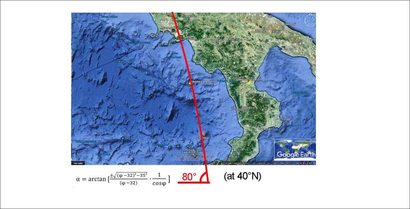
This is a place of symmetry, and square forms! A more detailed analysis can tell us much more.

geology

The mantle currents under Denmark

The distribution of Danish land can be explained according to the mantle currents.

This is a simplified convection rolls division lines drawing on a Google map base:

Jótland - Fjón - Sjáland - Skánn

This provides a base for analysis (if we are assured about the mantle convection system).

Therefore we can draw further by adding a few lines of reference:

Jótland - Fjón - Sjáland - 3

The main EW-axis goes right through Copenhagen, marked with a black line.

The easternmost point is also Copenhagen, and exactly 4.5° farther to the west is the west coast of Jutland. (Each convection roll extends 1.5° from east to west.)

This belt of Denmark is made up of three main polygons, one representing Jutland, one for the island Funen and one for the island Zealand, on which Copenhagen is located.

This provides a base for the geometry of Denmark.


geology

Etna, Stromboli and Vesuvius – how are they connected?

The three most famous volcanoes of Italy are all in the vicinity of the same convection division line:

Etna 01

The volcanoes Vesuvius and Stromboli are directly above the line. The line represents a division between convection rolls found at about 250 km depth. The black line represents the division between convection rolls at about 120 km depth. the margins of other parallel convection rolls are marked with thinner lines.

This gives us the opportunity to think about the difference between Vesuvius and Etna. It is common knowledge that Etna is located at the border line where the African tectonic plate slides under the European one. The ascending mantle underneath can then send lava up through the crust resulting in eruptions.

Note that this analysis changes nothing about traditional geology. But it becomes easier to understand if the convection rolls under the tectonic plates are taken into account.

And just to emphasize that this is calculated, based on sophisticated analysis, let us compare directly with local vector.

Stromboli - Vesuvius

This is how these volcanoes are connected within the mantle. This is calculated in the same way as for the tectonics and location of volcanic and geothermal sites in Iceland.

geology

South America and Indonesia compared – subduction symmetry at equator calculated

It is fascinating that the main division points of equator are directly above the division points between convection rolls of lower mantle, which are 30° apart! But details also tell a story. Let us look at the subduction points, exactly 180° apart on the equator. This can be easily checked on a Google map:

S-America and Indonesia Compared 01

The subduction zones have the same deviation from north on equator. This alignment of the red marks, exactly on equator, is the first derivation of convection cell alignment along with north-south pressure axis.

For S-America the point above large convection cells is within the trench. The relevant lines are down-welling at the point.  At Indonesia the point is 1.5° east of the trench opening.

Just to explain the relevant conditions, The sites are here marked on the convection cell model:

S-America and Indonesia Convection Model

All this is easily understood, once you have seen the basic pattern of convection rolls within the Earth’s mantle.