The volcano now erupting in Iceland has often not been included as an independent volcanic site on geology maps. It is a bit embarrassing now when Fagradalsfjall Volcano and the eruption site of Geldingadalir has become world famous. The volcanic zone of Reykjanes has a few volcanic systems, arranged en echelon along the peninsula from west to east. Having a model where the origin of magma is traced to the Mid-Ocean Ridge of the Atlantic Ocean, namely the Reykjanes Ridge, the result can be described with these maps:
Many different details make maps unclear, so down below is the same map slightly clarified:

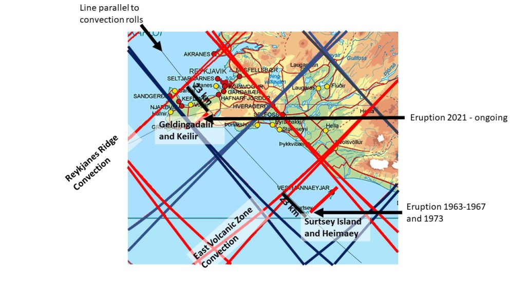
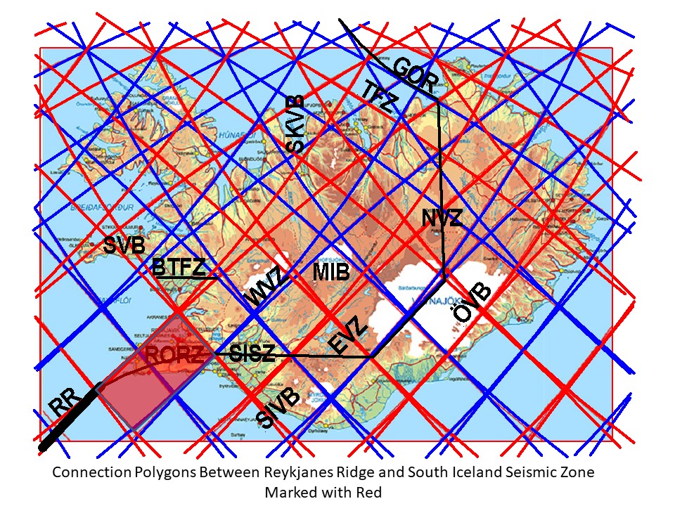
Ttectonic drift causes upbreaking within the polygons, providing channels for vertical influx of magma. First, the magma flows below Moho, within ductile material, and unnoticed on the surface, causing virtually no earthquakes. Then the magma breaks into the brittle part of the tectonic plate, at Reykjanes found at the depth of about 15 km. After that, the magma tends to create dikes perpendicular to the original flow direction, namely NE-SW. This takes place at the boundaries between the two tectonic plates of N-America and Eurasia. At the Reykjanes Peninsula the line is actually a few kilometers wide area, found in context with the Reykjanes Ridge on one hand and the South Iceland Seismic Zone on the other hand. A central axis can therefore be defined, and a distinct seismic zone that can be traced along the entire peninsula in context with the division line between the plates. The volcanically and seismically active areas are mainly found south of the theoretically central division line, here marked with a black curved line along the peninsula. The horizontal magma flow is then found to occur along the division lines between polygons, and two lines appearing as the polygon gives in to the tectonic drift effects.
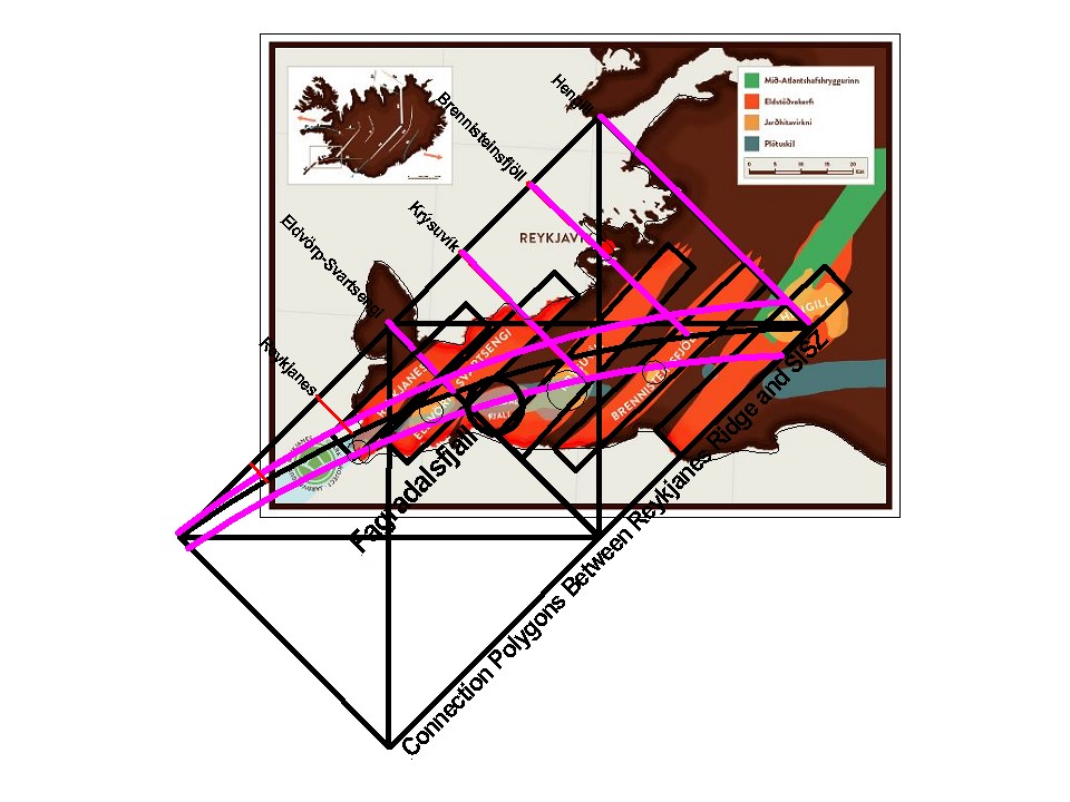
As a result, the volcanic systems of Eldvörp-Svartsengi, Krýsuvík, Brennisteinsfjöll and Hengill, are found directly in context with the magma flow, both within and at the sides of, the Reykjanes Polygon. The high temperature areas are found where the southern margin of the seismic zone crosses the volcanic systems. One system is defineable at the westernmost end, called Reykjanes Volcanic System, but according to the model it has its origin within the next polygon to the south-west.
Fagradalsfjall is clearly missing from what is said above, but likewise it is obviously erupting, so why is that? Looking at the model drawing, the opportunity for the magma flow mainly feeding the Krýsuvík Volcanic System, to ascend earlier through a weakness zone arises, where it crosses the main, central division line between the tectonic plates. This time, it should have happened according to this model, and the magma created a dike aligned towars S-W, triggering the eruption.
The feeding line of Krýsuvík Volcanic System is also responsible for the Fagradalsfjall Volcanic Systems, because the division line is forced to bend along the polygon, in order to make the connection between RR and SISZ possible. Likewise, it can be difficult to distinguish the division between Reykjanes Volcanic System and Eldvörp-Svartsengi Volcanic System. Therefore, for a long time, some geologists have only talked about four volcanic systems of Reykjanes, while others have seen six different systems.