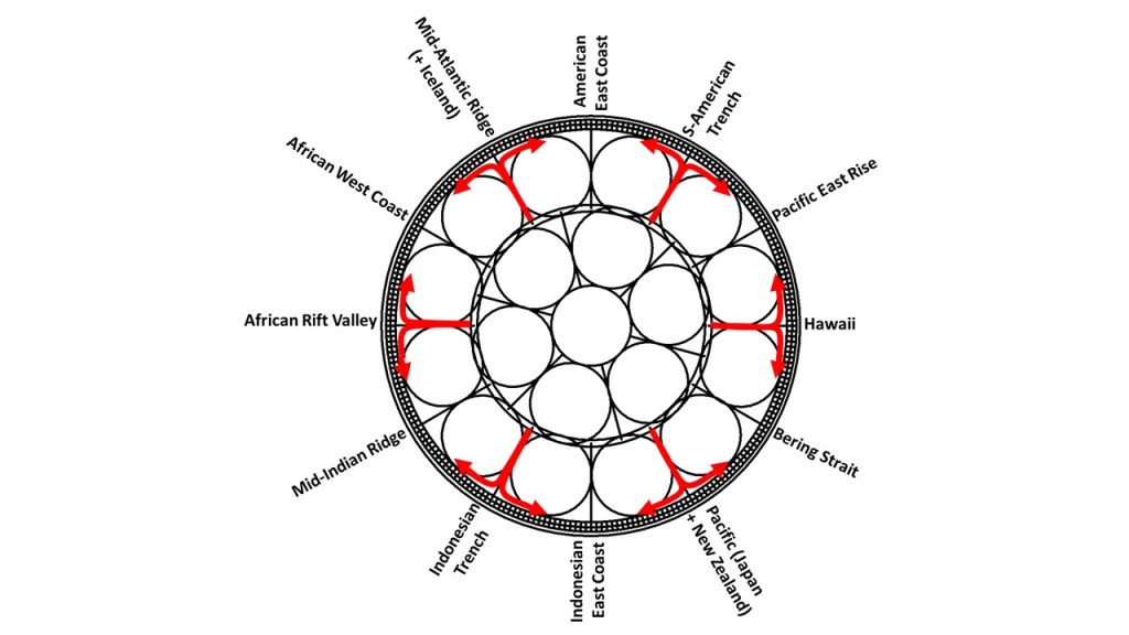
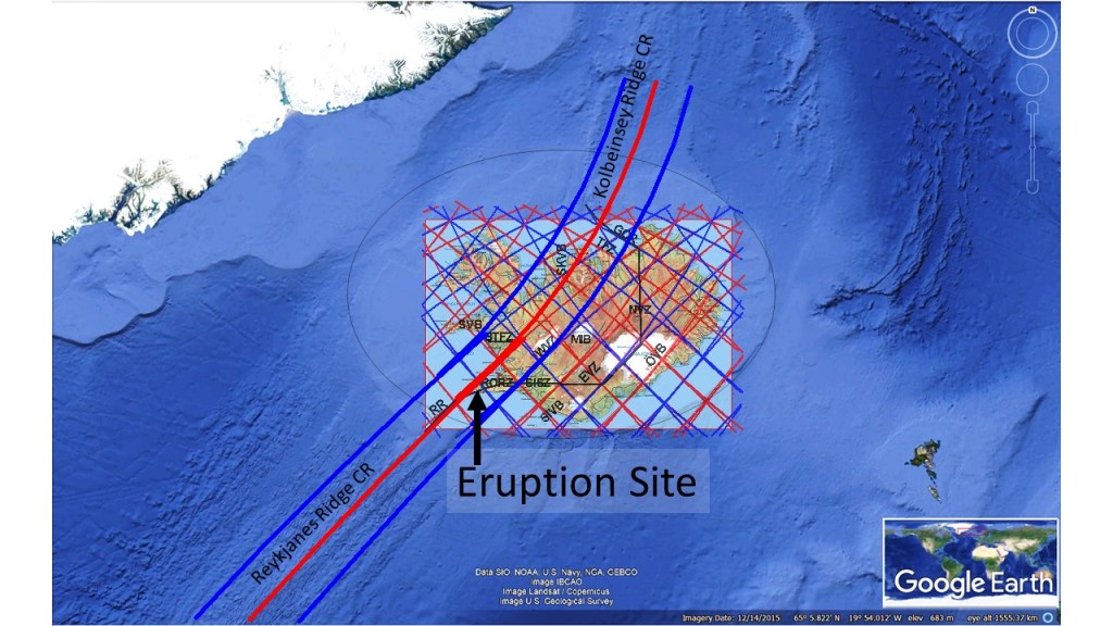
To introduce the model of convection rolls and how it explains the existence and distribution of geothermal resources in Iceland, I take part in the World Geothermal Congress held in Reykjavik this year (2021). The model should better have been developed in the nineteenth century when it was realized that land mass is regularly distributed along equator, and that must be for a reason. Someone should have considered that the span of the Atlantic Ocean and the Indian Ocean of 60° represented two large convecction cells, and the mainland of S-America, Africa and Indonesia span 30°, did show the location of a single large scale convection cell underneath. But no one did, so this became a debate finding place within the twentyfirst century! Harry Hess https://en.wikipedia.org/wiki/Harry_Hammond_Hess was on the correct track in 1962 with the article ´History of Ocean Basins´. Further development effort by the scientific community of his theory would have made this website obsolete. But my video about geothermal resources is found here, meant to bring us all one step closer to the ‘correct track’ again: https://wgc2020-virtual2.velkomin.is/login?redirect=/event/13040
The abstract is found on the website of WGC: https://pangea.stanford.edu/ERE/db/WGC/Schedule.php?SlotDay=4
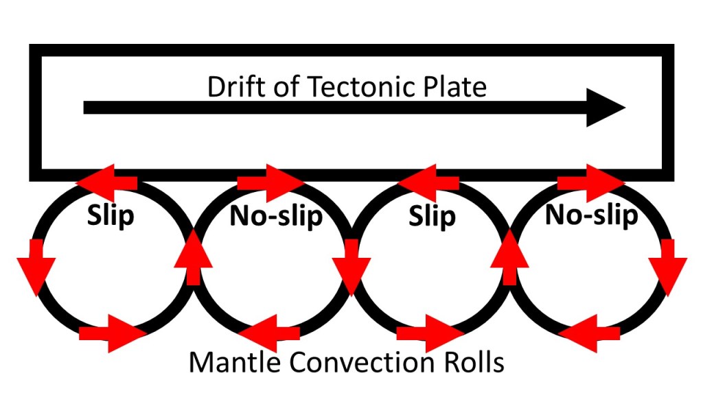
Realizing that convection takes place within the mantle is easy and acknowledged by virtually everyone engaged in geoscience. The convection pattern, on the other hand, was a bit hard to derive. Now it has all been clarified and shown to everyone. The starting point is obvious enough to be 100% convincing, namely the fact that convection rolls with height to width ration 1:1 clearly fit exactly within the equatorial plane. The rest has to be found out, step by step, with the help of some knowledge about physics. You have to consider that the Earth rotates, that the mantle convects, and the constraints resulting from the geoid shape. Then you find out the exact dimensions, shape and location of the convection rolls within the Earth.