The Convection Rolls Model, used here to explain various geological phenomena, can be used to trace the flow of magma within the tectonic plate. The flow below the brittle part of the cryst can nor be monitored, because it does not cause earthquakes. Also, it does not cause any alterations on the surface, so we can just make a wild guess.
Therefore, I use the model. and speculate how the eruption could occur within the model. Model is not reality, just a tool to eneavour to find something out about the real world. A guess based on a model can then be a used to make further research and investigations.
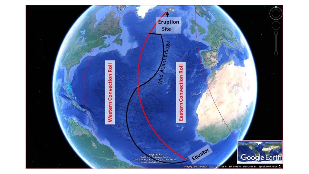
First, let have a look at the three dimensional drawing:

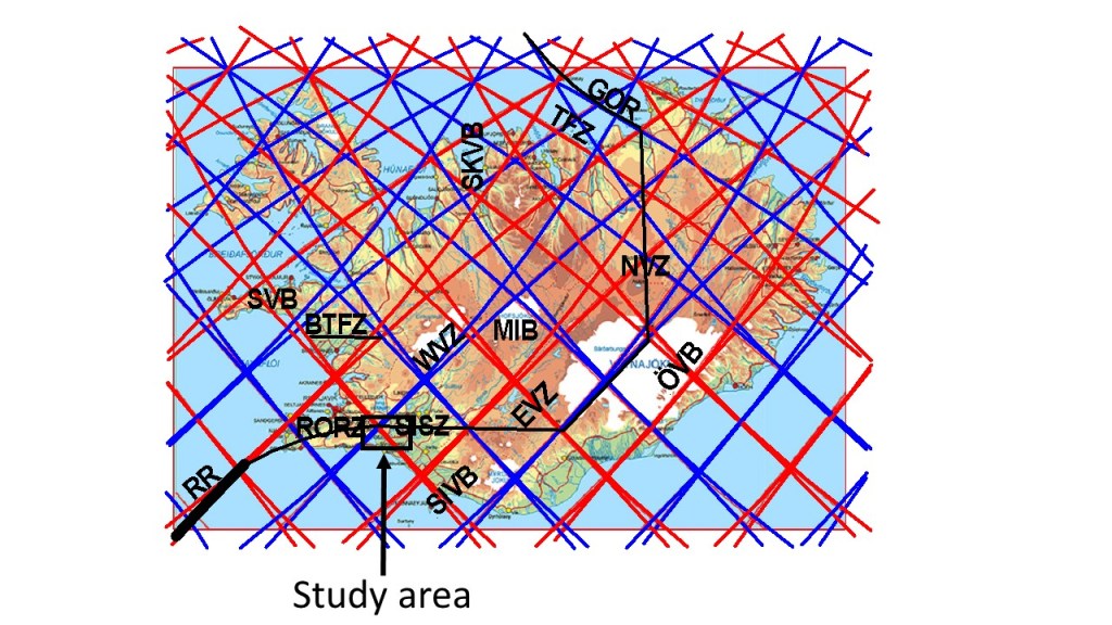
Then we can have a closer look on a map, showing the convection rolls division lines from above.

To see how the model works, the two lower dikes have to be drawn in 3D.
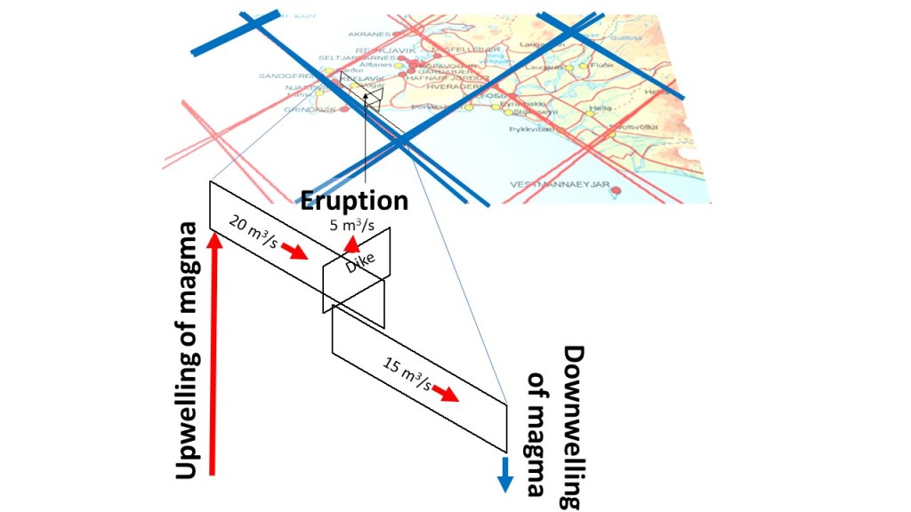
This drawing shows how magma enters the ductile part of the tectonic plate, and the lowermost part of the brittle crust, still not causing earthquakes or uplifting of surface. The hidden dike, probably around 10 km below the surface, of unknown height and width, channels magma towards the inner part of the polygon, until it reaches the central part near Keilir, where it ascends into the brittle crust, forming the dike responsible for the eruption at Fagradalsfjall. Out of 20 cubic meters per second, five are lost due to the eruption, but the remaining 15 proceed to the next lower crust dike, flowing all the way to the other side of the convection roll, where downelling occurs.
This might explain how the flow can be maintained for a relatively long time. The extra 15 cubic meters per second maintain the temperature and flow paths within the upper dike. The standard 5 cubic meters flow of the eruption are then related to the width of the dikes, and the upwelling through the crust originated from the convection rolls division lines, where the original melting should have taken place.
This can not be proved with any measurements at hand, so this is just an analyzis of what should happen according to the model, and these ‘lower dikes’ might not exist at all. Take care to know the line between the known and the unknown 🙂
For some real data, pleas check: https://www.facebook.com/jardvis/photos/a.934315269916271/4477778478903248/?type=3