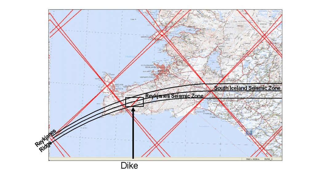
The structure of the volcanic area now active in Iceland is quite fascinating. The base of Fagradalsfjall is diamond-shaped, and is formed within the earthquake zone of the Reykjanes Oblique Rift. The zone is bent, because it connects two different systems of the Reykjanes Ridge (aligned NE-SW) and South Iceland Seismic Zone (aligned E-W). The earthquake faults are oriented NS, all the same, because the pressure from NE and SW is undisrupted by the swayed structure of the plate boundary and the related tension and rifting process.
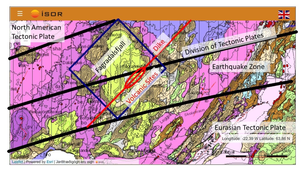
TThis map can be explained further: 1) Blue frame indicates the base of the tuya Fagradalsfjall. The sides are oriented N44°E and N44°W, because of the convection rolls underneath shaping the surface in various ways. 2) Thick black lines indicate the earthquake zone, connecting the South Iceland Seismic Zone and the Reykjanes Ridge. The middle line is in fact the division between the two tectonic plates of N-America and Eurasia. 3) Thinner NS oriented lines indicate location of earthquake faults within the zone. They have been mapped by many scientists for the last decades, for instance Páll Einarsson and Vigfús Eyjólfsson who I have referred to in other posts. The general layout here is extrapolated from their findings. 4) The red line shows the approximate location of the dike. It has the same orientation as the slopes of Fagradalsfjall, which in turn has the same orientation as the Reykjanes polygon of the convection rolls model. 5) The red ellipse indicates the sites of eruption. The erupting locations coincide with crossings between earthquake faults and the dike, as the magma can most easily make its way to the surface through the earthquake faults.
The earthquake faults form a pattern of dominantly NE-SW oriented fractures with en echelon arrangement on the surface, Farther down, they tend to become aligned closer to NS, as indicated on the map.
The end of the dike seems to be at the border line of the earthquake zone. All this harmony of nature becomes quite obvious once the eruption has started. Why do we not notice those things unless something happens, bringing more attention to the area?
Map base of ISOR is found here: http://jardfraedikort.is/?coordinate=65.21%2C-19.57&zoom=1
Mapping of earthquake faults: https://www.mbl.is/media/36/11536.pdf and https://www.vedur.is/…/utgafa/greinargerdir/2006/06001.pdf