The river Ölfusá flows in a remarkable zigzag pattern, either directly to the south or to the west. It can be explained by the fact that it flows through an earthquakes zone, which is aligned from east to west, and affected by individual earthquake faults, perpendicular to the comprehensive zone, and therefore oriented from north to south. Besides this, two volcanoes affect the flow, namely Hestfjall and Ingólfsfjall. Those volcanoes are located outside the West Volcanic Zone (WVZ), but appeared there all the same. Hestfjall is a shield volcano, and therefore the lava ascended through the weakness provided by a N-S trending earthquake faults. The same applies to the tuya of Ingólfsfjall. Shield volcanoes are formed in the same way as tuyas, but during ice-free periods, whereas a tuya forms under ice or water.
Here is a map, showing the river flow directions, exaggerated by superimposed blue forms:

The South Iceland Seismic Zone shapes the area, both with the seismic activity itself, and by providing weakness for magma to flow to the surface at certain locations. The shield volcano of Skálafell is also shown. The silhouette of Skálafell resembles a house seen from the east, and it is said that Ingólfur, the first settler of Iceland, once built a house there, and therefore the mountain got this name. These relatively young volcanoes are all found along the 64th parallel, shown on the map, which is also the theoretic main division line between tectonic plates. The line then bends southwards when prolonged to the west along the Reykjanes Oblique Rift, and the current eruption at Fagradalsfjall on Reykjanes Peninsula is also related to that division line.
Some relevant information can be found here:
Hestjall: https://de.zxc.wiki/wiki/Hestfjall_(Gr%C3%ADmsnes_og_Grafningur)
SISZ: https://en.wikipedia.org/wiki/Geological_deformation_of_Iceland
Ölfusá: https://en.wikipedia.org/wiki/%C3%96lfus%C3%A1
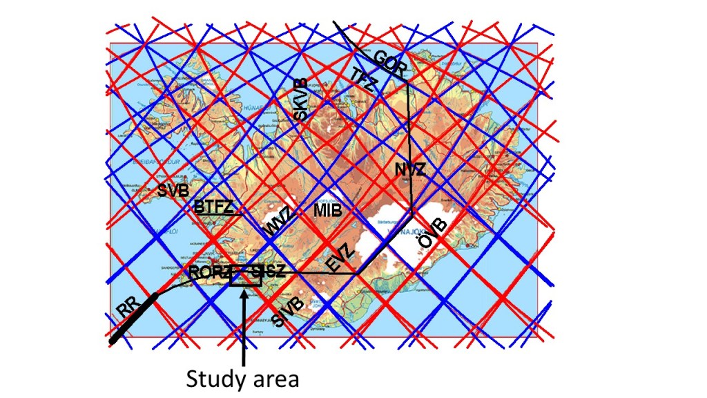
To clarify where the area is, please find it on this map below. The small, black square is found in between the South Iceland Seismic Zone (SISZ) and the Reykjanes Oblique Rift (RORZ).