The approximately 5 cubic meters per second of lava, flowing on the ground of Reykjanes these days, represent huge forces of the Mid-Atlantic Ridge. The ascending magma is originated from convection rolls, which on the time scale of 100 million years have divided the continents and shaped the Atlantic Ocean, as can be learned about here: https://en.wikipedia.org/wiki/Mid-Atlantic_Ridge
The convection rolls responsible for this huge formation of the Atlantic Ocean, is also driving the mechanism behind the eruption at Fagradalsfjall on the Reykjanes Peninsula in Iceland. The outer limits of the convection rolls are marked here (approximately) with red lines.
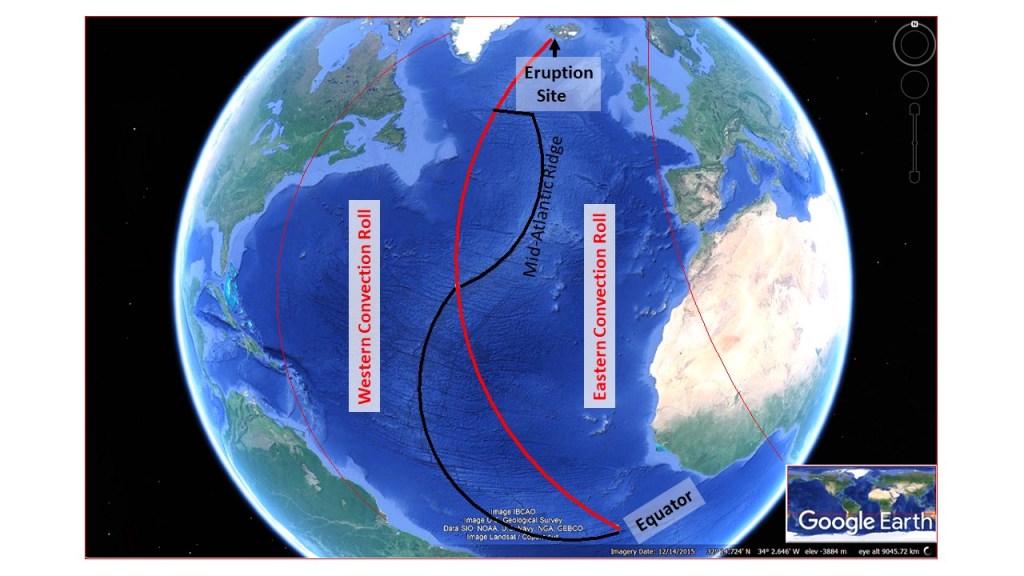
The eruption site at Fagradalsfjall is pointed out. The ridge coincides with the lower mantle division line along the Reykjanes Ridge close to Iceland, and also at 32°N and equator.
Some people like to go to see what is going on. Here is all about that: https://www.nationalgeographic.com/travel/article/is-volcano-tourism-safe
