The volcanoes of Eyjafjallajökull and Katla are among the most famous volcanic systems in Iceland. They occupy a prominent position in the geology of South Iceland and have long attracted attention because of their apparent connection. Historically, eruptions of the two volcanoes have often occurred within relatively short intervals of one another, suggesting that some form of interaction may exist between the neighboring volcanic systems.
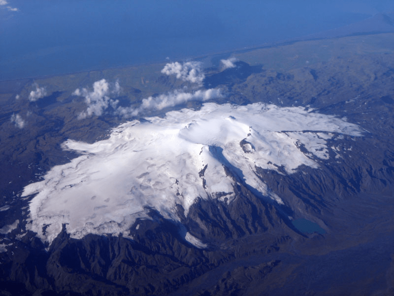
with a glacial tongue flowing northward from the summit crater.
(https://www.visindavefur.is/svar.php?id=77035)
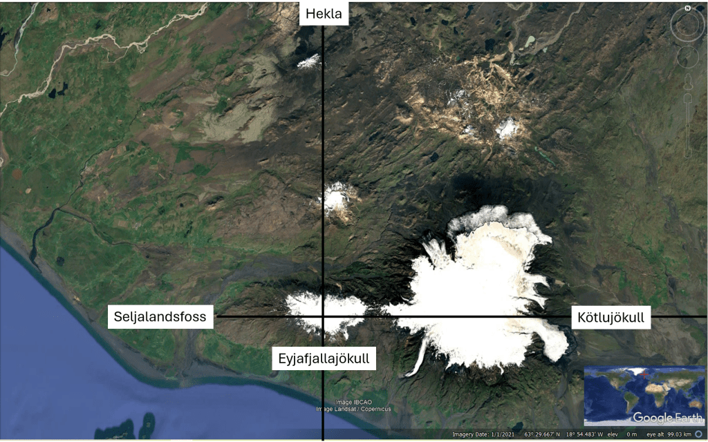
Geological maps reveal a remarkable east-west arrangement extending across the region. Katla lies beneath Mýrdalsjökull to the east, while Eyjafjallajökull forms an elongated volcanic edifice immediately to the west. The volcanic structures, fissure swarms, and associated tectonic features display a pronounced east-west alignment.
Eyjafjallajökull itself is an elliptical volcano. Its fissure swarm follows the long east-west axis of the edifice, indicating that the orientation is deeply rooted in the tectonic framework of the area. At the western end of this axis lies Seljalandsfoss, one of Iceland’s best-known waterfalls. At the eastern end, the glacier tongue of Kötlujökull marks the outlet area where meltwater and jökulhlaups from Katla most commonly emerge.
This eastern opening is particularly significant. When Katla erupts beneath its ice cover, large floods are generated. These floods frequently escape through the Kötlujökull outlet, effectively utilizing the same east-west corridor that connects Katla with Eyjafjallajökull. The repeated use of this pathway suggests that the axis represents a long-lived structural weakness within the crust.
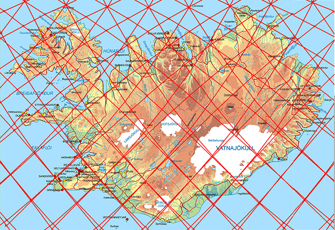
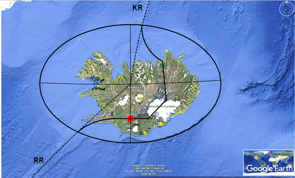
Within the framework of the mantle convection rolls model, this east-west trend coincides with the central axis of a polygon formed by convection-roll division lines. In this interpretation, the geometry observed at the surface reflects deeper patterns within the mantle. The Eyjafjallajökull–Katla axis occupies the center of one such polygon, while other volcanic systems define its boundaries and corners.
tectonic boundaries, and major geological features tend to develop along these persistent structural lines.
The north-south arrangement of volcanic centers is equally intriguing. Hekla occupies a prominent position to the north-east, while Vatnafjöll lies between Hekla and Eyjafjallajökull. Drawing a line through Hekla, Vatnafjöll, and the summit crater of Eyjafjallajökull reveals a clear north-south trend. According to the mantle convection rolls interpretation, this line represents another major axis of the same polygon.
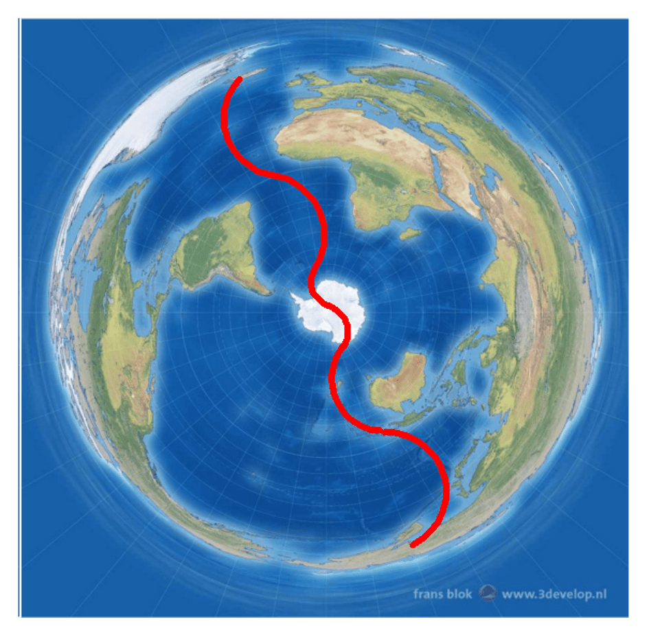
When viewed in a broader context, the north-south alignment does not end in South Iceland. Similar trends can be traced along the Mid-Atlantic Ridge, which itself forms one of the most prominent north-south geological structures on Earth. Extending the same geometric framework to a global scale, the trend can be followed toward the Southern Ocean and ultimately to the minor axis of the elliptical form of Antarctica identified elsewhere in this study, as seen here for example:
Whether examined locally or globally, Eyjafjallajökull and Katla occupy a unique position within Icelandic geology. Their historical relationship, their shared east-west structural alignment, the pathway of Katla’s jökulhlaups, and their position within larger tectonic patterns all point toward an underlying degree of geometric organization. The volcanoes are not merely neighboring volcanic systems; they appear to form part of a larger structural framework extending across Iceland and beyond.

The Eyjafjallajökull–Katla connection therefore provides an excellent example of how local volcanic features can be examined within a wider geodynamic context. The geological observations themselves are well established. The challenge is to understand whether these observations are isolated phenomena or components of a larger pattern linking Icelandic volcanism to the geometry of mantle processes on a planetary scale.
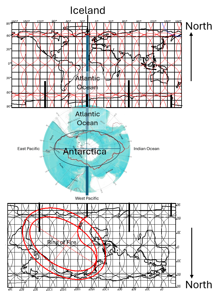
The minor axis of Antarctica aligns with Iceland to the north and, when extended southward,
coincides with the extrapolated minor axis of the Ring of Fire south of New Zealand.
The relationship becomes apparent on a South Pole-centered map
with the surrounding continents displayed on both sides of Antarctica.
The elliptical shape of the Antarctic Plate exhibits major and minor axes that are parallel to the corresponding axes identified in Iceland, particularly those associated with Eyjafjallajökull. Within the framework of the mantle convection rolls model, an apparent geometric connection can also be traced between Iceland and the Ring of Fire. The northern intersection of the Antarctic minor axis aligns with Iceland, while the opposite intersection point coincides with an extrapolation of the minor axis of the Ring of Fire south of New Zealand. This relationship can be examined by displaying world maps on both sides of a South Pole-centered projection, revealing the continuity of the large-scale geometric pattern.
.https://www.3develop.nl/blog/antarctic-projection-penguins-world-map/?utm_source=chatgpt.com
The continuity of the convection-roll pattern associated with the Mid-Atlantic Ridge and the subduction zones of the western Pacific can then be observed.
