The south of Baffinsland is shaped in the same way as Iceland. Just compare these drawings:
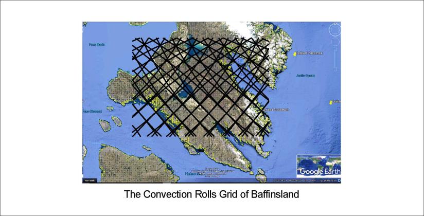
It is obvious that the main faults and coastlines follow the lines. It is also important that at 64°N, Baffinsland extends exactly 9° from coast to coast, or the width of 6 convection rolls. Just to clarify:

In Iceland, at the same latitude as this part of Baffinsland, the upper most (first) layer is of course more apparently shaping the surface. Here is a map of Iceland (based on a map from Náttúrufræðistofnun), and the grid has exactly the same pattern as for Baffinsland:
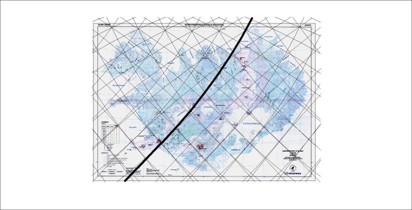
The numerous details can then by worked out by scrutinizing these maps.
Published by Steingrimur Thorbjarnarson
I am a geologist, graduated from the University of Iceland, and taught geology for a few years. I have gained some knowledge about Earth's inner structure, so I provide this website as my contribution to answer one of the greatest questions remaining within the realm of geoscience. Experiments show that the mantle should form convection rolls when close to the melting point. I took this literally, and calculated the dimensions and shape of these mantle convection rolls. Then I compare that model with the surface. This makes it possible to provide many interesting examples about geology found on my blog.
View all posts by Steingrimur Thorbjarnarson
