The 64th parallel intersects some of Iceland’s most significant volcanic and geothermal centers, including Hekla, Landmannalaugar, and Öræfajökull, which line up remarkably well along that latitude, about 3° of longitude apart. Let’s now trace the 64th parallel north (64°00′ N) carefully from west to east.
Tracing 64° N, Iceland

1. Western Start — Reykjanes Peninsula (22°–21° W)
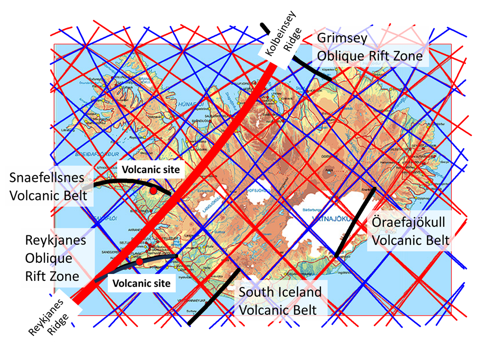
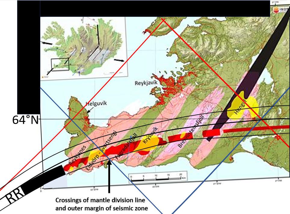
The 64th parallel enters Iceland at the southern Reykjanes Peninsula, intersecting the Reykjanes Volcanic Belt, the onshore continuation of the Mid-Atlantic Ridge.
- Key systems: Reykjanes, Svartsengi, Krýsuvík–Trölladyngja, Brennisteinsfjöll.
- Geothermal activity:
- Svartsengi (Blue Lagoon) — high-temperature field exploited for power and bathing.
- Krýsuvík — intense fumaroles and sulfur deposits along faulted rhyolite ridges near Lake Kleifarvatn.
- Volcanism: Basaltic fissure eruptions, most recently the Fagradalsfjall events (2021–2024), lie within a few kilometers north of 64° N.
2. Hengill and Hveragerði Region — Western End of SISZ (21° W)
At 64° N, the parallel runs just north of Hveragerði and crosses the Hengill volcanic system, a major geothermal center and the western terminus of the South Iceland Seismic Zone (SISZ).
- Geothermal:
- Hellisheiði and Nesjavellir plants utilize the Hengill field; production wells reach >300 °C.
- Surface features include fumaroles, silica terraces, and mud pots in Hveragerði valley.
- Tectonics: The SISZ runs eastward from here to Hekla (~19.5° W), spanning roughly 1.5° of longitude, as you noted.
- It’s a transform zone, accommodating lateral spreading between the Western and Eastern Volcanic Zones.
3. South Iceland Seismic Zone (SISZ) — Between Hveragerði and Hekla (21°–19.5° W)
At 64° N, the line traverses the seismically complex Hreppar microplate.
- Numerous NNE–SSW strike-slip faults and en-échelon fissures characterize this belt.
- Though volcanic activity is minimal, earthquakes (M 6–7 historically) are frequent.
- Geothermal springs occur near Flúðir and Laugarvatn, used locally for heating and bathing.
4. Hekla Volcano (19.7° W)
At precisely 64.00° N, 19.7° W, lies Hekla, Iceland’s most active stratovolcano.
- Type: Elongate ridge volcano, 1491 m high.
- Eruptive behavior: Mixed basaltic-andesitic, with both explosive and effusive events; last eruption in 2000.
- Structure: A central fissure system about 40 km long trending SW–NE.
- Geothermal: Weak surface manifestation; heat flux mainly magmatic.
- Relation to SISZ: Marks the eastern terminus of the seismic zone and transition into the Eastern Volcanic Zone (EVZ).
5. Landmannalaugar–Torfajökull Region (18.8°–18.5° W)
Still right at 64° N, this area sits within the Torfajökull volcanic system, a vast rhyolitic caldera overlapping the Fjallabak fissure swarm.
- Geothermal:
- Active hot springs, mud pots, and steam vents along the Laugahraun lava and Brennisteinsalda area.
- Surface temperatures reach >100 °C; deep hydrothermal systems exceed 250 °C.
- Volcanic features:
- Rhyolitic domes (Brennisteinsalda, Bláhnjúkur).
- Mixed eruptions between Torfajökull and Veiðivötn fissure systems (e.g., 1477 AD event).
- Significance: It’s one of Iceland’s largest silicic geothermal regions, directly intersected by the 64th parallel.
6. Veiðivötn–Bárðarbunga Fissure Swarms (18°–16° W)
Crossing the central highlands, 64° N passes just south of Veiðivötn, part of the Bárðarbunga–Grímsvötn volcanic system.
- Recent activity: 1477 AD Veiðivötn eruption produced >5 km³ of basaltic tephra; the fissure extends ~100 km.
- Geothermal: Subsurface high-temperature zones exist beneath Holocene lava fields; limited surface expression due to remoteness.
- Topography: Alternating lava plains and crater rows — a direct result of fissure rifting at the EVZ’s central axis.
7. Northwest Vatnajökull Margin – Hamarinn & Kverkfjöll (16°–15° W)
Approaching the Vatnajökull ice cap, 64° N crosses areas where subglacial volcanism dominates.
- Hamarinn (Loki): Central volcano beneath ice, source of jökulhlaups into the Tungnaá and Skaftá rivers.
- Kverkfjöll (64.7° N, 16.7° W): Slightly north of the parallel but significant. Features:
- One of Iceland’s most vigorous geothermal fields, extending under the ice margin.
- Fumaroles, hot ice caves, and sulfur deposits at the ice edge.
- Heat flow >1 W/m², indicating magmatic heat directly below.
- Interaction: These subglacial systems release jökulhlaups, linking geothermal processes to glacial hydrology.
8. Öræfajökull Volcano (64.00° N, 16.65° W)
Exactly on the 64th parallel, Öræfajökull forms the southeastern corner of Vatnajökull.
- Type: Stratovolcano; Iceland’s highest peak, Hvannadalshnúkur (2110 m).
- Eruptive history: Catastrophic 1362 and 1727 eruptions, both explosive (VEI 5+), with ash fallout across Europe.
- Geothermal activity:
- Weak at the surface due to heavy glaciation, but meltwater and hydrothermal alteration indicate subglacial heat flow.
- Structure: A large caldera, with geothermal vents beneath the ice—likely connected to a shallow intrusive complex.
9. Eastern Termination – Breiðamerkurjökull to Höfn (15°–14° W)
The 64th parallel exits Iceland across the southeast coastal plain and the Vatnajökull outlet glaciers.
- Geothermal: Minimal visible activity; only low-temperature springs.
- Volcanic: Ancient subglacial ridges and pillow lavas beneath the sands mark earlier Holocene eruptions under ice.