Uncategorized

Bárðarbunga – following magma trail

Today there two earthquakes were measured at Bárðarbunga – 3.9 on Richter Scale. Besides that, water from its geothermal areas probably finds it way from there to the river Jökulsá á Fjöllum.

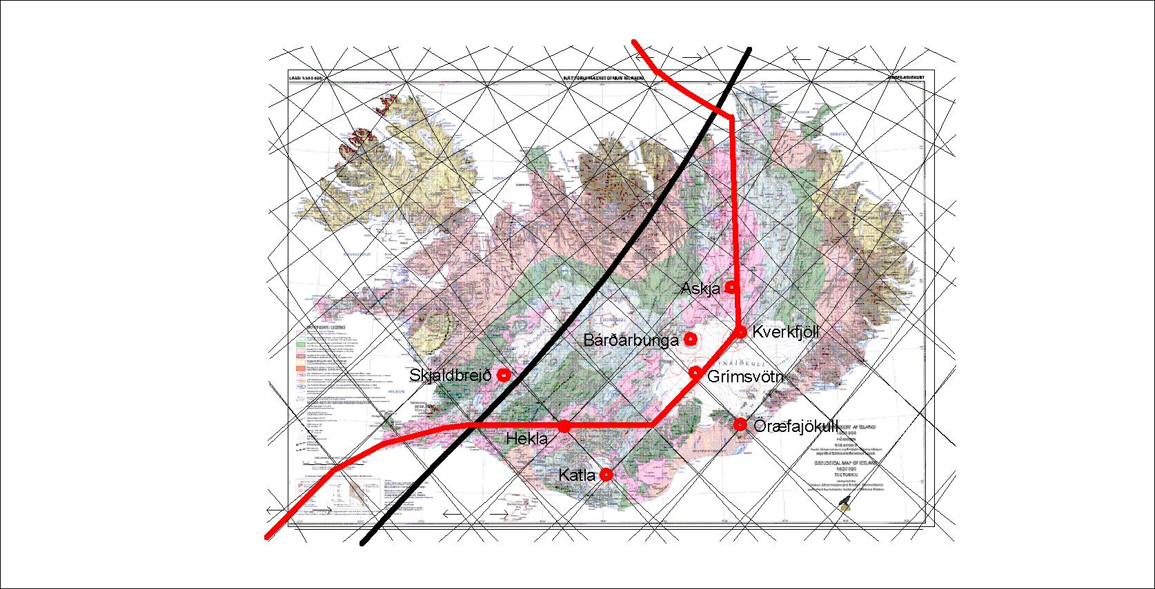
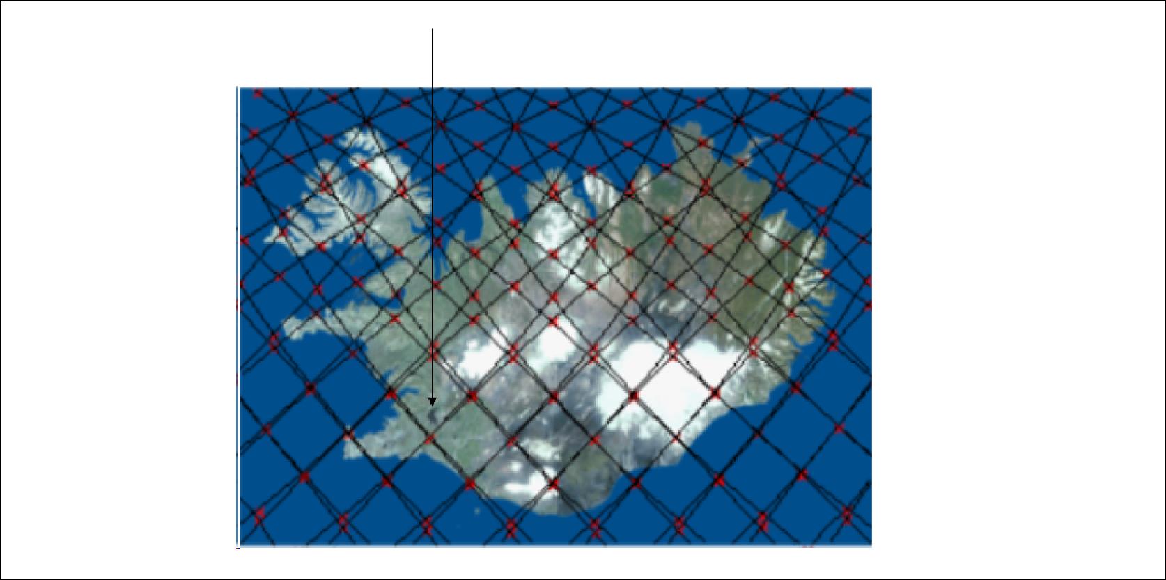
In 2014 the volcanic site of Bárðarbunga erupted. It was called the Holuhraun eruption, because the lava came up to the surface about 45 km away from its place of origin. How can magma flow so far, thereby forming a dyke, and then eurupt? The bedrock around is much colder, cooling the magma down over such a long distance. By looking at a map of convection cell system it becomes understandable.

First the magma did flow to the SE, perpendicular to the rift zone! It is explainable, because the convection cell system under Iceland always provides lines more and less perpendicular to each other forming polygons. Then the magma turned 90° to the NE along the rift zone. When close to the NE edge of the polygon it turned to the north, and on the relevant line turned slightly to the right and over to the next intersection line between two adjacent convection rolls. Then eruption occurred, the largest lava flow in Iceland for 230 years!

The explanation must be that extra magma was added from below, when the dyke material was flowing above the convection rolls line, causing it to erupt.

Bárðarbunga magma trail

The drawing shows how I combined information from the Icelandic Meteorological Office Web Site with the lines formed by the convection rolls below. It is curious enough that all the directions resemble calculations, and similar calculations can be repeated for tectonics all around Iceland.


Uncategorized

Öræfajökull – strange position?

20171025_145202

Jökulsárlón (Glacier Lagoon) with Öræfajökull in the background.

The position of Öræfajökull fits exactly to the arrangement of convection cells under Iceland. Recently, quite many earthquakes were measured below the SW part of the mountain. At the 64th parallel all the four layers are equally thick. It is the latitude where the convective layers from north and south meet and arrange themselves in a regular pattern. You can see a drawing showing this at the front page of this website. Accordingly, the flow of magma is probably originated about 120 km below the surface, first flowing through the ductile part of the tectonic plate and then making its way with help from the constant work of the other three layers on the same point up through the brittle part of the crust.

This is of course not easy to understand at first, but along the 64th latitude both Hekla and Öræfajökull are over crossings of these four convective layers.

As this convection cell system can be put into a mathematical form according to some very simple preconditions, we can understand why Öræfajökull has this location on the 64th parallel. Is that enough for us?

Basics

Uncategorized

Tectonic drift

Morgunblaðið published this map in June 11th 2004. The title can be translated: The land is still widening and moves northwards. The same map was then published in a booklet – ISNET2004 – by Landmælingar Íslands (National Land Survey of Iceland). On page 37 it is repeated that Iceland drifts to the north.

Basics - landrek - Ísland

To clarify this further: Iceland drifts closer to the North Pole, away from equator.

The results presented with ISNET2004 fit accurately with the convection cell system extending from the North Pole over Iceland, as shown here:

Basics

Note the symmetry and how exactly the vectors fit with the calculated lines in the East and West of Iceland.

Uncategorized

Background of this work

In 1962 Harry Hess made a big contribution by showing the importance of mid ocean ridges in Earth’s geology. At the same time he put forward his idea about convection current system:

Hess, Harry. „History of Ocean Basins.“ Petrologic studies: a volume in honor of A. F. Buddington Geological Society of America (1962): 599-620.

Basics Hess

This picture drawn by Harry Hess, if taken accurately, gives 8 large convection cells around the globe.

In 1971 Uwe Walzer wrote an article showing that convection cells within the earth must be as regular as possible. He explained the preconditions for for this conclusion and searched systematically for a solution.

WALZER, UWE. 1971. Pure and Applied Geophysics Volume 87, Number 1, 73-92, DOI: 10.1007/BF00878910

Basics Waltzer

This drawing by Waltzer has 14 large mantle currents.

With additional information available since the times around 1960-1970, I found the large convection cells to be 12, not 8 or 14! And with the help of a few laws of physics, geology of Iceland suddenly seems so much more simple to understand!

The logo of this site shows the slightly different pattern:

cropped-logo-magicmagma-core-mantle-crust1.jpg

With the 240 smaller cells side by side under the crust and by referring to the Coriolis Effect (different angular velocity for each latitude), the 3D model was completed.

It can be used right away to answer a million questions!