Comparing the Icelandic West Fjords with the Bering Strait at the same latitudes, the same orientation of tectonic features appear. And this is the same case as I have already shown in other posts with Scandinavian Peninsula, Greenland and Baffinland at the same latitudes! When information like this has been gathered, and it can be manifested again and again, it becomes a proof that a systematic convection cell system is affecting the tectonics above:
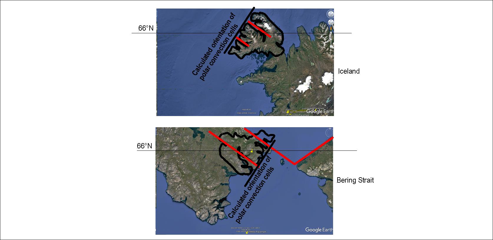
The black straight line is the alignment of convection rolls extending from the pole, and the red lines indicate the direction of convection rolls extending to equator.
With a map at hand, using the convection cell model for comparing different areas becomes quite easy.
