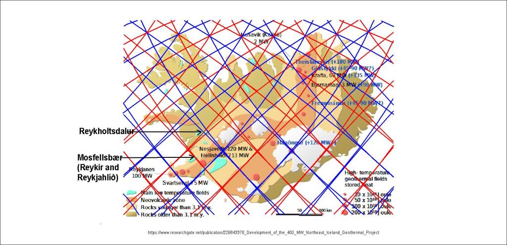
We know why geothermal heat is found in the area of Reykir near Mosfellsbær, providing Reykjavik with about half of the geothermal energy needed to heat the city. It is explained for instance in an article by Daníel Einarsson (3D modelling of the Reykir geothermal areas in Mosfellssveit, Iceland).

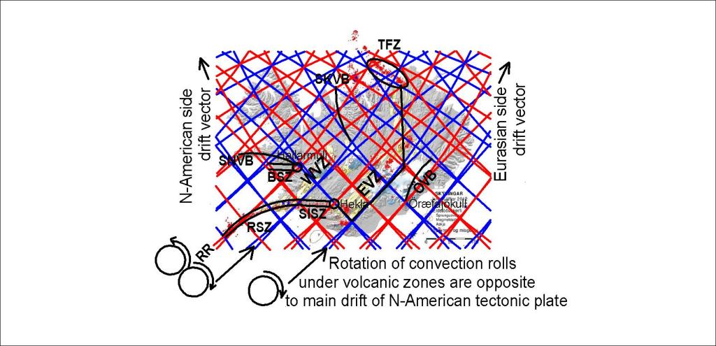
This shows clearly the NW-SE alignment of the area, even though it is associated with a fissure swarm oriented NE-SW. Therefore a comparison with the mantle convection rolls alignment is needed to see the reason for this topography and arrangement of geothermal resources within the area.

The alignment is found to be the same as of the calculated NW-SE lines. Therefore it can be reasoned that the geothermal activity is associated with three factors. First an old high temperature area that has cooled down, second the fissure swarm from Krýsuvík and Trölladyngja, and thirdly from the effect of the edge of the relevant polygon, whereas two division lines of convection rolls are found underneath the geothermal fields.
Here is the article by Daníel Einarsson.