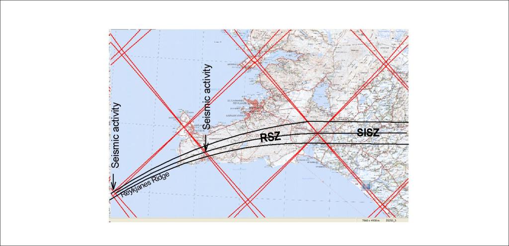
The seismic zones of Reykjanes and South Iceland are similar, yet the SISZ is much more prominent than the RSZ. A certain degree of continuity is suggested on this map:
Suggested continuity of Reykjanes Seismic Zone and South Iceland Seismic Zone.
This suggestion is based on the mapping of faults in the area:
Red line added to the original map.
The accurate bending of the RSZ is suggested by a central axis through 1/3 the length of the SW side of the Reykjanes Polygon, and the ends are found at the corners near Hveragerði and of the Reykjanes Ridge as shown on the map.
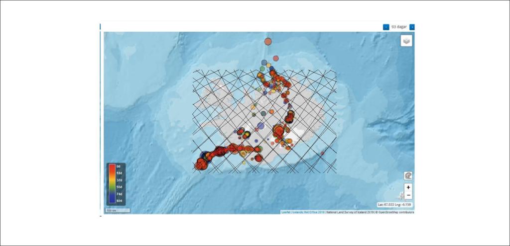
To further compare:
Comparing convection rolls grid and earthquakes from Nov 2019 – Feb 2020
I am a geologist, graduated from the University of Iceland, and taught geology for a few years. I have gained some knowledge about Earth's inner structure, so I provide this website as my contribution to answer one of the greatest questions remaining within the realm of geoscience. Experiments show that the mantle should form convection rolls when close to the melting point. I took this literally, and calculated the dimensions and shape of these mantle convection rolls. Then I compare that model with the surface. This makes it possible to provide many interesting examples about geology found on my blog.
View all posts by Steingrimur Thorbjarnarson