The convection rolls underneath Iceland shape the volcanic and earthquake zones. A line can be drawn between the tectonic plates, and then the interaction between teconic drift and convection rolls can be derived. Here the main zones have been marked on the map:
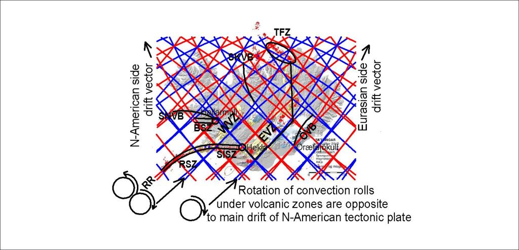
Without this grid, the reasons for the location of all those volcanic zones and earthquake zones become obscure. The similarity between the position of SISZ with Hekla and BSZ with Hallarmúli is pointed out specially. Hekla and Öræfajökull appear at the same kind of crossings, 3° apart on the same latitude. The difference between the mountains can be explained, as Hekla is at the edge of a rift zone, whereas Öræfajökull is not. Tjörnes Fracture Zone is aligned along the convection division lines. The South Iceland Seismic Zone polygon is found both south and north of the division line of the tectonic plates. The southern end drifts eastwards, while the northern end drift has a component to the west. Therefore it breaks in the middle in a way known as the bookshelf pattern.
