geology

How are Iceland and Hawaii connected?

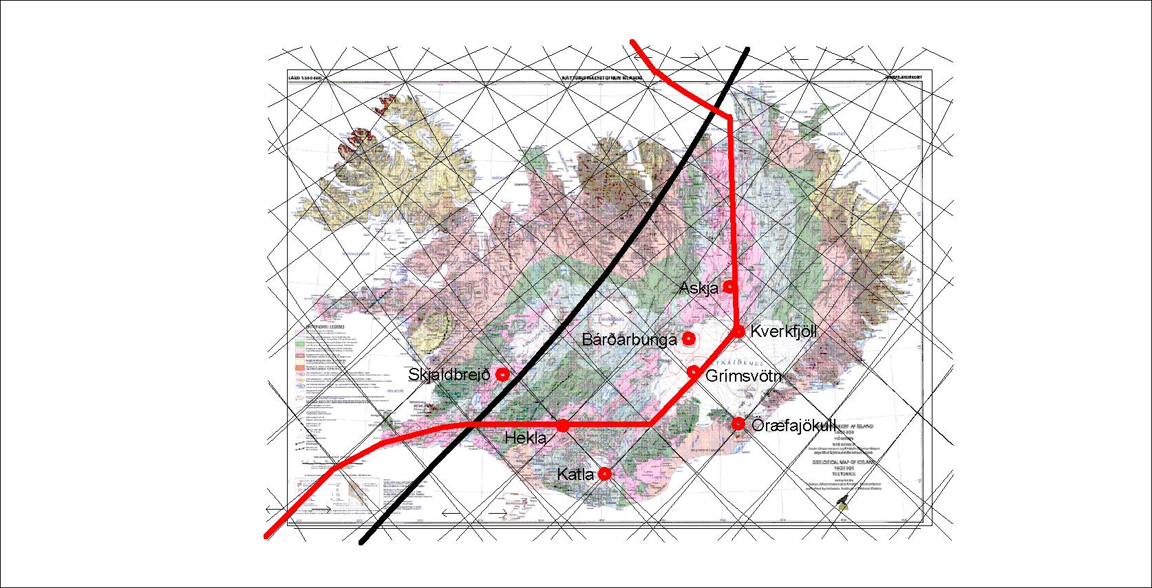
Iceland and Hawaii are often mentioned at the same time, because they are the two strongest hot spots in the world. In 1989, T. Neil Irvine of Geophysical Laboratory, Carnegie Institution of Washington, noticed that Iceland and Hawaii are exactly 90° apart. It was a valid reason for him to make an analysis of the mantle currents within the Earth. He started by pointing out two sources of upwelling magma under Iceland and Hawaii, and the other locations forming a rectangular framework of 90° to each direction on the globe. I really appreciate this attempt, and the mathematical relation is a fact. But the convection cell system model here described is different from the one Neil Irvine made. Therefore, to understand why Iceland and Hawaii are 90° apart, the mathematical preconditions have to be derived in two steps, as the angle between the relevant convection rolls is 120°, and the hot spots Irvine referred to are close to different crossings of the convection cell system that lead to the intriguing angle of 90° compared with Earth’s center.

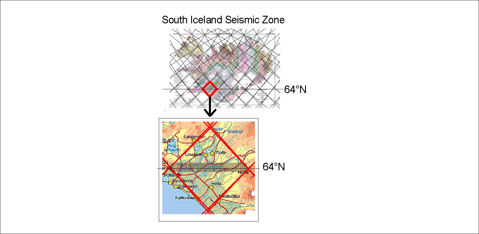
Here you can see the mathematical path of the six ascending division lines of the large convection cells of Earth’s lower mantle. The relationship is revealed to everyone by looking for less than one second!

Iceland and Hawaii

The relationship between Iceland and Hawaii above main horizontal division lines of large convection cells in Earth’s mantle.

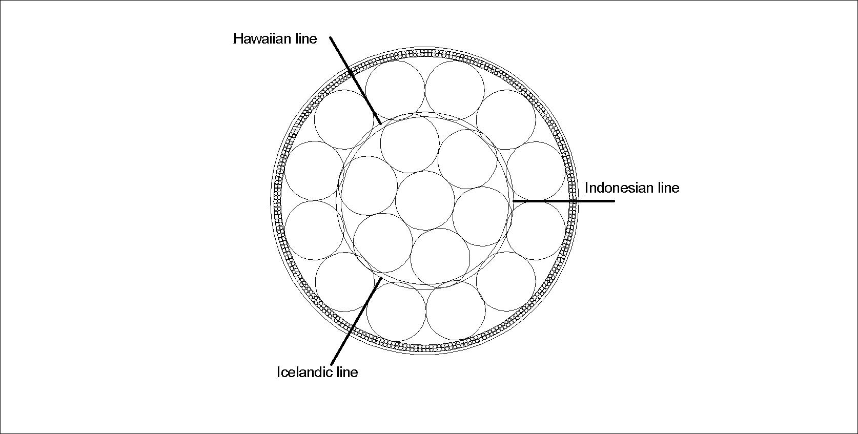
To better understand this in 3D, the convection rolls equator plane is added here to se the vertical aspect. The rolls shown here as circular sections extend to north and south as shown above.

Iceland - Hawaii - Indonesia - lines
Uncategorized

Can we predict volcanic eruptions?

The answer is of course both yes and no. It is yes because volcanic eruptions have been predicted many times correctly. Still, nature takes us by surprise all the time. With a model of convection rolls it will be possible to predict activity level of different volcanic sites and areas in the future. A key to that is the so called V-shaped ridges of Reykjanes peninsula, because there we see activity propagating along the ridge to the SW. Similar movement of activity centers along other lines should be found and thereby additional activity level at certain locations can be predicted.

Uncategorized

Which volcano will erupt next in Iceland?

For the last four decades, about one eruption has occurred every two years in Iceland. Still we know nothing about the next one, Where, when and how questions can not be answered. Something new is surprising us now and then, like Öræfajökull now melting the ice at its top. Rather big earthquakes at Bárðarbunga bring it to our attention again and again. Let us have a look at the list of some of the suspected volcanic sites:

Iceland - division lines of lower mantle and tectonic plates

Recently earthquakes shook Skjaldbreið and it seemed like magma was entering the crust a few kilometers below the mountain. Hekla has changed its rhythm, but the mountain has expanded more than before the last eruption. Katla is a mystique: When will the next large scale flood happen?  Bárðarbunga and Grímsvötn are going through a period of activity. Actually Bárðarbunga is the most likely candidate for the next eruption. It is also a very interesting case to study, as it is in the middle of a polygon, showing itself to be a caldera with the function of feeding the spreading zone with magma forming huge dykes to cope with the tectonic drift. Askja can in turn be affected by the dykes propagating from Bárðarbunga. Recently even Kverkfjöll became a suspect when there were signs of eruption found in rivers flowing from that area. And finally, magma must be responsible for the melting of ice at the top of Öræfajökull. We just do not know the details of the intrusion below the mountain.

Uncategorized

South Iceland Seismic Zone Polygon

I mentioned the SISZ earlier, as it is one of the clearest examples of polygons marked by the mantle convection cells. The balanced conditions within the ductile part of the tectonic plate lead to earthquake faults exactly in between the symmetrical lines around it to the NW, NE, SW and SE. The faults are therefore aligned NS.

SISZ - South Iceland Seismic Zone explaination

In this way it becomes much easier to analyze every feature of earthquake zones of this kind. The reasons for pressure directions become clear. In this case, pressure is exerted from NE and SW. NS-faults are drawn with 715 meters interval along the 64th parallel.

Uncategorized

The Vatnajökull Polygon – simplified

This can be called the Vatnajökull Polygon:

Vatnajökull Polygon

At three corners of the main polygon the mantle convection rolls form, there are very famous volcanic sites, Grímsvötn, Kverkfjöll and Öræfajökull. Esjufjöll are found close to the center of the polygon. But the polygon is very unlike the next polygons to the NW and W which are in a rift zone. The Vatnajökull Polygon is very active, but no rifting is taking place within it. The polygon should still move partly as a whole, and therefore activity at Bárðarbunga and especially Grímsvötn and Kverkfjöll might affect Öræfajökull. It is obvious how this polygon provides the main area for Vatnajökull. The line from Öræfajökull to the NE also marks the eastern edge of the glacier. So, the convection rolls far below give us a framework to explain the appearance of the wonder world of  Vatnajökull.