geology

Convection cells alignment compared with the Scandinavian Peninsula and Iceland

Norway shows remarkable similarity with the shape of convection rolls pattern.

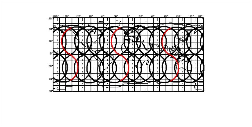
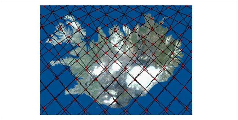
The grid resulting from the relevant analysis looks like this:

Article-Scandinavia-picture-02

With one basic formula, the main features of the Scandinavian Peninsula can be accounted for. One prediction of the theory is that identical latitudes frequently share parallel topographic features.

In northern latitudes (above 60.3°N), this formula is used:

β n = 90° – arc tan {[(35.342 – (ϕ – 96)2) 0.5  / (ϕ – 96)](1/cos ϕ)}

where β represents the direction, either as Nβ°W or Nβ°E of the convection rolls extending from the North Pole to the latitude of 60.3°N, and ϕ is the latitude.

According to the above formula, the direction is about N33°E, and it fits very well to the general trend of both coastlines at the same latitude as shown:

Article-Scandinavia-picture-03

Article-Scandinavia-picture-04

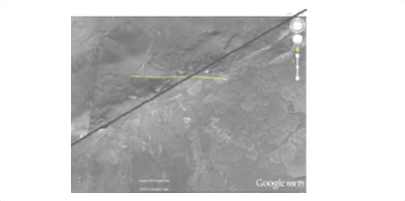
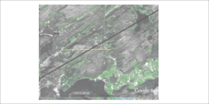
The direction can be detected even more clearly in the mountains of Norway where the valleys have the predicted orientation.

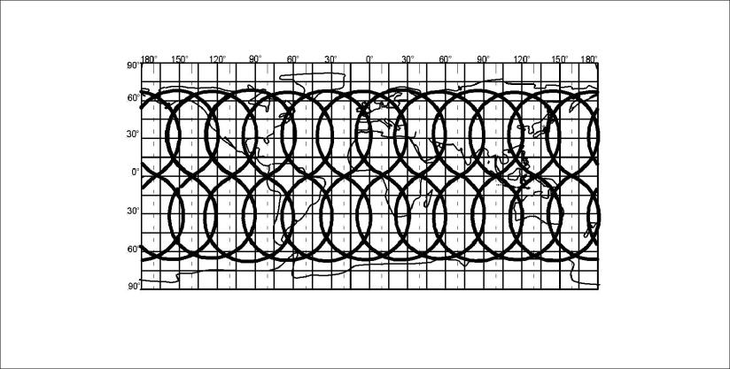
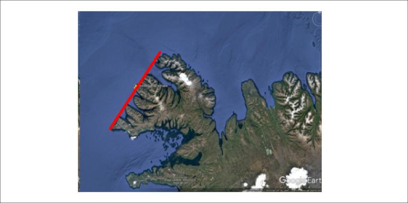
In addition, the fjords of Iceland, for instance Arnarfjörður, have the same orientatin as the side valleys of Scandinavian peninsula, extending between Norway and Sweden. The direction of these valleys can be calculated with the same formula for the convection rolls extending from equator:

β e = 90° – arc tan {[(35.342 – (ϕ – 32)2) 0.5  / (ϕ – 32)](1/cos ϕ)}

The calculation gives the value of about N55°W.

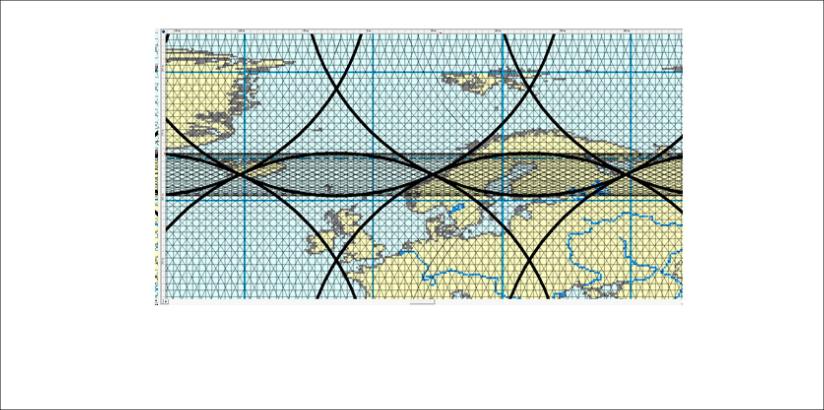
Therefore, when the direction β e is added to the maps, the resemblance becomes clear:

Article-Scandinavia-picture-05

Article-Scandinavia-picture-06

Same directions for Iceland and Scandinavian Peninsula, both for the fjords in Iceland and rivers in Sweden.

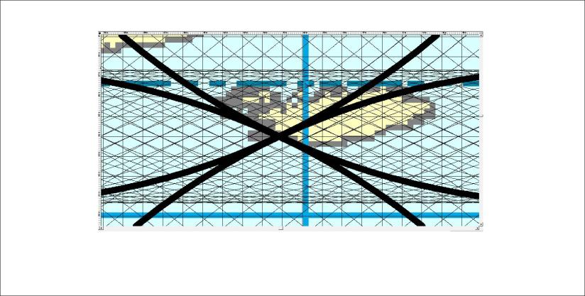
We can compare the convection rolls alignment at 60°N  with the Hardangerfjord system. The relevant vector is oriented N33°E, as shown here:

Article-Scandinavia-picture-07

In turn, the E-W orientation of Sognefjord is inherent in the convection roll system everywhere because of the symmetrical form of the polygons resulting from the two uppermost layers below the crust.

There are many other similarities to be pointed out, and I often show people how the volcano Hekla has its counterpart in Norway, exactly 30° of longitude apart. I have already written another blog post about this. Considering that the convection cell system underneath is largely identical at those two places, it becomes easier to understand.

Article-Scandinavia-picture-08

Hekla

Article-Scandinavia-picture-09

Trondheim area 30° of longitude from Hekla along 64°N.

This similarity is a surprise, but still expected according to this theory about the conditions prevalent within the mantle.

Uncategorized

The convection cells below the tectonic plates of the Earth

The convection cells of the mantle are symmetric and stable, constantly affecting our surroundings for billions of years. The basics are so simple that words are not necessary. Just have a look at this sketch below:

Convection cells - basic two rolls

The Reykjanes Ridge is a good example, with a pair of convection cells underneath. These convection rolls extend over all the globe. The subject introduced here as the Convection Cell System of the Mantle is therefore based on a very simple precondition. How this section is then extended over the entire globe and all the relevant implications is of course a bigger piece to swallow 🙂

Uncategorized

The discontinuities at 410 and 670 km depth – regular convection layers!

With the precondition that convection takes place in a regular way, with equal height and width, it is easy to show that the main discontinuities at 410 km and 670 km are found where different convection cell layers meet.

Main layers 410 km and 670 km

Convection rolls of Earth’s mantle

As shown above, the convection rolls fit exactly to the measured layers. The intersection between the rolls is always of the same proportion.

The lower rolls below 410 km depth are found within the larger rolls of the lower mantle. It explains why volcanic activity can follow the tectonic drift above, for instance the Cameroon line of volcanic activity in Africa.

Uncategorized

Convection rolls division lines of Iceland, Hawaii and Indonesia

It becomes easy to comprehend the activity of Iceland, Hawaii and Indonesia when looking at the convection cells pattern. The 2D sketch of equator plane is:

Iceland - Hawaii - Indonesia - lines

And the relevant world map of the same lines is then:

Lines - Iceland - Hawaii - Indonesia - surface

Where the lines for Iceland, Hawaii and Indonesia are marked red.

All this can be derived from one simple precondition: Stability conditions of the mantle.

Once understanding what this means, calculations can replace compiling data in many cases, saving effort and money on a grand scale.


Uncategorized

Why Indonesia and Iceland have many volcanoes?

Iceland, Hawaii and Indonesia have special positions over the three main division lines of convection roll division lines of the Earth. This can be looked at in more and more details according to the time and effort of analysis. Let us have a look at the world map:

Lines of convection system - 12 main lines of world

Not understood? This shows that Iceland, Hawaii and Indonesia have the three main division lines of the mantle convection rolls within the Earth.

Let us have a closer look at Iceland:

Lines of convection system - Iceland

This drawing shows Iceland with the polar system included, main division lines darkened.

Then more accuracy can be added:

Lines of convection system - Iceland accurate

So we add this map, just to show that each line can be derived very accurately.

This is the pattern to use to make it easier to understand the volcanic activity of not only Iceland, but also Hawaii, Indonesia and all the world.

This line pattern does result from the arrangement of convection rolls within the Earth.