Uncategorized

A simplified picture of tectonics in Iceland

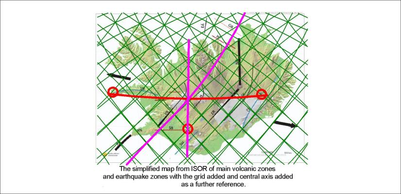
Simplifying tectonics and geological settings can be useful. At ISOR this map was made to give a general idea about the volcanic zones and earthquake areas. Comparing this with the calculated grid shows resemblance:

ISOR map as a base for the grid pattern and main axis

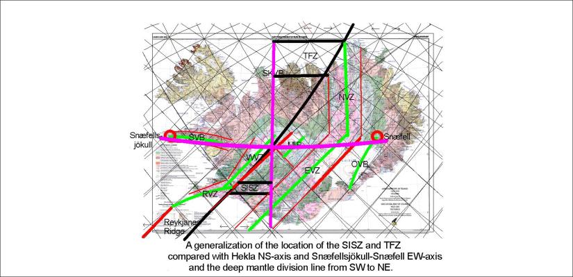
The black lines are originally on the map from ISOR. The EW axis between Snæfellsjökull and Snæfell is then added, and the NS-axis from Hekla.

One aspect of this simplification is that the Skagafjörður volcanic zone appears totally in this manner as a connection with Hofsjökull volcanic system or Mid Iceland Belt.

Volcanic Zones and Belts of Iceland

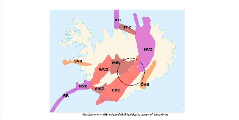
Refering to this drawing, where the Skagafjðrður Volcanic Belt is missing, we can add it to refresh the memory:

Volcanic Zones and Belts of Iceland - Skagafjörður Volcanic Belt added

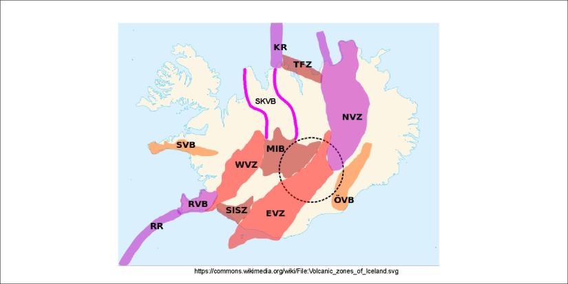
It also shows how the Skagafjörður Volcanic Belt connects with Kolbeinsey Ridge in a similar way as RVB connects with RR. The parallel functions of SISZ and TFZ also become clearer.

The Skagafjörður Volcanic Belt should therefore be included in the general tectonic layout of Iceland, as it gives a more comprehensive picture of the processes shaping the country.

Connection between Reykjanes Ridge and Kolbeinsey Ridge

This leads to a picture of a connection between the ocean ridges south and north of the country without the help of SISZ and TFZ. The wide red line indicates the ridge originated continuity over Iceland.


Uncategorized

Tjörnes Fracture Zone – the complicated feature of Iceland

Tjörnes Fracture Zone is found both on land and under sea at the north coast of Iceland.

It is similar to the SISZ, but differs as the weakness of the tectonic plate underneath is manifested in different pattern of epicenters.

Gosbeltin öll - Tjörnes

The description found in an article by Bryndís Brandsdóttir and others, here linked, is interesting, as it says that actually Tjörnes Fracture Zone is aligned EW. The three main lines of epicenters show how the polygons brake up in a regular pattern.

Sometimes manipulating with reality can make things clearer. To compare the earthquake zones with the main underlying factors of mantle convection and its polygon pattern and other implications, let us draw this map with Icelands main three axis:

Hypothetic Iceland - Not Real Iceland

The NS-axis through the craters of Eyjafjallajökull, Hekla, Hveravellir area and Drangey of the Skagafjörður Volcanic Zone, the EW-axis from Snæfellsjökull to Snæfell with Hveravellir at the center, clarify the locations of SISZ and TFZ.

Therefore, focusing on the mantle convection cell pattern gives a very clear picture. Tectonic drift is of course the reason for the dynamics of these earthquake zones, but this ‘reason for the reason’ is quite important.

The latitude of 64.75°N plays a major role, and the shift from NE trend to NS coincides with the division between large polygons in the southern half of Iceland and the smaller and more irregular polygons of the northern half.

Uncategorized

The double nature of volcanic areas of Iceland

The extinct volcanic zone of Skagafjörður tells a story about the double nature of volcanism in Iceland in general. The eastern North Volcanic Zone has taken entirely over the volcanic and rifting functions.Gosbeltin öll 01

The coherence between the South Iceland Seismic Zone and Tjörnes Fracture Zone becomes more appearent when comparint its location with the Skagafjörður volcanic Belt. The Tjörnes Fault Zone can be regarded as an EW-trending.

The large scale axis from Snæfellsjökull to Snæfell provides a connection to practically all the volcanic zones (and those classified as volcanic belts).

Uncategorized

The theoretic central line of Skagafjörður volcanic zone

The volcanic activity of the past two million years includes the Skagafjörður volcanic zone, active from 2 million years ago to about half a million years before present, but now extinct.

Árni Hjartarson wrote his PhD thesis about this area, and in his essay this map is shown:

file:///C:/Users/Lenovo/AppData/Local/Temp/Arni-Hjartarson-2003-PhD-heil-1.pdf

Skagafjarðargosbeltið - Árni Hjartarson - kort

The form is in harmony with the other peripheric zones:

Skagafjarðargosbeltið - og jaðarbeltin

This line extending from the still active Hofsjökull caldera of the Central Icelandic Volcanic Zone, is found both by tracing the central axis of the outlines of the volcanic zone as drawn by Árni Hjartarson and the relevant points of the convection rolls grid.

Uncategorized

The bent volcanic zones of Reykjanes, Snæfellsnes and Öræfajökull

There are three volcanic zones that show similarities when compared with the convection sysmtem of mantle underneath, namely Reykjanes, Snæfellsnes and Öræfajökull. They mainly cover two polygons each. The Öræfajökull and Snæfellsnes systems both start at the same latitude, one with Snæfellsjökull, the other with Snæfell. These mountains have the same system position compared with Hekla for instance. But this map is for everyone to ‘read’:

The bent volcanic zones