
The Three Large-Scale Tectonic Rings
After the mantle convection roll system had been analysed, a number of secondary relationships became easier to recognize. The geometry of the Ring of Fire became more comprehensible, and extrapolation of its form led to the hypothesis that the Ring of Fire may represent only one of three adjacent large-scale tectonic systems of comparable dimensions surrounding the Earth.
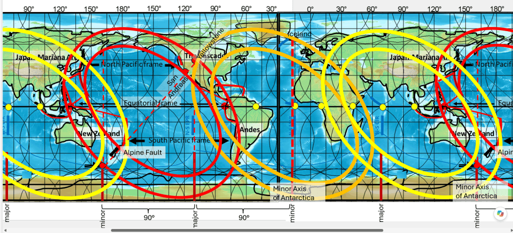
An important clue was that the dimensions of the Ring of Fire could be defined by its span across the equatorial region and then traced away from the equator. The inner boundary was found to span 120°, from approximately 146°E to 94°W. This suggested a simple possibility: the Pacific Ring may occupy one of three approximately equal 120° sectors around the globe, with comparable tectonic rings associated with the Atlantic and Indian Oceans.
The outer boundary of the Ring of Fire is somewhat more difficult to define. A first approximation suggests a span of about 150°, but comparison with major tectonic structures indicates that the effective width may be somewhat greater. Features such as the Kermadec–Tonga system, and particularly the Red Sea, provide important constraints on the position of the outer boundaries of these large-scale elliptical tectonic forms.
Africa as a Test of the Geometry
Africa provides a useful example of how major tectonic structures correspond to this geometrical duplication of the Ring of Fire.
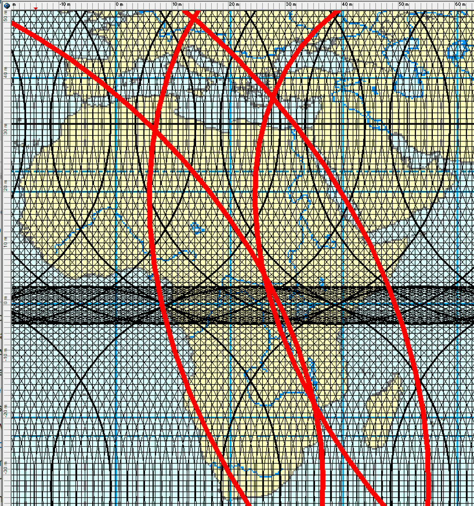
The Red Sea follows the orientation of the proposed outer ellipse remarkably closely. In the present mathematical construction, the ellipse is centred at approximately 29.3°W, 6.0°S, with minor and major axis lengths of 71 and 96.5 units, respectively, and is rotated by 45°, corresponding to a slope of −1 in the planar representation. The corresponding inner ellipse has minor and major axis lengths of 51.8 and 77.7 units.
The major-axis direction of the outer ellipse also extends mathematically close to the South Pole, linking the geometry of the oceanic rings with the Antarctic system.
A Six-Part Global Arrangement
Although three elliptical tectonic rings are identified, the complete arrangement can also be viewed as a six-part system, because each ellipse consists of two opposing halves.
This introduces an interesting comparison with hexagonal geometry. In a regular hexagon, each side has the same length as the radius of the circumscribed circle. Sixfold arrangements are also common in physical systems where comparable units are distributed around a centre.
The possible relationship with the mantle convection roll system therefore deserves examination. If the tectonic arrangement is divided into six principal sectors, the positions of the convection-roll divisions can be compared with the boundaries between these sectors. However, the numerical relationship between the number of rolls and the six sectors should be treated separately and tested precisely rather than assumed from the geometry alone.
Width of the Tectonic Rings at the Equator
The western boundary of each outer ellipse appears to be closely related to a principal equatorial upwelling node, while the corresponding inner boundary shows a similar relationship to a downwelling node.
The tectonic boundaries do not coincide exactly with these theoretical points. The outer and inner limits appear to lie slightly to the west and east of them, respectively. This displacement may be significant, particularly where subduction systems extend several degrees beyond the underlying geometrical division.
The observed east–west width of the tectonic rings at the equator therefore appears to be closer to 20° than to 15°. A theoretical value of 21° would fit the convection-roll framework particularly well: a 15° lower-mantle convection unit, combined with two 1.5° upper-mantle roll widths on each side, gives
15° + 3° + 3° = 21°.
This provides a possible geometrical explanation for the greater width of the tectonically active zone relative to the underlying 15° division.
The African Rift System Within the Ring Geometry
When the geometry is compared with a tectonic map of Africa and the surrounding oceans, several major relationships become apparent.
The Red Sea lies along the outer boundary of the proposed Atlantic tectonic ring. The Mediterranean region, including its major subduction systems, occupies a position comparable to an active segment of the Ring of Fire.
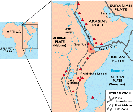
The East African Rift System also falls within the proposed large-scale tectonic geometry. Particularly striking is the southern continuation of the rift system through the Malawi Rift toward the Indian Ocean. This major tectonic division follows approximately the double boundary separating the proposed Atlantic and Indian Ocean Rings.
Thus, several of Africa’s most important active tectonic structures—the Mediterranean convergence zone, the Red Sea spreading system, the East African Rift and its continuation toward the Indian Ocean—can all be examined within the same geometrical framework derived initially from the Ring of Fire.
A Framework for Further Testing
This geometrical construction raises a large number of new questions, but they can be addressed individually.
The important point is that the geometry provides specific, testable predictions. The positions of spreading centres, subduction zones, rift systems, plate boundaries and major tectonic junctions can be compared independently with the predicted inner and outer ellipses and with the underlying mantle-convection divisions.
The next stage is therefore not to add further complexity to the model, but to test each correspondence separately and determine how accurately the simple geometrical construction agrees with the observed tectonic structure of the Earth.


