Here is a good way to take a first look at how the mantle convection-roll system beneath Iceland works:
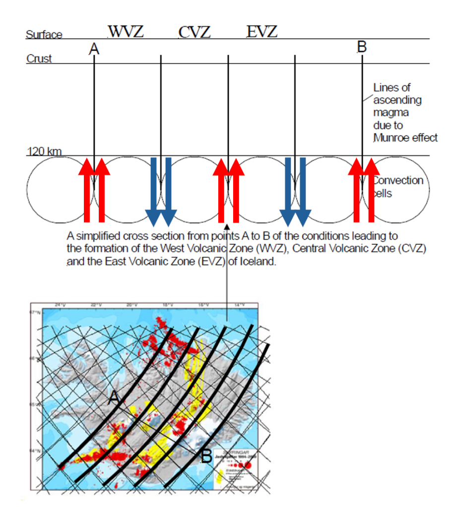
The convection rolls, once incorporated into a model of Iceland and the layers below it, appear to explain much of the country’s main geological framework. It is easiest to begin with the uppermost layers, since they likely have the most direct influence on the tectonic plate above. Here, a section is shown with reference points A and B. We can then focus on four distinct convection-roll sections.
The first roll, extending from the Kolbeinsey Ridge, corresponds closely with the West Volcanic Zone and the Reykjanes Volcanic Zone, eventually meeting the Reykjanes Ridge system of rolls at the southwestern corner of the country.
The second roll passes beneath the northern part of the North Volcanic Zone and extends toward the center of Iceland, framing the Central Volcanic Zone. It also aligns well with the South Iceland Seismic Zone.
The third convection roll is situated beneath the complex formed by the southern part of the North Volcanic Zone, the East Volcanic Zone, the South Iceland Volcanic Belt, and the Westman Islands volcanic system.
The fourth roll, located near point B, appears to provide the conditions necessary for the Öræfajökull Volcanic Belt.
