A large river of North Iceland shows resemblance with the forces underneath. It finds its way directly to the north by swaying to the polygons east of the central axis of the North Volcanic Zone. The small polygons there are under pressure from the central polygons of the volcanic zone, thereby breaking up diagonally from north to south, providing tectonic lines for the river to follow.
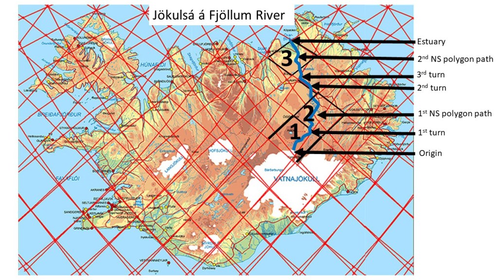
Three polygons are marked on the map, namely those with inner tectonic structure for the river to flow afert. The first is still affected by the East Volcanic Zone, with tensional forces leading the river to the NE. At the boundary of the next polygon, the river is already east of the central axis, and the polygon must therefore be subject to some pressure and rotation, breaking it diagonally NS. The river flows to the 2nd turn where it starts following the border between two polygons. At the western corner of that polygon, it enters the realm of the third polygon, being the northernmost of the North Volcanic Zone series, it has a trend for providing NS tectonic features, leading the river accurately to the northernmost corner, where the estuary is found.
