The path of Skjálfandafljót can be traced according to the tectonics related to magma flow. First, the direction of each section follows the tensional matrix, or pressure induced on the primarily diamond-shaped polygons as shown here.
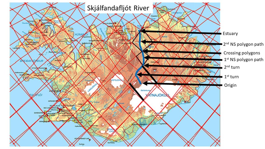
The origin follows an NW aligned path, until it reaches the border of the polygon, then it turns towards NE along the division line. At the northern end of the polygon, the river turns northwards, and crosses the northern corner of the other small polygon as well (1st NS polygon path), repeating the same story within the next polygon (2nd NS polygon path) until it reaches the estuary.
In this way, the relationship between tectonics and river flow can be explained, by referring to the effect of convection rolls below the tectonic plate. https://en.wikipedia.org/wiki/Skj%C3%A1lfandaflj%C3%B3t
The name, Skjálfandafljót, refers to the Skjálfandi Bay, literally meaning Trembling Bay due to frequent earthquakes in the area. The tectonical activity level probably contributes to the clear features of this particular river alignment.
