The lowest and highest points of Iceland are found side by side in the SE. The area is far from the rift zone, still the convection cells below at 120 km depth are divergent, creating tension to the east and west. The effect of this tension should be noticed at the surface, explaining the unusual lowering of the bedrock which is found just east of Öræfajökull forming the Glacier Lagoon.
A section of the Glacier Lagoon and the glacier tongue Breiðamerkurjökull looks like this:
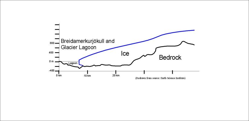
This shows us that in the future the Glacier Lagoon will probably become about four times longer than it is today. The expansion of it should also slow down soon as can be reckoned from the drawing.
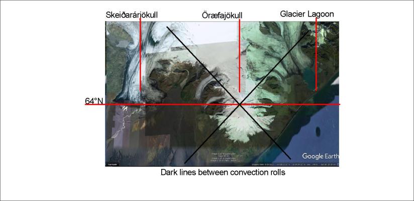
The Glacier Lagoon is in the range of influence of the 64th parallel, just as the edge of Skeiðarárjökull and the top of Öræfajökull. The forces of the convection cells at this parallel make us surprised, and as can be seen from the comparison on Google Earth map, the coastline follows the direction of convection rolls underneath, as well as the edges of the glacier.
The guides of the boats on the lagoon often mention the coincidence that the highest and lowest points of Iceland are found side by side, as the lagoon is over 300 meters deep while Öræfajökull is 2110 meters high. But there are reasons for everything!
This can be compared with a former post about the Vatnajökull polygon.
