Geosea near Húsavík in Iceland is a new tourist attraction. The baths make use of geothermal heat in the area, originating from boreholes at the seaside.
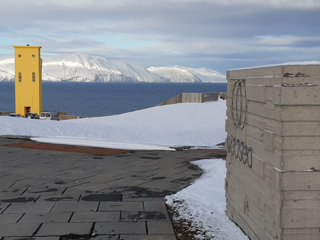
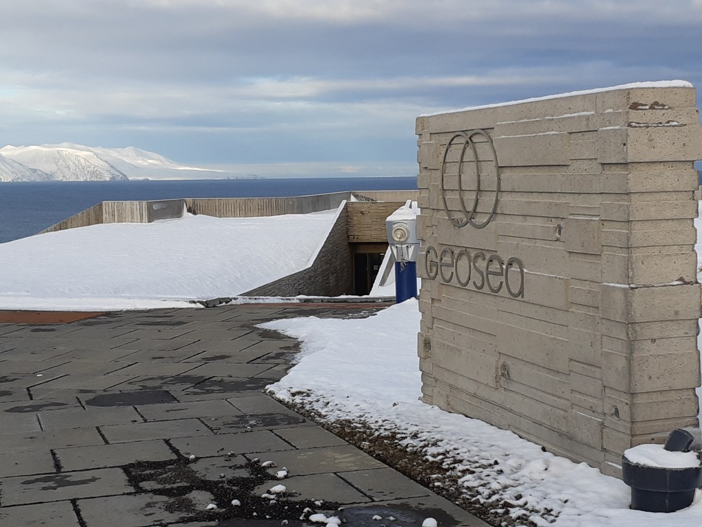
Geosea near Húsavík in Iceland is a new tourist attraction. The baths make use of geothermal heat in the area, originating from boreholes at the seaside.
The Hellisheiði Power Plant is found on the list of top ten geothermal power plants in the world. As a single power plant producing about 300 MW of electricity and with the equivalent of 133 MW for supplying hot water, it provides a total of over 400 MW of energy.
Here is the official link with the figures: http://www.onpower.is/about-us
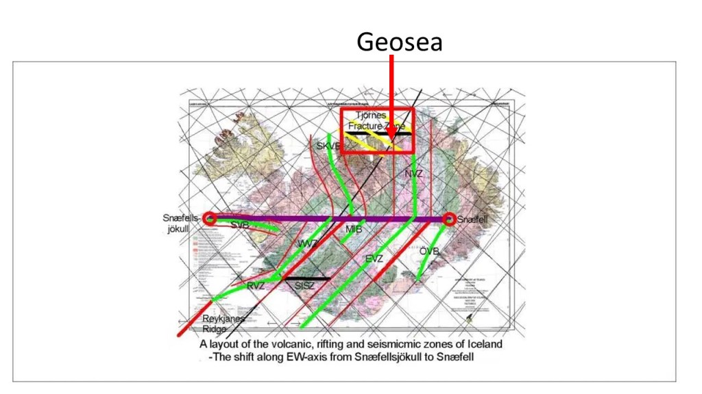
The location of Hellisheidi Power Plant is in accordance with the convection currents of Earth’s mantle, as shown on this map:

These lines are derived from the section of convection rolls found at equator.

By deriving the division lines to the north from equator, they can be traced towards Iceland. The main division line between two of the twelve large convection rolls of lower mantle is found under the power plant, providing the energy and geological preconditions for utilization of geotherrmal heat.
Where the Power Plant is located, the two plates of Europe and America meet. But underneath the two mantle convection rolls under the eastern and western side of the Atlantic Ocean pull in opposite directions, excerting the force necessary for the tectonic drift to occur.
Let us have a closer look (zoom in) at the crossings, pointed out on the large scale map above:
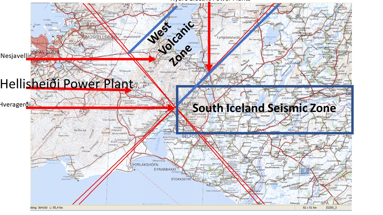
The town of Hveragerði has the most spectacular location, as the main crossings are found at the montain Reykjafell at its side. Only just over 10 km away is the Hellisheidi Power Plant. Another power plant of Nesjavellir is nearby. In between them is the volcano Hengill, with the division line under it, with the orientation of NW-SE. In this way, we can look into the details of the main crossings of convection rolls in Iceland, providing a set of very special geological phenomena.
At the equator line, special physical circumstances prevail, simply becaus of the rotation. The division points between convection rolls play therefore a strong role there, acting as constraints to the tectonic drift.
There you can see. By systematically studying this, the world becomes easier to understand 🙂
The Faroe Islands are formed in a similar way as Iceland. Those interested in the geology of the islands can first read https://en.wikipedia.org/wiki/Geology_of_the_Faroe_Islands.
Then look at the map of the Faroe Platform. You can notice the round form north of the islands.
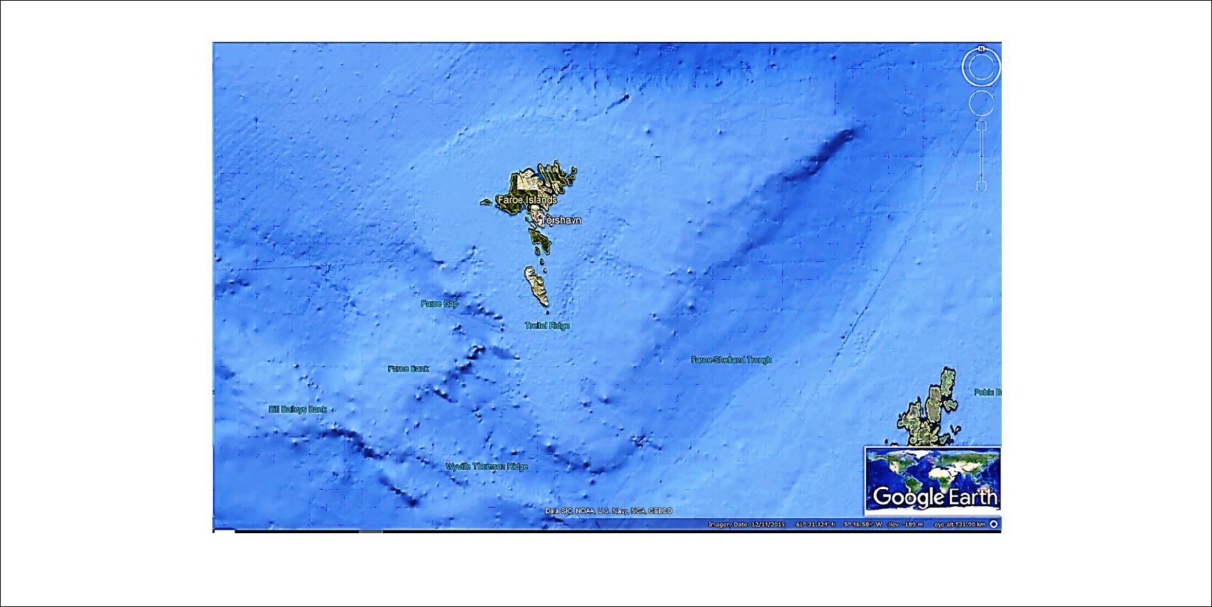
East of the islands, the Faroe-Shetland Trough seperates the two island clusters. West of the Faroe islands, the Faroe Gap plays a similar role.
This can be considered in relation to the convection rolls system. The Faroe-Shetland Trough clearly follows the convection rolls alignment. Let us combine the calculated alignment and the circular formation north of the islands, assuming a north-south symmetry of the said form.

The calculated alignment of convection rolls at 62°N has the deviation 53° from west axis. The arc found north of the islands has symmetrical end points, coinciding with similar trends of the sides to the east and west (both have deviation of 53° from east-west axis). The resulting fan image is the basic form of the Faroe Islands Platform.
And if compared to the convection rolls system, you might become surprised!

This shows that the more you look into each aspect, the more you know, the more you understand, the more clear the resemblance between surface topography and interior magma flow.
But how did the Faroe Islands get to the present location. The basalt formation are up to 58 million years old. This can be traced backwards, thanks to GPS measurements of tectonic drift. https://www.iris.edu/hq/files/programs/education_and_outreach/aotm/14/1.GPS_Background.pdf
If we simply prolong the drift vector over 58 million years, the distance is more than 1,000 kilometers. Take the two factors into account, expansion of sea floor, and the rotation of it:

This happened when Greenland was splitting apart from Canada. Therefore the old fissures are in the Faroe Islands are oriented NW to SE. Later, the orientation of the Reykjanes Ridge became dominating, so the volcanic fissures became aligned NE to SW http://iugs.org/33igc/fileshare/filArkivRoot/coco/FieldGuides/No%206%20Faroe%20Islands%20Basalt%20Group.pdf
And if this is not enough to explain, let us look into the past:

Greenland and Baffinland started to be divided, leaving marks of volcanism in W-Greenland. The effect became two-fold, as the line to SE split Greenland from Baffinland, but also the polar line leading over Greenland to SE became active. Volcanism can therefore be traced over Greenland https://www.google.com/search?client=firefox-b-d&channel=crow&biw=1920&bih=938&tbm=isch&sa=1&ei=dMwjXezIHsTSkgXzoZqwBQ&q=travelling+of+hot+spot+over+greenland+map&oq=travelling+of+hot+spot+over+greenland+map&gs_l=img.3…3714.4204..4556…0.0..0.98.361.4……0….1..gws-wiz-img.mJyecj4yRqg#imgrc=cd2ypyiYZPaOFM:
Later, when the Reykjanes Ridge took over, the line from Iceland to Greenland caused volcanism in E-Greenland. Therefore, the path over Greenland is actually caused by two different convection rolls division lines.
This could of course also be drawn with 10 pictures in a timeline 🙂
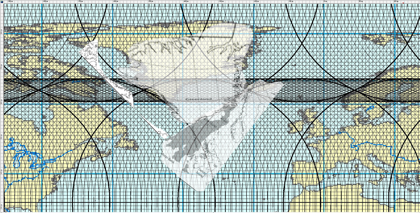
This is a bit different from convectional drawings. The lines fit to all the igneous rock formations. The line forming the Labrador Sea extends between Ireland and Scotland, causing eruptions there. The combined effects of expansion of the North Atlantic, Charlie-Gibbs Fracture Zone and the N-E rotational trend of Europe explain the movement to present location during the next 58 Ma. Greenland on the other hand drifts back and forth during that time, first to N-E and then to N-W.

This map is from https://www.mn.uio.no/ceed/english/about/blog/2017/volcanic-ash-layers-svalbard.html

This is by no means an exact drawing, but what is pointed out here is the combination of the main system responsible for the opening of the Labrador Sea, the shift to the formation of the Reykjanes Ridge, and the igneous rock in Ireland and Scotland.
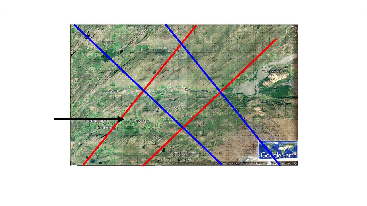
In Borgarfjörður the area around Reykholt provides naturally about 400 liters per second of boiling hot water. The Reykjanes Ridge line to NE and the NW line of Hekla intersect there and create these extraordinary conditions.
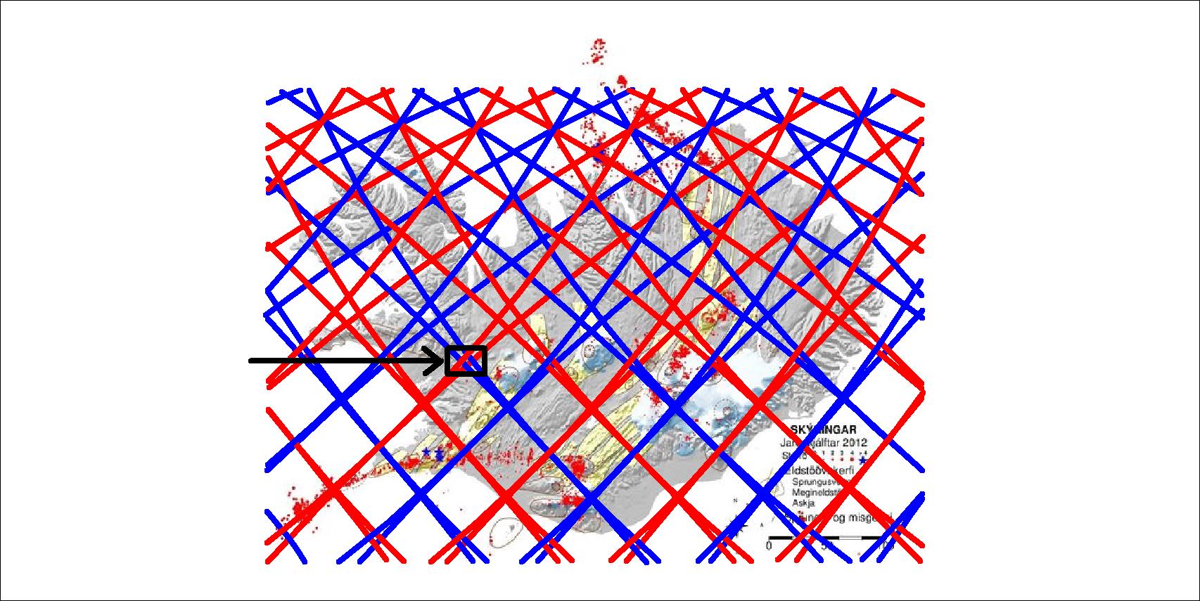
The valleys are oriented E-W due to the outer pressure on the polygon. A cube of mainly ductile material breaks from one corner to the other). The combination of side pressure and heat source creates a geothermal area.