The Blue Lagoon in Iceland is close to the Reykjanes Ridge which divides the Eurasian tectonic plate from the North American tectonic plate. Shown in context with the mantle currents, the exact location is on the top of a perpendicular division line.
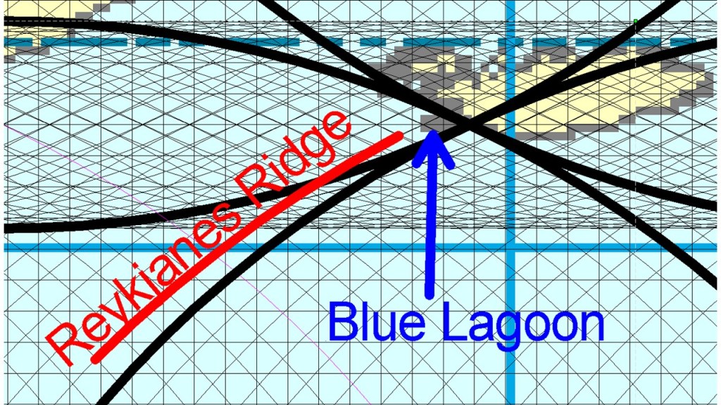
Besides this, the Reykjanes Ridge actually ends close tho the Reykjanes Peninsula, and a volcanic zone replaces its role as a divisional feature between the tectonic plates. The Blue Lagoon is found within that volcanic zone, explaining the location further. Zooming in and adding the tectonic division line shows how accurate the crossings fit with the location of the Blue Lagoon:
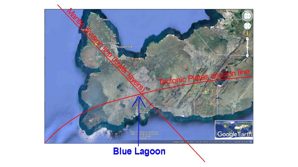
The tectonic featueres consist mainly of NE trending volcanic fissures and N-S oriented earthquake faults, but NW trending topography might also be found. Detailed material and maps can be found at this site:
An indication that the NW-SE oriented mantle division line, underneath the convection rolls oriented NE-SW shaping the Reykjanes Ridge, have direct effect on the area is this map showing the changes of gravity as measured from 1975 to 1999:
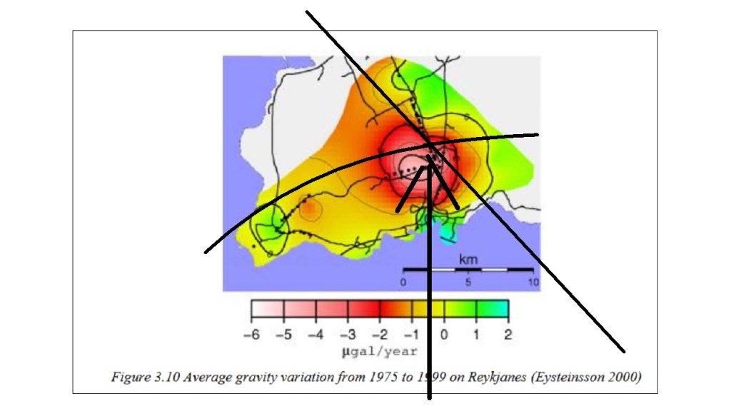
Information about the measurements are found in this article: https://skemman.is/bitstream/1946/31865/1/Melissa_Thesis_report_FINAL.pdf
