The Hellisheiði Power Plant is found on the list of top ten geothermal power plants in the world. As a single power plant producing about 300 MW of electricity and with the equivalent of 133 MW for supplying hot water, it provides a total of over 400 MW of energy.
Here is the official link with the figures: http://www.onpower.is/about-us
The location of Hellisheidi Power Plant is in accordance with the convection currents of Earth’s mantle, as shown on this map:

These lines are derived from the section of convection rolls found at equator.

By deriving the division lines to the north from equator, they can be traced towards Iceland. The main division line between two of the twelve large convection rolls of lower mantle is found under the power plant, providing the energy and geological preconditions for utilization of geotherrmal heat.
Where the Power Plant is located, the two plates of Europe and America meet. But underneath the two mantle convection rolls under the eastern and western side of the Atlantic Ocean pull in opposite directions, excerting the force necessary for the tectonic drift to occur.
Let us have a closer look (zoom in) at the crossings, pointed out on the large scale map above:
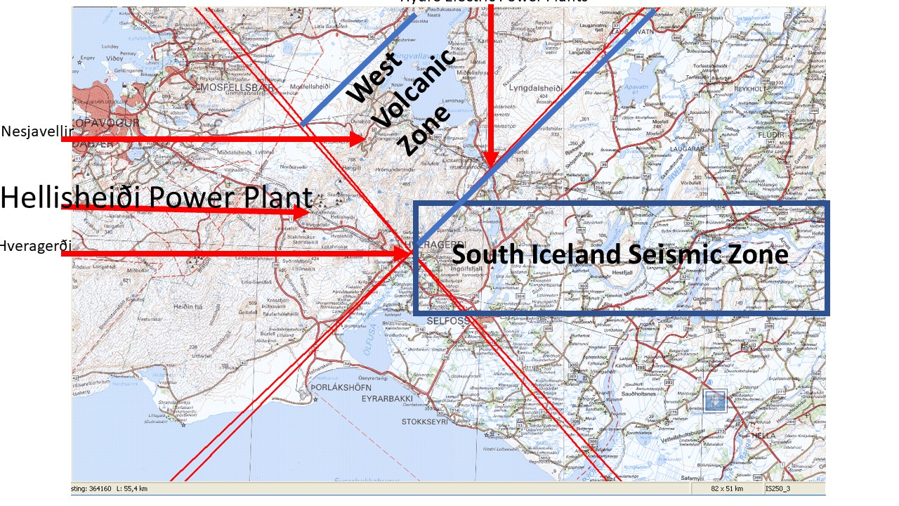
The town of Hveragerði has the most spectacular location, as the main crossings are found at the montain Reykjafell at its side. Only just over 10 km away is the Hellisheidi Power Plant. Another power plant of Nesjavellir is nearby. In between them is the volcano Hengill, with the division line under it, with the orientation of NW-SE. In this way, we can look into the details of the main crossings of convection rolls in Iceland, providing a set of very special geological phenomena.
