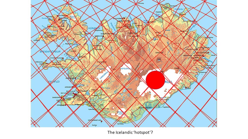
The central area of the largest glacier of Europe, Vatnajökull, can be compared directly with the division lines of the convection rolls. Here are some details:

- 1) Firstly, the Vatnajökull large scale polygon, with upwelling division lines at the eastern side and downwelling ones at the western side, is almost entirely covered with ice. The combination of weather system and the mountain range has resulted in accumulation of a glacier in this area. The surroundings show resemblance with the system of convection rolls matrix underneath. 2) Öræfajökull volcano covers the main intersection point. 3) Grímsvötn volcanic area is found in context with the western mini-polygon. 4) Kverkfjöll volcano fits with the northern mini-polygon. 5) Skeiðarárjökull glacier tongue is rooted at the SW border line. 6) Skaftárjökull section forms a semi-circle east of the Grímsvötn corner. 7) Bárðarbunga has its own foothold with a caldera, along with Dyngjujökull outlet towards the north. 8) Brúarjökull covers the area between Kverkfjöll and the eastern edge in the NE. 9) A long mountain range over two polygons where mantle rolls division line coincides with the edge of the glacier.
- The SW part of central polygon shows the same NW trend around Skeiðarárjökull as for the SE side of the same large scale central polygon.
The glacier has of course no direct connection with the convection rolls underneath, but it works like a marker pen for highlighting the geological conditions.
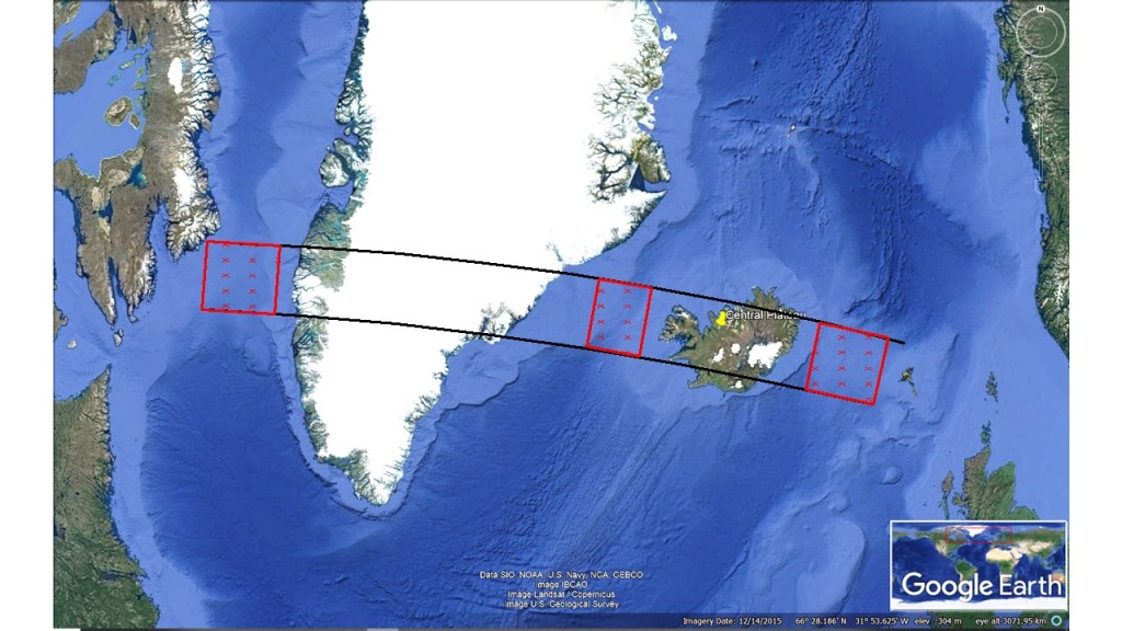
The location of Vatnajökull: