Uncategorized

The North Volcanic Zone of Iceland

The North Volcanic Zone is differs from the WVZ and EVZ in the south. It is aligned directly NS as a whole, but individual volcanic systems point slightly to the NE. Comparing the grid to the map of National Land Survey of Iceland gives this picture:

Drift - North Volcanic Zone

The vectors of tectonic drift as mesures for ISNET 2004 are divided around the NS-oriented NVZ. By marking the main polygons of the zone red, the main volcanic areas are seen to be found within them, thereby functioning to meet the tectonic drift as these polygons break up, making space for more magma input from below.

The directional effect on tectonics resulting from diverging to the east and west on the polygons is thereby quite obvious.

Uncategorized

The volcanic zones of Iceland

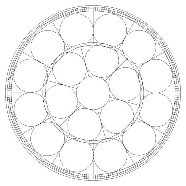
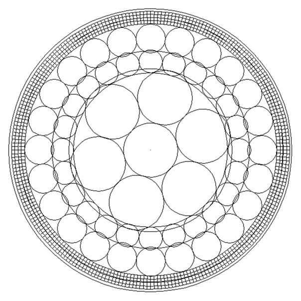
There are seven volcanic zones in Iceland. Let us analyse that on a simplified map. The volcanic zones can be described according to convection rolls pattern. (Four different layers of convection rolls cut through the ductile part of tectonic plates with Muroe Effect at the division lines, creating this pattern of polygons. It is the same law of physics as used for shaped charges.)

Volcanic zones - RVB

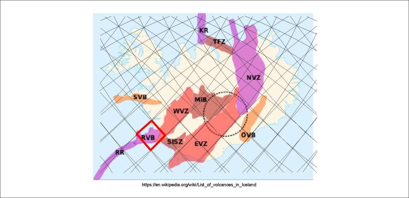
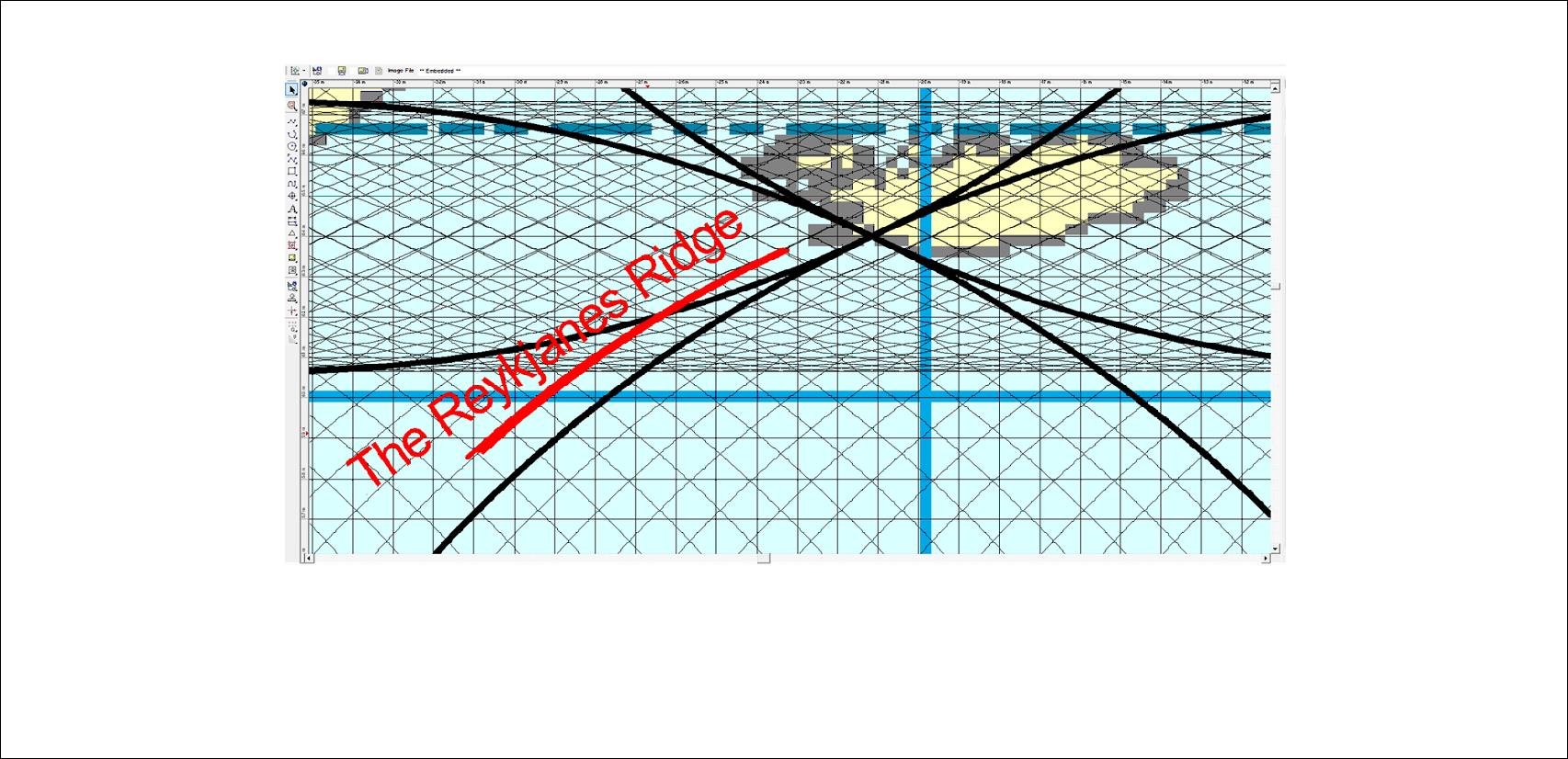
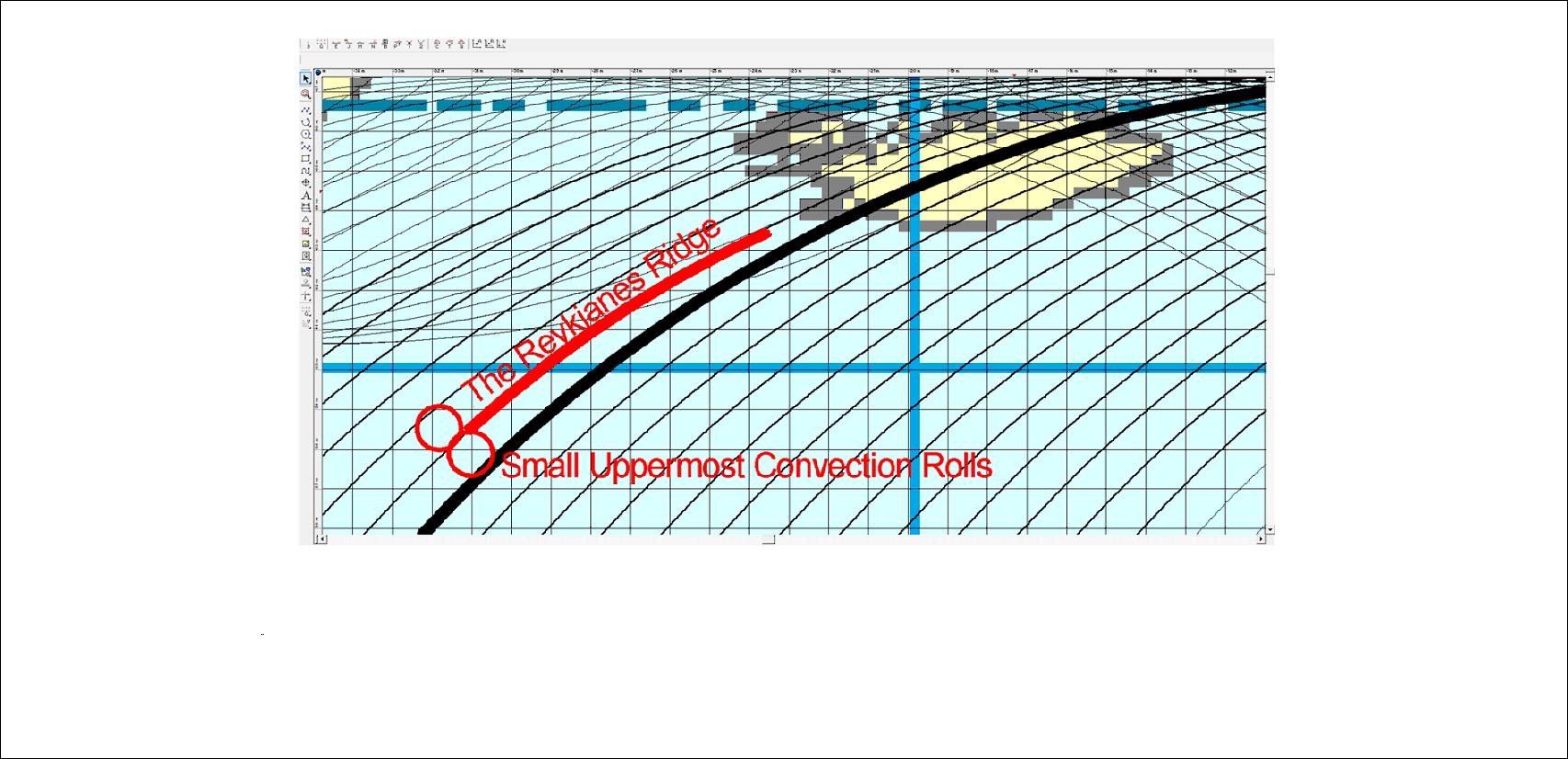
First, the Reykjanes Volcanic Belt (RVB) is found within a polygon, bending to the next polygon to the SW, forming the end of the Reykjanes Ridge.

Volcanic zones - WVZ 01

The West Volcanic zone is related to a polygon in the western highlands, and does occupy it fully.

Volcanic zones - WVZ 02

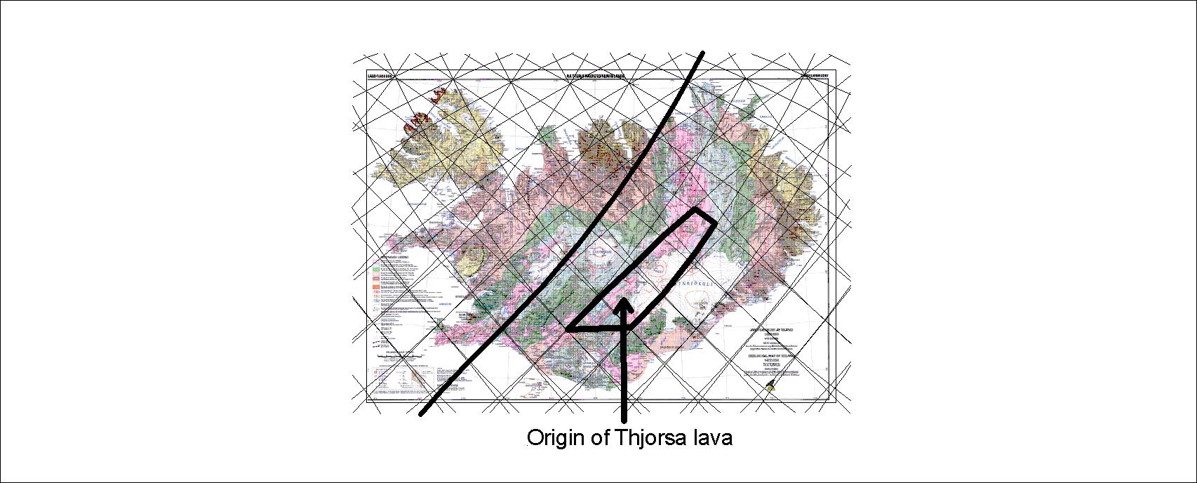
A more complete picture is shown when the half the adjacent polygons are combined with the main WVZ polygon. To understand better, we can have a look at an old map as a base:

Volcanic Zones - layer 3 (layer 1 of equator system)-

This map shows the connection between the WVZ, RVB and RR. The third layer of the intersection zone is shown. (It is the upper most layer for most of the globe, from equator to 60.7°N and 60.7°S.)

Let us keep on with the wholistic comparison:

Volcanic zones - MIB

The Mid Iceland Volcanic Belt is represented by the central polygon, only slightly extanding out of that area, mainly in the southern part of the next polygon to the east.

Volcanic zones - EVZ

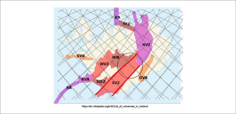
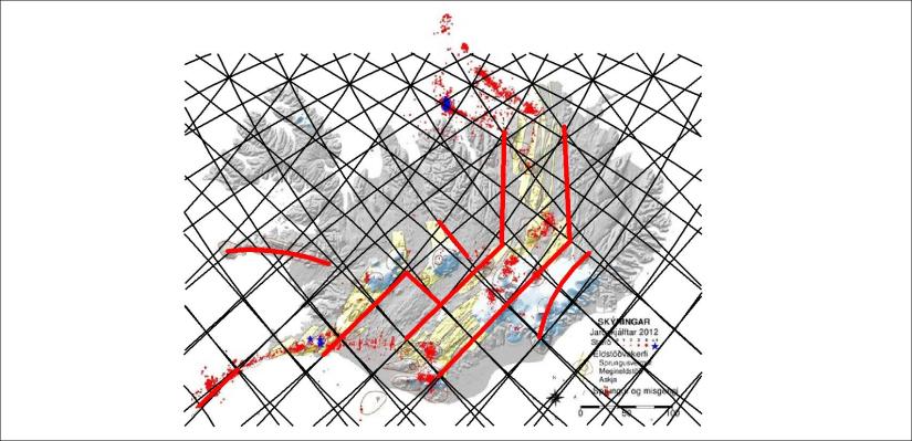
The East Volcanic Zone shows very strong resemblance with the convection rolls pattern. It can be explained, as the upper most roll is extending from NE to SW under that area. The mantle flow is mainly from west to east, pulling the crust apart, playing the main role of tectonic drift at those latitudes.

Volcanic zones - NVZ 01

The North Volcanic Zone is aligned NS, and the axis can be shown with a single line.

Volcanic zones - NVZ 02

To further clarify how the zone follows the NS-symmetric pattern of polygons, the main ones are pointed out here.

Volcanic zones - NVZ 03

Finally, the outer limits of the NVZ are drawn through the central axis of the peripheric polygons.

Volcanic zones - ÖVZ and SVZ

Finally, the two outposts of volcanic zones, the Snæfellsnes Volcanic Belt and the Öræfajökull Volcanic Belt are shown. The endpoints are Snæfellsjökull and Snæfell, and those two outposts of Icelandic volcanoes are found on the same latitude, in the same settings compared with the convection rolls pattern.

More accurate comparison can be made with more precise maps, such as this one:

Volcanic Zones - map from Páll Einarsson

The accuracy of division lines and mapping of surface features becomes obvious. The SISZ and Tjörnes Fracture Zone can also be connected with certain polygons and lines.

Marking up a few features can clarify a few things:

Volcanic Zones - map from Páll Einarsson - inserted polygons

The convection rolls extending from SW to NE are quite dominant, but at around 65°N, where the effect of the other convection rolls becomes more apparent, and the pattern becomes more complicated, a sharp turn to the north occurs. the NVZ has several volcanic systems arranged in an en echelon pattern directly to the north. Then the Tjörnes Fracture Zone obviously follows the convection rolls aligned SE-NW of the equator system.

In this way, the volcanic zones can be compared with the convection rolls under Iceland.

Uncategorized

The layers of Earth and convection rolls sections

Drawing the Earth with its layers in correct proportions:

Inner core, outer core, Gutenberg layer, 410 km discontinuity, 250 km discontinuity, tectonic plate bottom line at 120 km depth, surface with radius 6371 km.

Six currents added to outer core, with equal hight and bredth. It coincides with the outer limits of the Gutenberg layer.

Convection rolls sections added with same hight and bredth to the lower mantle. They coincide with the lower limits of Gutenberg layer and 410 km depth from surface.

The convection rolls sections are further identified with vertical lines where they are divided from each other.

The remaining layers are filled with convection roll sections of identical height and breadth, thereby completing this section of the convection roll model.

According to the details of transition layer, 410-670 km, and division of the lower mantle, this picture does emerge:

This is how it works 🙂

Then this is traced to the north and south, and finally compared with the surface and our general knowlede about the Earth, based on measurements, physics and calculations.

Uncategorized

The mantle currents shaping the Reykjanes Ridge

The Reykjanes Ridge is like a long mountain on the sea bottom. It is obviously being pulled to east and west, so convection rolls must be at its sides. The shape can be traced in a mathematical way, and drawn like that:

Reykjaneshryggurinn - rauður

Everyone can trace this and compare with a map, for instance on Google Map, that the red line exactly shows the location of the top of the Reykjanes Ridge. The convection roll between the black line and the red pulls to the east, the other roll pulls to the west.

To make the drawing less confusing, let us omit lower rolls, showing clearly the small rolls shaping the Reykjanes Ridge:

Reykjaneshryggurinn - 03

Actually, the main division line of large mantle cells (black line) is not below the Reykjanes Ridge, because the small convection rolls under the tectonic plate at that location are convergent. The divergent convection rolls at the two sides create the Reykjanes Ridge, and then north of 64°N the EVZ appears.

In this way, the tectonics can be understood quickly by comparing to the convection rolls.

Still, in this way you do not have the whole story. Of course, there are more chapters that have to be learned to further analyzing the various complications of relationship between tectonics and mantle currents. This is a section of one chapter out of many 🙂

Uncategorized

Long distance lava flow – how can it happen?

Lava temperature can be around 1250°C on the surface, and just below the tectonic plates around 1500°C. One question is how lava makes its way to the surface? Another is how it can flow as far as it does. The example down below is 140 km. How can that happen?

Þjórsárhraun

This sign is found in the town of Stokkseyri at the south coast of Iceland.

So where does the lava come from? It is originated from the most active rift zone of Iceland, close to where we locate the hot spot. The lava is actually from the volcanic system  Bárðarbunga within the hot spot area.

Þjórsárhraunið

This drawing shows the location of the eruption, right within the main volcanic zone oriented NW-SE. Huge dykes are ofthen created when eruptions like this one occurs, due to the tectonic drift, as the dykes fill up the faults as the land is being pulled apart.