I am a geologist, graduated from the University of Iceland, and taught geology for a few years. I have gained some knowledge about Earth's inner structure, so I provide this website as my contribution to answer one of the greatest questions remaining within the realm of geoscience. Experiments show that the mantle should form convection rolls when close to the melting point. I took this literally, and calculated the dimensions and shape of these mantle convection rolls. Then I compare that model with the surface. This makes it possible to provide many interesting examples about geology found on my blog.
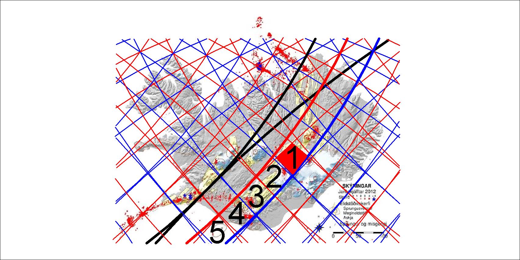
The East Volcanic Zone is divided into 5 parts shown here:
The polygons of the East Volcanic Zone
Each of those polygons is somehow special, and No. 1 fits the area often pointed out as the hot spot of Iceland. It is being pulled to the east and south (as the blue lines show local downwelling) against the main drift direction towards NW. No. 2 and 3 belong to rift zone, but 4 and 5 are sometimes called South Volcanic Zone, because it all belongs to the Eurasian tectonic plate and is not being torn apart. No. 4 is the area of Eyjafjallajökull and Mýrdalsjökull, and No. 5 is the polygon of Vestmannaeyjar.
The lower mantle is divided along the middle of the Atlantic. This division line becomes double within the intersection zone at the latitudes of Iceland.
If there was just one line, it would be easy to understand. (If it was so easy, it would probably have been found out at least 100 years ago.) It is difficult to understand, because there are actually two lines.
The division lines of lower mantle. The next lines are found 30° to the east and west
Tracing the calculated lines of division lines, the main central lower division lines are found:
The central division lines
The crossings are found at 64°N and 21°10’W in the slopes of Reykjafell mountain (meaning Steam Mountain) at the side of the town Hveragerði (meaning Hot Spring Town). That point is found directly north of the middle point of the Atlantic at equator ( 0°N and 21°10’W).
This section is valid for equator. This system extends all the way to the latitude of 60.7°N. Between the parallels of 60.7° and 67.3° the so called intersection zones are formed.
The plane of each convecting cell section shoul be parallel to the rotation plane of Earth at other latitudes too. The centrifugal force constantly affects a moving particle of the flowing and convecting mantle. That has to be kept in mind, understanding the proportions of the convection rolls extending north and south from equator. An hours lecture would clarify further what is meant by that 🙂
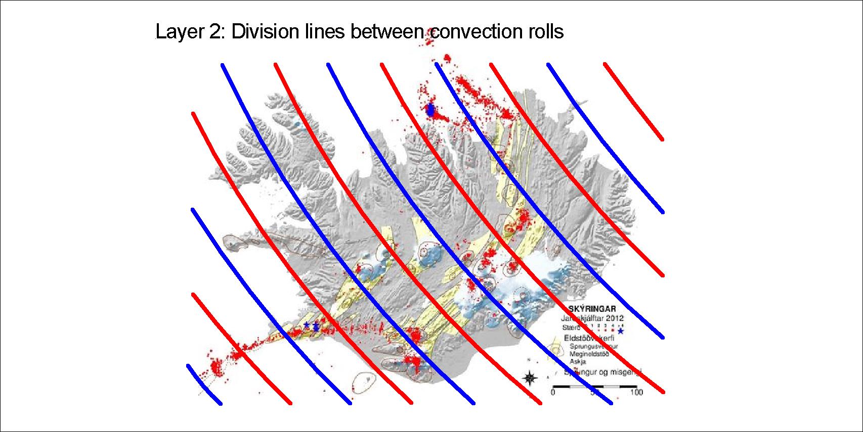
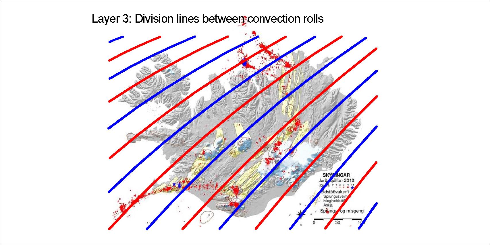
The layers between 120 and 410 km depth affect the tectonics of Iceland. Within the division lines between the rolls, Munroe effect sends magma up into the tectonic plate, marking polygons at the surface. The four sets of division lines of the four layers are drawn here, red for upwelling and blue for downwelling.
The upper most layer extends NE to the poleLayer 2 extends NW towards the poleLayer 3 extends SW to equatorLayer 4 extends SE to equator
The situation in Iceland is exceptional, as south of 60.7°N there are only two layers within the range of 120-410 km.
The four layers explained, layer 1 at the top and layer 4 at the bottom. Below layer 4, ther large convection cells of the lower mantle extend down to the Gutenberg layer
These four layers have to be looked at in context with the large convection rolls of lower mantle. The tectonics of Iceland can then be studied in detail by referring to the convection rolls system.
The four layers combined
By drawing all the lines on one map, the pattern ruling the formation of tectonics in iceland is shown.
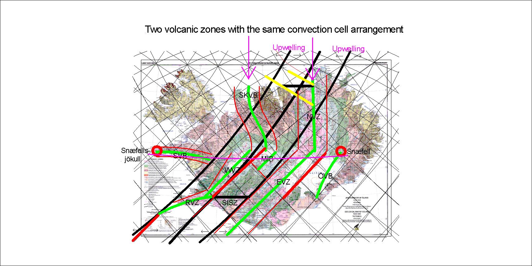
How do the volcanic zones really work? A tension between the large scale tectonic drift and local opposite mantle flow create a pulling effect on the area, so rifts and faults appear.
How the east volcanic zone of Iceland is formed
An upwelling line markes the western boundary of the east volcanic zone, and a downwelling line mars the eastern side. The flow under is from west to east, opposite to the drift of the tectonic plate. The local and global trends are opposite to each other.
The western volcanic zone is shaped in the same way. The eastern side is found along the next downwelling line, but the effect of pulling is only found in half the polygon. Snæfellsnes volcanic zone is also facing upwelling lines in the north. The Öræfajökull zone is facing the eastern trend of the tectonic drift, therefore having an upwelling line to the east.
Geologists focus on one volcanic zone of North Iceland, the one extending from Askja to Öxarfjörður. The Skagafjörður volcanic zone is still active, as earthquakes occasionally show, and Hofsjökull might be a part of it still active. Again, we can compare model and real circumstances:
Skagafjörður and Öxarfjörður are 3° apart, having same arrangement of convection rolls
The accurate consistency between model and surface features is one more reason that the convection rolls of the model are correctly calculated.