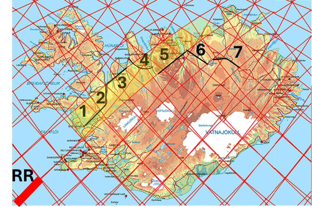
We can describe the route across North Iceland with reference to the map and its division lines. Note that the convection roll leading from Reykjanes Ridge main section is slightly coloured with yellow. Imagine setting out from Borgarnes in polygon 1 and driving up across Holtavörðuheiði. The road runs parallel to the division line until reaching the center of polygon 2, where it then turns directly north into Hrútafjörður. From there, the route bends toward the northeast, following the division line until arriving at the northern corner of polygon 3, where the road turns toward Blönduós.
The road onward into Skagafjörður curves repeatedly before turning inland, eventually entering Öxnadalur precisely at the boundary line adjoining polygon 5, the same line that defines the principal axis of the Reykjanes Ridge, continuing all the way to Akureyri.
From Akureyri to Mývatn, the main direction once again runs parallel to a division line, crossing one polygon, and thereby the other convection roll of the Reykjanes Ridge, from one side to the other (no. 6). To continue from Mývatn toward East Iceland, the route first heads directly east across a small polygon that appears to exert a major influence on the geology of the region. Beyond this point, the road follows the boundary of polygon 7 (the next convetion roll) until reaching the highlands of East Iceland.
Roads are, of course, constructed independently of geology or geological principles. Nevertheless, the landscape itself strongly influences where it is most practical to build them. If the boundaries formed by mantle convection rolls are indeed real, then they reveal themselves in various ways across the terrain. With this in mind, one may consider, while travelling from one region to another, which geological processes and structural influences may have shaped the environment within each individual section of the journey.
