Rivers are essential for agriculture, and investigating their origins involves geography and meteorology; however, a full understanding necessarily includes geology. In Yunnan Province, China, there is a protected region of parallel rivers, primarily the Irrawaddy, Salween, Mekong, and Yangtze.
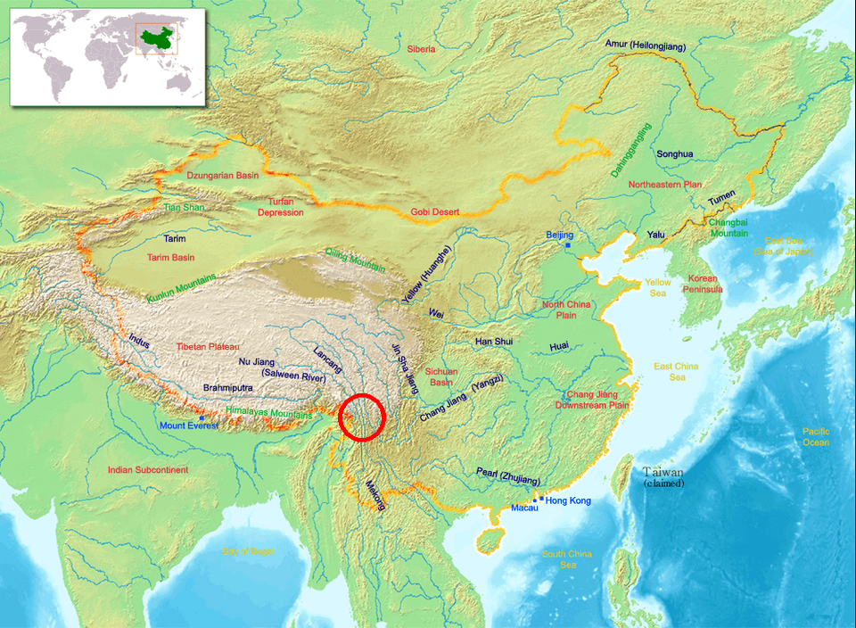
The basic geological framework is well established: as the Indian Plate drifts northward and collides with the Eurasian Plate, crustal material is displaced eastward and subsequently flows southward. However, the valleys themselves are conspicuously oriented north–south, which suggests that they should be examined in the context of the mantle convection roll system. The region discussed is marked by a red circle on the map below.
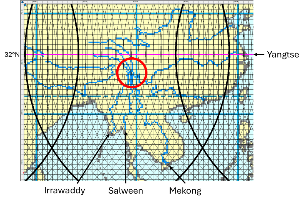
This system of valleys lies along a major north–south axis of the Eurasian continent, centrally positioned relative to large-scale convection rolls in the lower mantle. This can be observed by comparison with the broader division lines on either side of the circled area. Within the region itself, the inferred asthenospheric division lines are predominantly north–south, while in the southern part of the circled area they diverge toward the southwest and southeast.
The rivers respond accordingly. The Irrawaddy turns southwest, following the alignment of a southwest-trending convection roll. The Salween maintains a north–south course. The Mekong follows a southeast-trending convection roll, while the Yangtze makes a pronounced turn toward the east.
The 32nd parallel is marked, as the Himalayas are closely associated with this latitude. It has been proposed that the Indian continent is able to underthrust beneath the Eurasian Plate where upper and lower asthenospheric division lines coincide and are oriented strictly north–south, thereby facilitating continental subduction.
The result is a remarkable river system, irrigating vast regions that originate from this single tectonic hub. These rivers flow rapidly through rugged terrain, where the water acquires mineral nutrients that are ultimately delivered to the agricultural lowlands of China, Vietnam, Laos, Thailand, and Myanmar.
The Three Parallel Rivers of Yunnan Protected Areas (Chinese: 云南三江并流; pinyin: Yúnnán Sānjiāng Bìngliú) is a UNESCO World Heritage Site in Yunnan province, China:
https://en.wikipedia.org/wiki/Three_Parallel_Rivers
The Irrawaddy river is here being added as the fourth parallel main river of the area.
