Statistics is a scientific tool and we can apply it on Indonesian volcanoes. They are evenly distributed in a row, ready to be handled mathematically. On Sumatra we have the eight volcanoes of Marapi, Talang, Kerinci, Sumbing, Kaba, Dempo, Gunung Besar and Suoh, all pointed out with an arrow on the map below. Krakatau is in fact the end volcano of that row, being also the turning point from NW-SE alignment to the E-W trend of southern Indonesia.
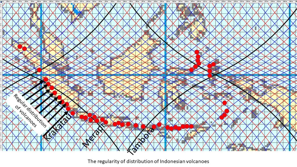
The distribution fits to a system of convection rolls spanning 1.5 degrees from east to west. The layer responsible for the effect leading to the said distribution is found at the depth of 265-410 km, as shown on the map. We can then ‘zoom in’ on individual volcanoes if we want to understand better the relationship between mantle currents and volcanism within that area. It is well known that subduction of the crust leads to volcanism in the area, but the distribution of volcanoes has to be explained further by referring to the convection rolls system. Note that the famous volcanoes, Merapi and Tambora, are found on the same latitude.
The black lines indicate the location of large scale division lines, found with 30° interval from east to west. Similarly, Indonesia spans 30° from east to west along equator, and the east and west coasts coincide with the edges of one large scale convection roll of lower mantle. Red lines indicate up-welling of mantle material, whereas blue lines stand for down-welling. Further information: https://en.wikipedia.org/wiki/Volcanism_of_Indonesia
