The pattern of land distribution along equador is one of the characteristics making our globe beautiful seen from space. Pointing the regularity out makes us think as well as feel. This circle spanning 30° along along 0° of latitude tells a story. A string is drawn through the circle, showing how the Amazon area is approximately aligned.
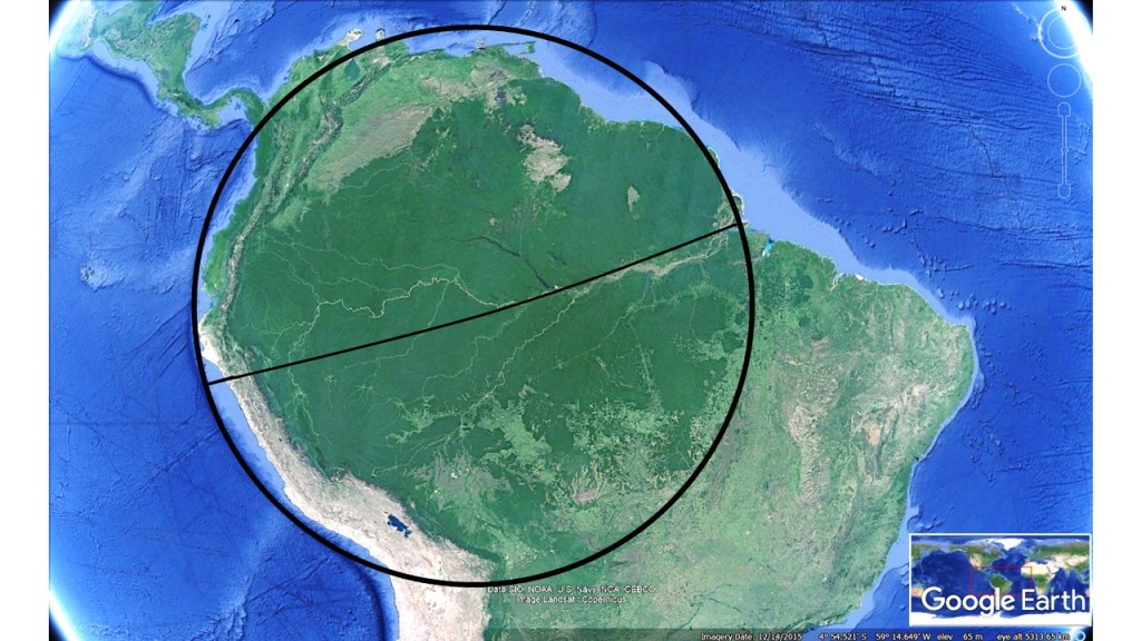
The forces of tectonic drift have been affecting South America quite strongly. According to the model of convection rolls, the Amazon estuary is located at a divisional line/point of downwelling between two large scale convection rolls of lower mantle. The span of the continent is exactly 30° along equator from coast to coast. This provides some constrains on the tectonic drift, causing South America to rotate. This circle represents one aspect of these present movements.
