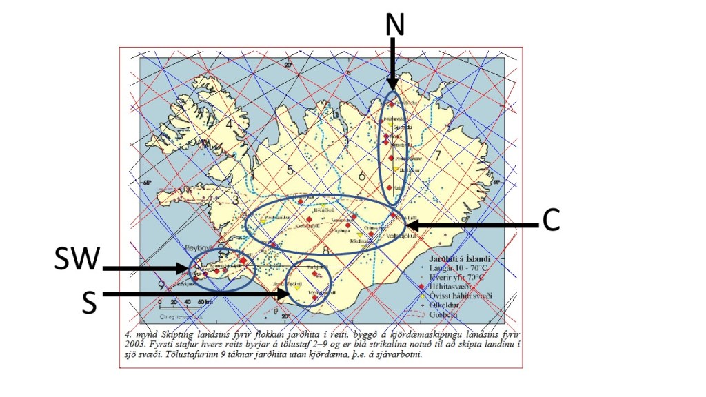
The high temperature areas in Iceland can be divided into four, rather distinct, areas. Here they are marked with SW = southwest (Reykjanes Peninsula), S = South Iceland, C = Central areas, and N = North Iceland.
The basic map is from Orkustofnun https://orkustofnun.is/gogn/Skyrslur/OS-2003/OS-2003-062.pdf
SW: Reykjanes consists mainly of one polygon, with Svartsengi on a division line, and also Hengill, but the other three areas of Reykjanes, Krýsuvík and Brennisteinsfjöll are found on the tectonic division line between N-America and Eurasia.
S: These areas are found to the SW of the main rift zone of Iceland, East Volcanic Zone.
C: This is the largest area. The hight temperature areas are found at the main crossings found between the division lines, therefore forming a rather regular pattern. This consistency between division lines and high temperature areas is one of the proofs of the existence of the division lines surrounding the polygons.
N: These areas form a line oriented directly N-S. Two of them are strictly originated from the tectonic division line, besides being centrally located within the relevant polygon, namely Askja and Fremrinámar. The others are found in context with the Mývatn hub of small polygons. Öxarfjörður is here classified as high temperature area, being exactly at crossings of convection rolls division lines and the tectonic N-S division line.
