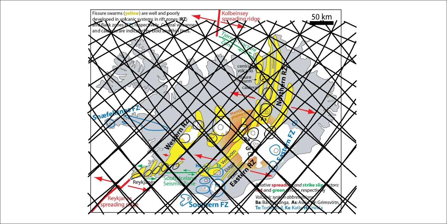
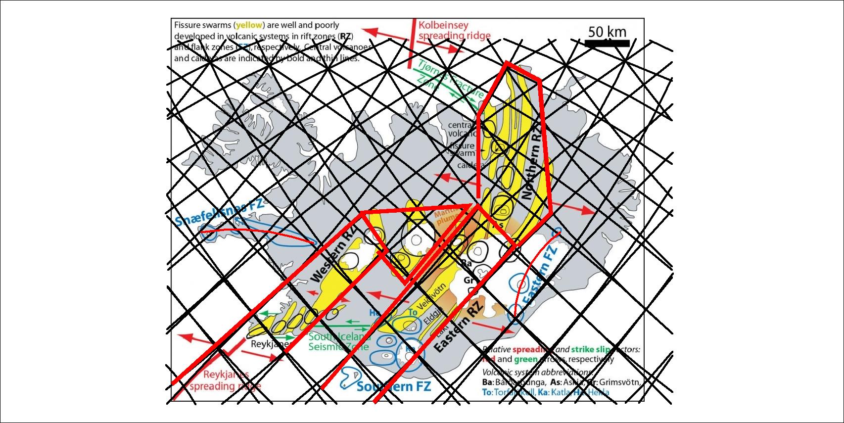
By showing the polygons mostly includen, the two volcanic zones of the south, can be marked clearly, and the north volcanic zone becomes tracable as well. The two zones of Snæfellsnes and Öræfajökull clearly span over relevant polygons.
I am a geologist, graduated from the University of Iceland, and taught geology for a few years. I have gained some knowledge about Earth's inner structure, so I provide this website as my contribution to answer one of the greatest questions remaining within the realm of geoscience. Experiments show that the mantle should form convection rolls when close to the melting point. I took this literally, and calculated the dimensions and shape of these mantle convection rolls. Then I compare that model with the surface. This makes it possible to provide many interesting examples about geology found on my blog.
View all posts by Steingrimur Thorbjarnarson