Can we find geothermal heat with the help of convection cell system? Yes, it is the very base of exploring the Earth’s surface. But how? Let us see the relevant part of the world convection cell grid drawn on a Google map:
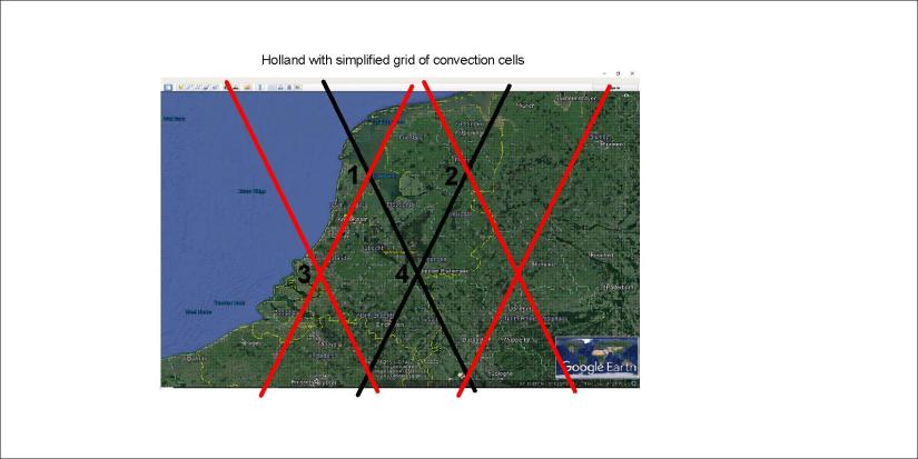
The country is mainly made up by two polygons, with EW-axis from points 1-2 and 3-4. The topographic consistency is mainly found on the line between points 1 and 4. Divergent force should be found close to the coast between 1 and 3.
Accordingly, searching for geothermal resources should in the beginning mainly be focused on line 1-4. (Actually Geothermal energy in the Netherlands has been partly modeled, showing precisely this trend, and can be seen on maps showing the tectonics of the Netherlands.) Then the pressure exerted on these two polygons should be estimated according to the precondition that it is originated from the relevant sides. Then the reason for the division found along 1-4 will be made clear. Thereby it can be found out weather EW-axis or NW-axis is the main factor for weakness within the tectonic plate. Then the main faults within the crusts can be found and mapped. The heat flow from the Earth can then be utilized effectively, as water can be heated by flowing along the deep faults.
This is not easy, but at least in this way we should know a bit more about what we are doing.
Red lines show upwelling, the upper more (120-250 km depth) aligned SW-NE, the lower more (250-410 km depth) aligned SE-NW. Black lines show downwelling.
