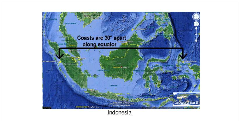
Indonesia does extend exactly 30° along equator, just as everyone can see on a map (approximately from 99°E to 129°E). It fits to the analysis that underneath there is a convection roll in the lower mantle, exactly 30° wide. This is the big mystery of the equator line!
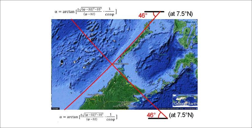
Looking at the details of Indonesia, some interesting forms show up. Two of the convection division lines look like this:
With these calculated lines put into place, let us look at how nature has shaped the tectonics around:
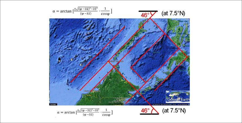
This is a place of symmetry, and square forms! A more detailed analysis can tell us much more.
Published by Steingrimur Thorbjarnarson
I am a geologist, graduated from the University of Iceland, and taught geology for a few years. I have gained some knowledge about Earth's inner structure, so I provide this website as my contribution to answer one of the greatest questions remaining within the realm of geoscience. Experiments show that the mantle should form convection rolls when close to the melting point. I took this literally, and calculated the dimensions and shape of these mantle convection rolls. Then I compare that model with the surface. This makes it possible to provide many interesting examples about geology found on my blog.
View all posts by Steingrimur Thorbjarnarson
