The volcanic sites of Sveifluháls and Brennisteinsfjöll clearly have the same alignment as the West Volcanic Zone, that is N43°E. But the peninsula on which most of Reykjavik is built points N54.8°W. It is 1/4 of the angle between convection rolls and EW axis alignments. The tectonic direction can be detected from the Bláfjöll area.
As for Elliðaárdalur valley, the NS axis and EW axis meet where some of the geothermal sites are found. The rims of the extinct Viðey volcanic site are found in the area, but these tectonic settings adhere the preconditions for ground water reaching the hot bedrock and ascend towards the surface.
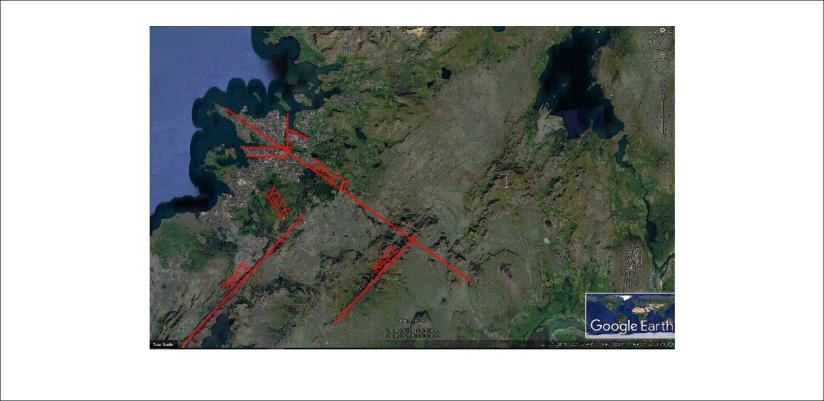
The basic tectonic framework of the surroundings of Reykjavik
Published by Steingrimur Thorbjarnarson
I am a geologist, graduated from the University of Iceland, and taught geology for a few years. I have gained some knowledge about Earth's inner structure, so I provide this website as my contribution to answer one of the greatest questions remaining within the realm of geoscience. Experiments show that the mantle should form convection rolls when close to the melting point. I took this literally, and calculated the dimensions and shape of these mantle convection rolls. Then I compare that model with the surface. This makes it possible to provide many interesting examples about geology found on my blog.
View all posts by Steingrimur Thorbjarnarson
